
Day 12
Start: CA 74 to Idyllwild
Finish: Forbes Saddle
Daily Mileage: 14.8
Trip Mileage: 166.6
It snowed and hailed off and on yesterday and overnight. Bands came and went, and the snow and ice was melting almost as fast as it could accumulate. In the end, there was a thin coat of snow and ice in town, and it was 21F when Justice and I left our warm rooms for the road.
Many of the hikers seemed to be arranging rides back to the trail with locals, but that seems a bit unnecessary to me when your thumb can get you to the same place without someone going out of their way. On the cold, icy morning, it took just a few minutes until a local picked us up and took us part of the way back to the trail, leaving us at a road junction. It took a few minutes longer to get a second hitch, but we were soon on our way and were the first PCT hikers to arrive at the trailhead from the presumably large amount headed for the same place today.
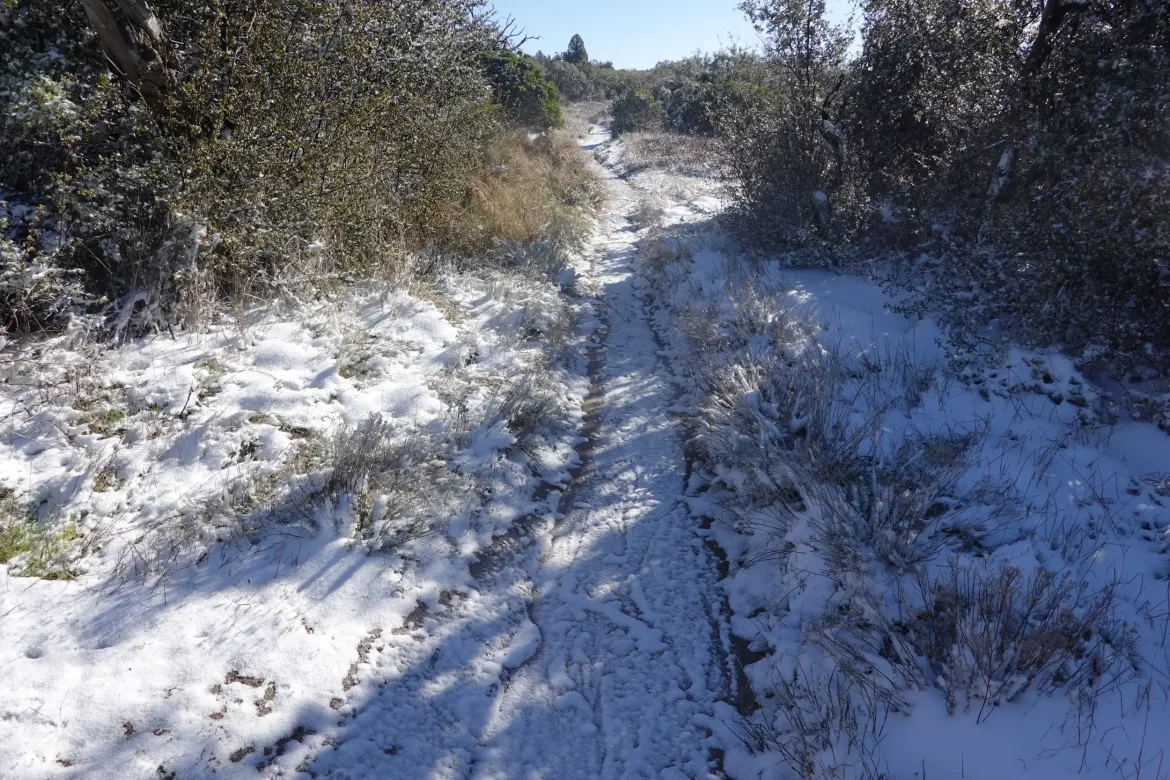
Another couple arrived as we were preparing to head out, and Justice and I hit the trail in the lead. However, after a wintery mix yesterday, that translated to me breaking trail through the bushes overhanging the trail coated with wet ice/snow. I would frequently stop to whack the bushes with my hiking poles so I would get less wet as I brushed past, but that was not fully effective and I kept getting slapped with cold, wet branches. I got a brief respite when I decided to put on my gaiters and rain skirt and the other hikers passed, but they quickly yielded to me when I caught back up to them.
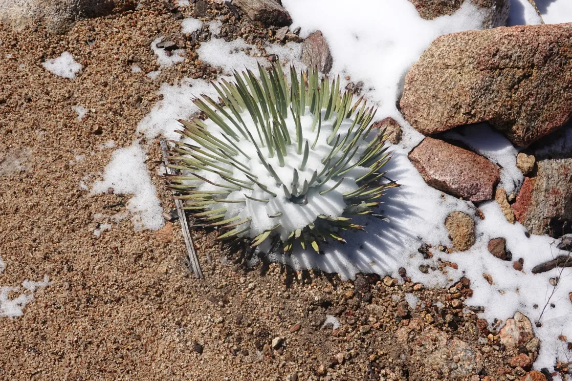
The trail started off in low hills following the high ridge of San Jacinto. First it paralleled, and then it began a slow ascent. There was patchy snow on the ground, but it was quickly melting in the morning sun.
With my pants covered, the snow became less of an issue and I made decent time. Justice and I were shooting for 15 miles today to set us up well for the following days. I was feeling good and flying down the trail, knocking off the miles faster than I needed to. By the time I reached a pass on the ridge, I took a break to kill time and enjoy the sun after a couple dark days.
We stopped to get water for the night and following day with about 7 miles to camp. It was still early afternoon, so it seemed like there was a ton of time to finish, and that it would be a relatively easy, short day. However, I grabbed a gallon of water and we still had some climbing to do with my also refilled food bag. That really weighed me down, especially at the higher elevations we were at of 6-7,000 feet.
The trail slowly climbed and I slowed my pace to accommodate my pack weight. The new weight really wore on me for some reason. I’ve carried much more food and water, but it is still early in the trip, so I’m probably not acclimated to it enough yet.
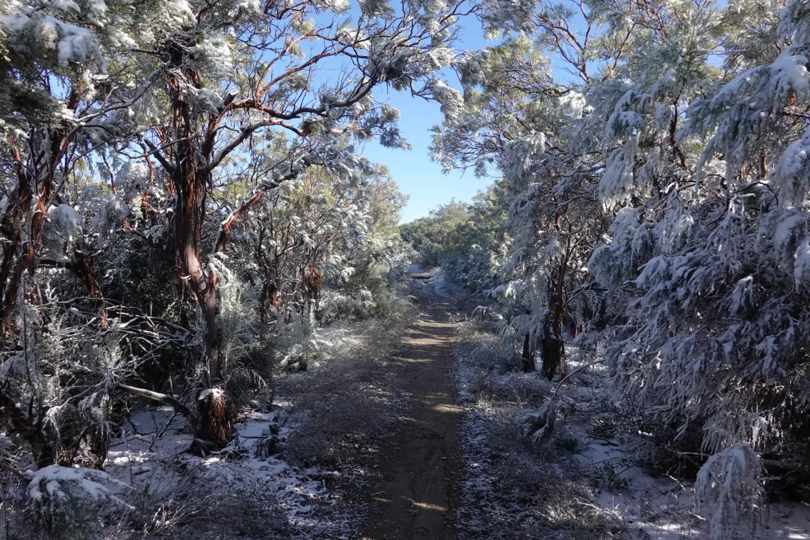
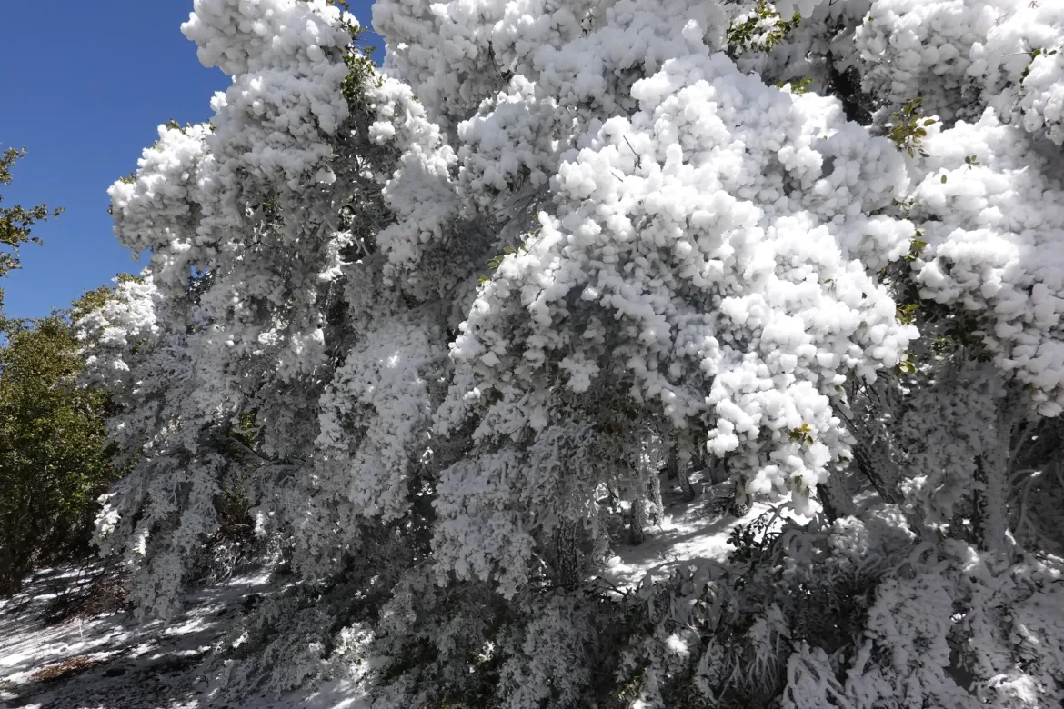
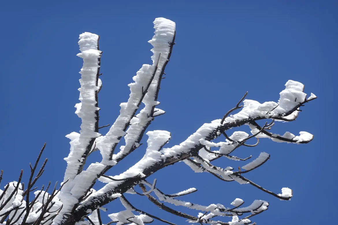
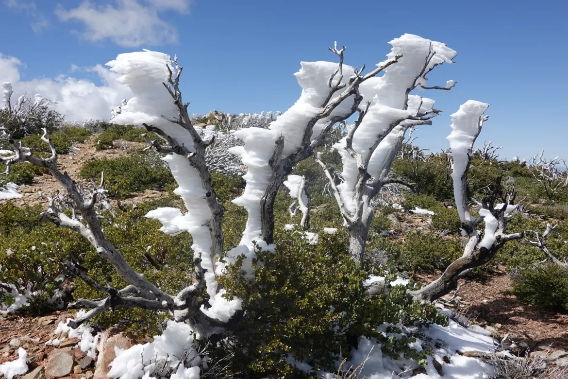
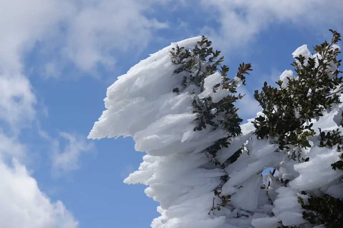
The trail stayed high on the ridge, and there was some great rime ice buildup on the windward side of the trees from the storm yesterday. It must have really been blowing since there was almost a foot of ice built up on some trees.
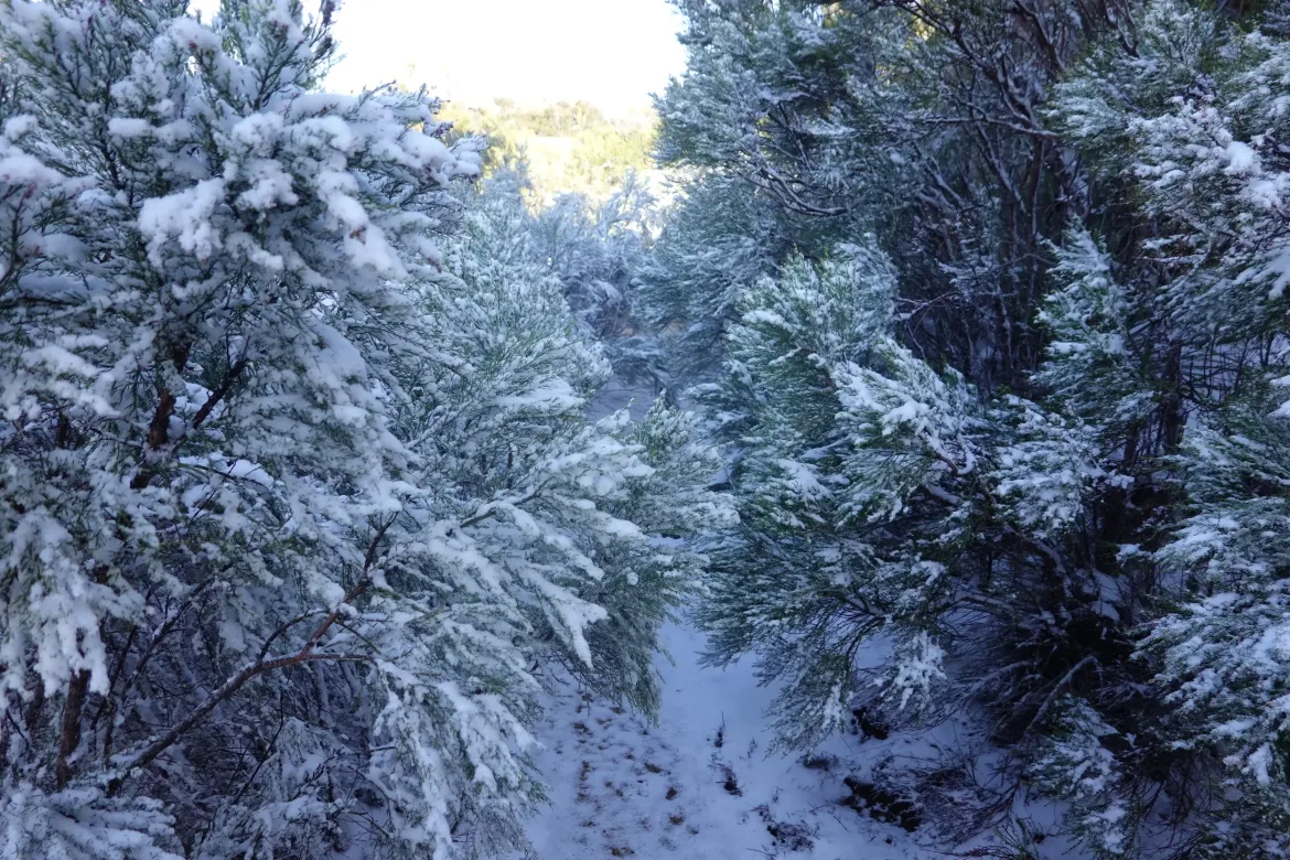
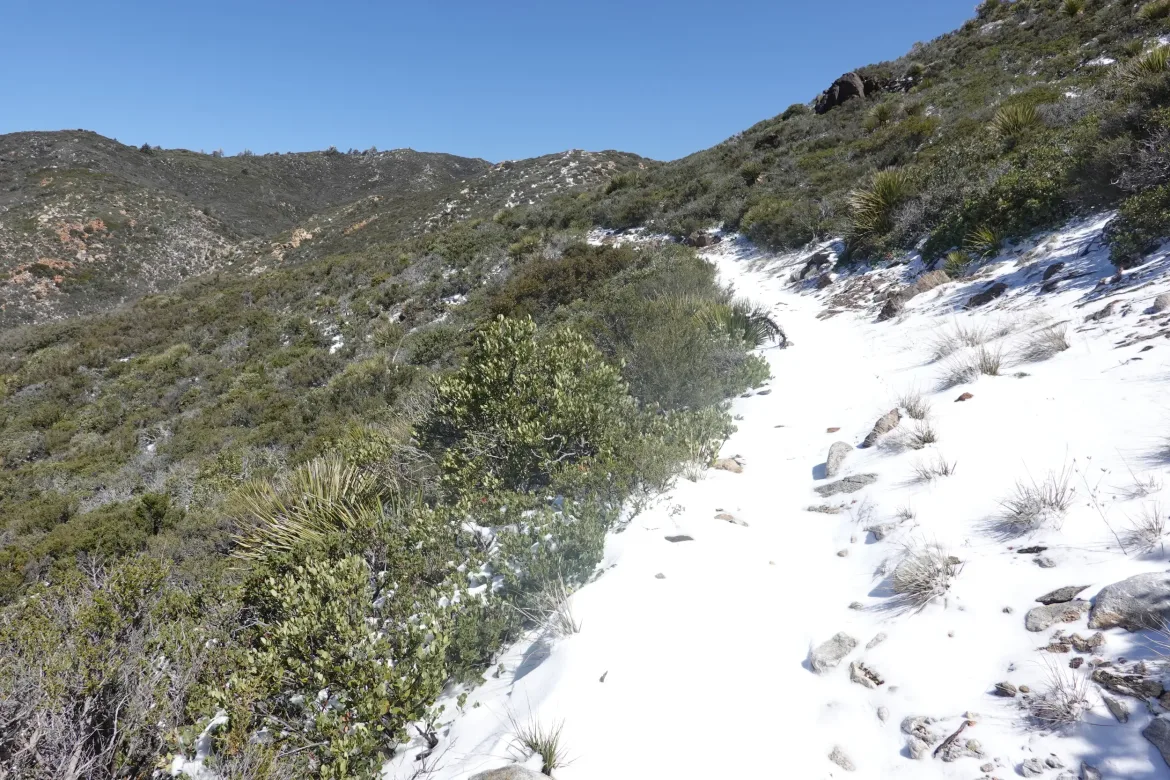
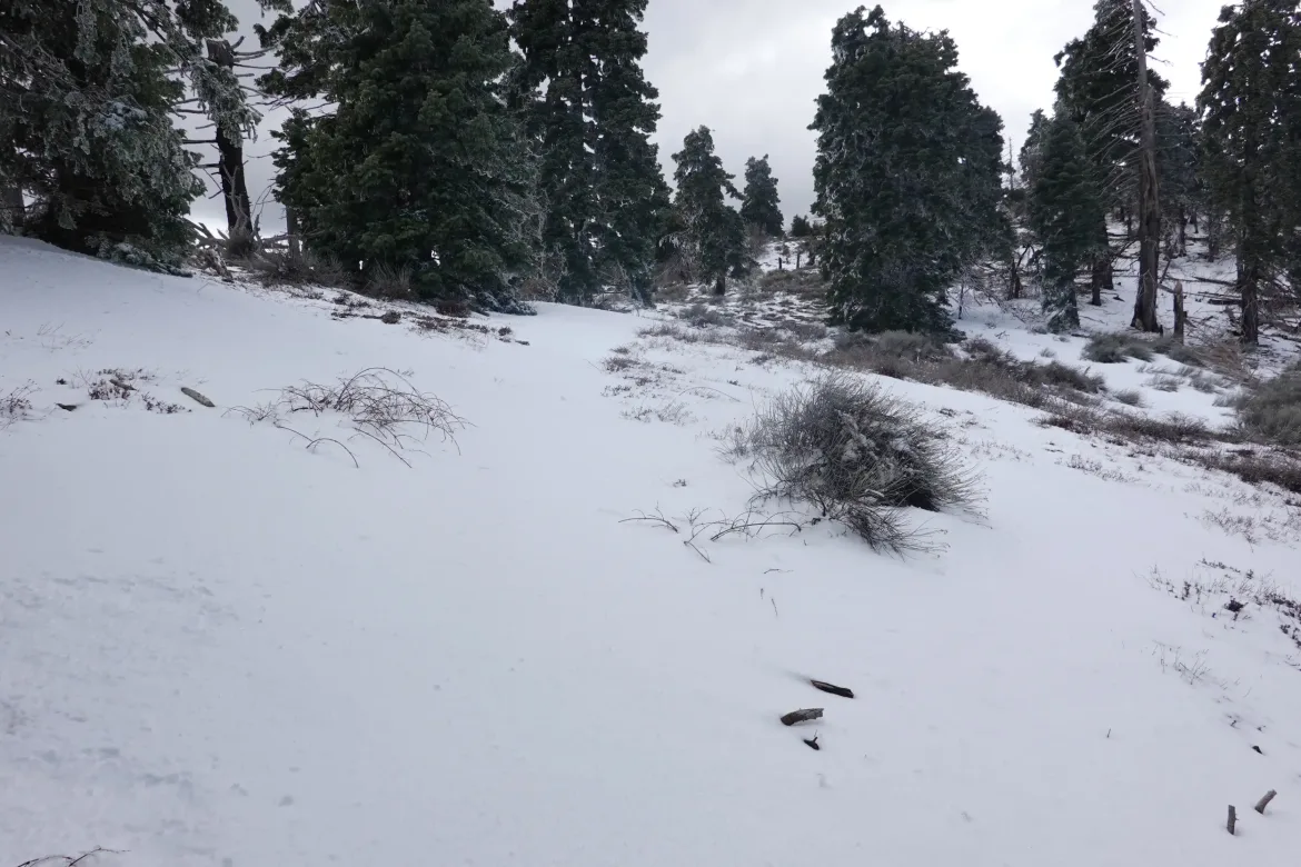
When I finally got to the top of the ridge, I thought the hard part was done and I could cruise into camp. However, the trail changed. It entered a wildfire area from a few years ago and there was suddenly much more snow on the ground.
The snow became ankle deep or more for much of the time which obscured the trail. I was still in the lead, so I had to figure out where the trail went and try to keep my shoes from getting too wet since it’s supposed to freeze overnight.
In the burn area, there were several awkward blowdowns, but the main issue was the trail was overgrown with new growth following the fire. At times the bushes completely obscured the trail and I just had to look down to see where the trail went and push my way through. In addition to going over or under the blowdowns and breaking trail through the snow.
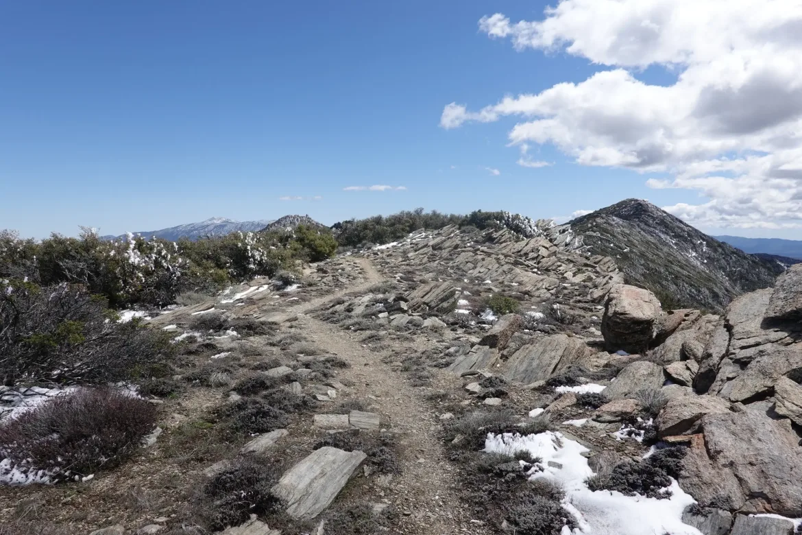
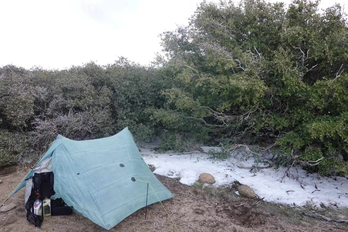
This section was slow and was really draining my energy. It ended up taking me a lot longer than I expected to finish up the day with the challenges of the last stretch. At last I reached Fobes Saddle where Justice and I planned to camp just after 4. It was still an 8 hour hiking day for the 15 miles of trail. I had to sit down immediately because I was more exhausted than I think I have been yet on this hike. I made it though, and that’s all that matters. This spot is at 6,000 feet and is the lowest point on the trail for a while which will be good for the forecast low temperatures tonight.
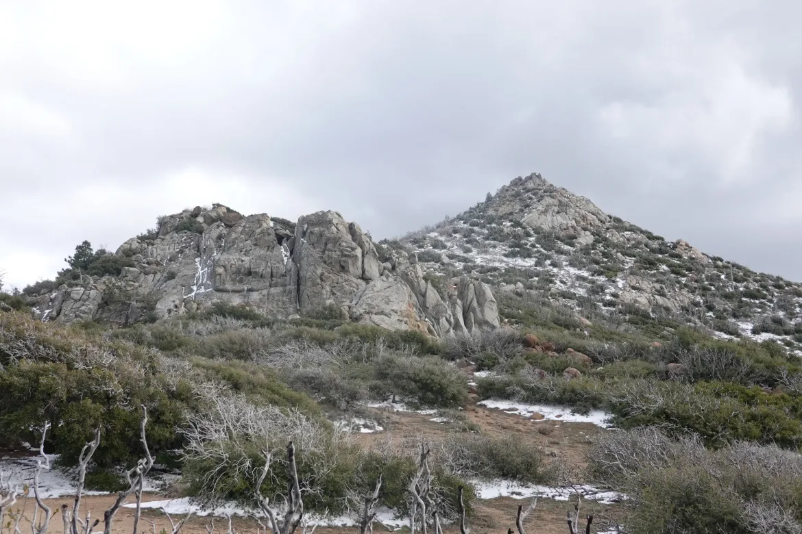
I also got a good view of the next few mountains ahead. It seems that the last stretch of snow stops at the saddle and it is largely snow free for the next couple peaks at least. So weird how there was just a 3 mile stretch of trail with much heavier snow than even the higher mountains ahead. Must have been some sort of localized snow burst or something.
In any case, I had time to rest and recuperate before bed, and Justice and I made plans for tomorrow. A couple other hikers rolled up later. It will be nice to have others around for the upcoming stretch of trail because there isn’t information on the snow conditions in some areas and it gets up to 9,000 feet. Tomorrow should be a challenging day. Not sure how it will go, but I will give it my all and see where I can get.