
Start: Near North Bass Trailhead
Finish: Crazy Jug Canyon
Daily Mileage: 8.8
Trip Mileage: 836.8
Elevation gain/loss: 916/4654ft
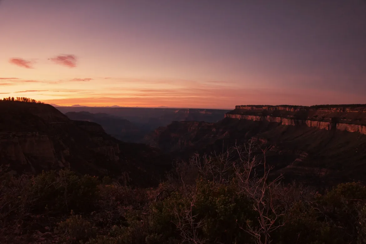
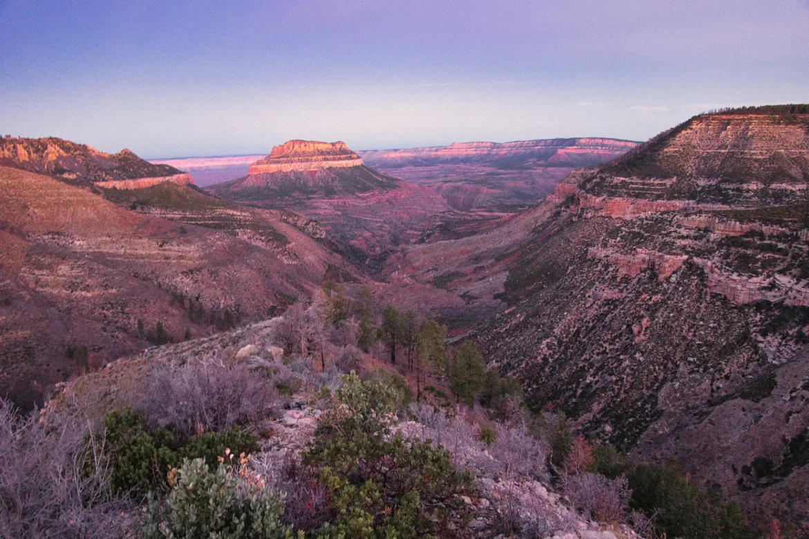
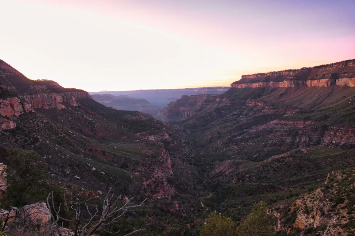
I was awake when my alarm went off at quarter to five. I wanted to hit the trailhead at first light, and I had about an hour to get there, so I got up and started packing accordingly. It was a clear, cold night, and I’m sure it was below freezing, but I had the motivation to get this day started so I could tackle its challenge.
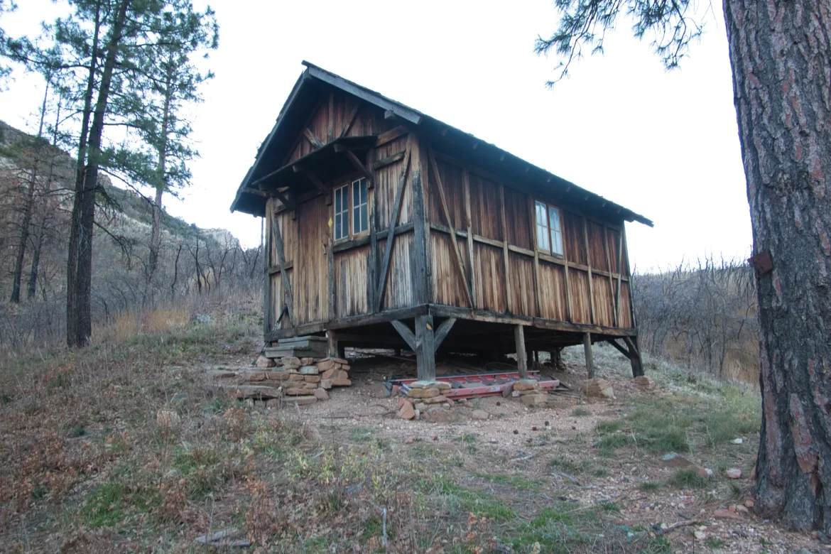
I don’t really like night hikes, but it was just necessary here. At least I was just going along the enclosed 4×4 track, not through some exposed scenic vistas. I was constrained to the muted glow of my headlamp but made good time marching along the road. I got to the trailhead just as the sun was starting to color the sky oranges and pinks. I snapped a couple of quick shots and headed down the trail, which would switch back down to Muav Saddle, where I took a brief stop at Theodore Roosevelt cabin. It’s not actually his cabin, but he was rumored to camp at the spot when he was hunting mountain lions in the when he was president. I took off my extra layers and prepared for the hard part of the day.
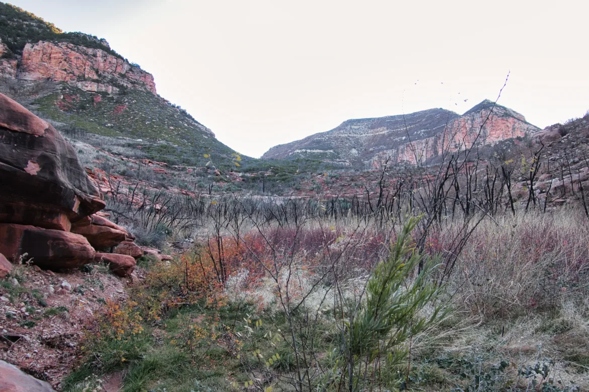
Today’s goal was to do Saddle Canyon up to Crazy Jug Canyon. Saddle Canyon is the most notorious section of the Hayduke Trail and is considered the most difficult and slowest section of the trail. I had read many journal entries where it took people all day to go five miles to Crazy Jug. That was in the spring, though, when there’s more sunlight. That’s why I wanted to start in the canyon as early as I could in the day to make sure I could get to Crazy Jug.
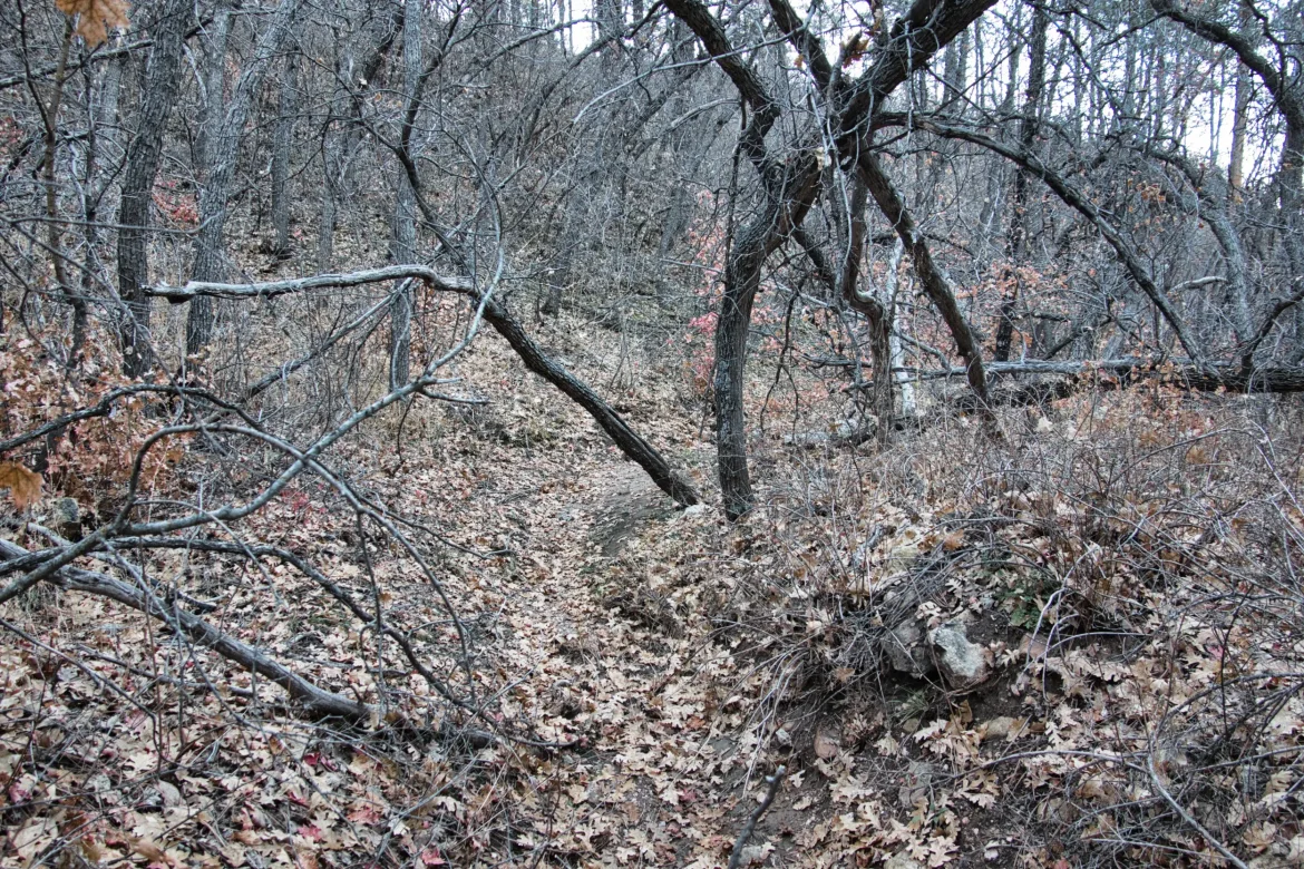
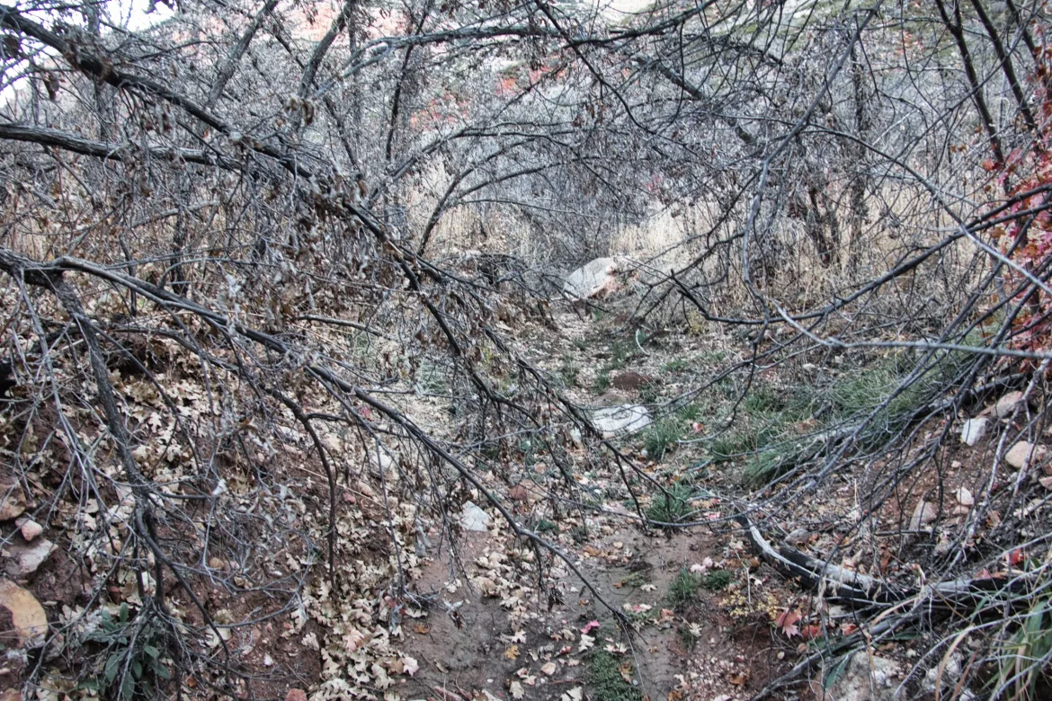
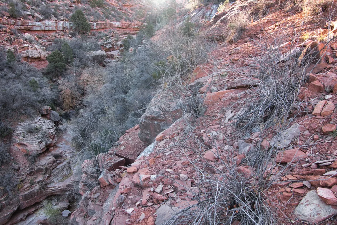
Saddle Canyon is completely trailless. I started off my descent following a trace of a wash through brush. The brush wasn’t actually too bad, and I did make pretty good time through it. About half the time I was in the wash, and the other half of the time I was skirting the sides when the wash got too brushed in. I pretty much tore through that first area at just slightly below my normal pace. That started to give me confidence that I’d have the time to complete the canyon today. However, I still had a long way to go and the biggest challenges.
I came across a couple of flowing streams from springs early on, which weren’t even in my guidebook. I can’t blame myself for carrying the extra water, but I’m starting to flag stuff like this for future hikers. The bushwhacking alternated between scrub oak and various small thorn bushes, but there was a large section that was burned out where just stubs of former trees remained. Made it easier for me to travel, though the ground was a bit looser, and obviously I would have preferred it was not burned out.
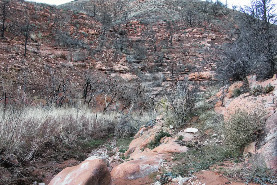
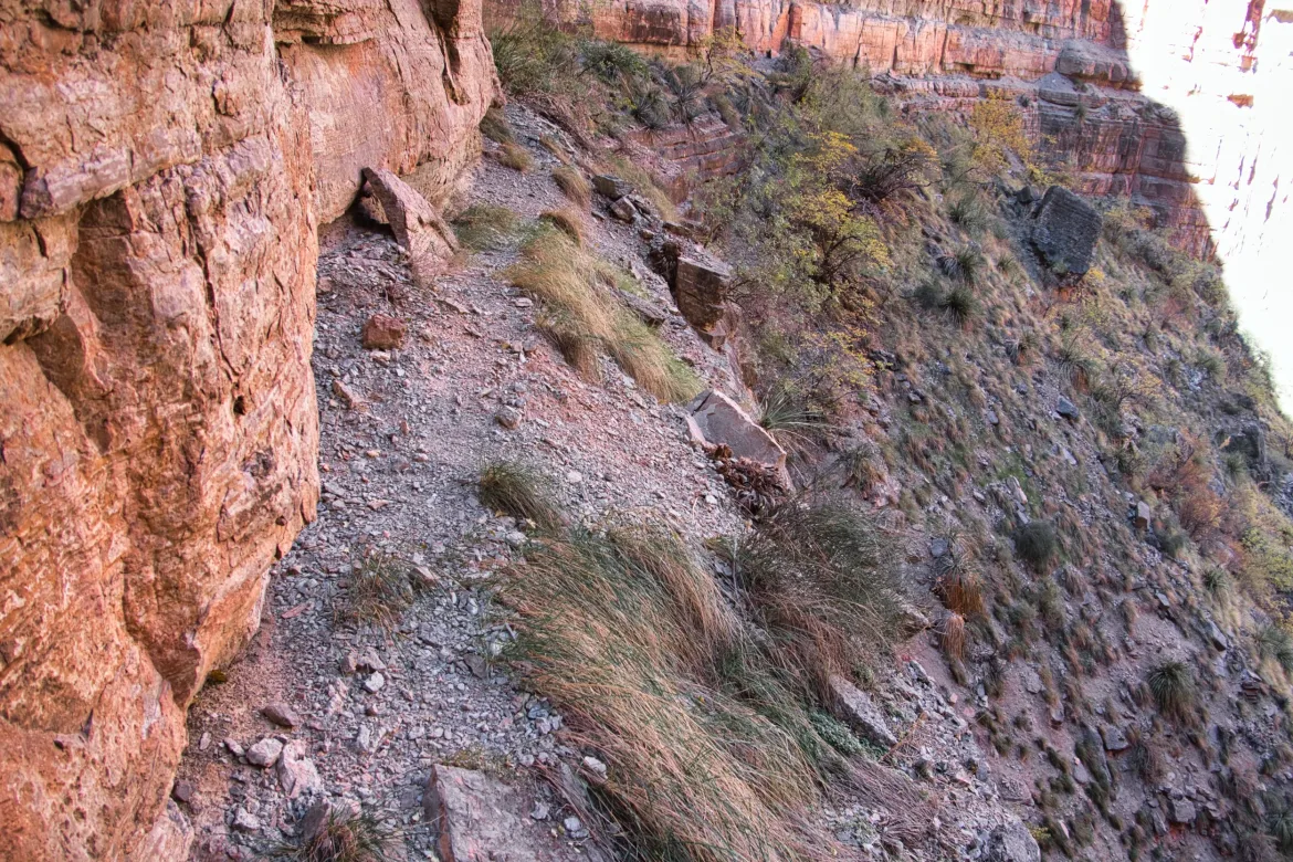
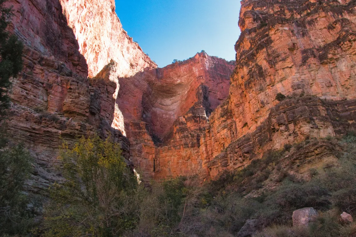
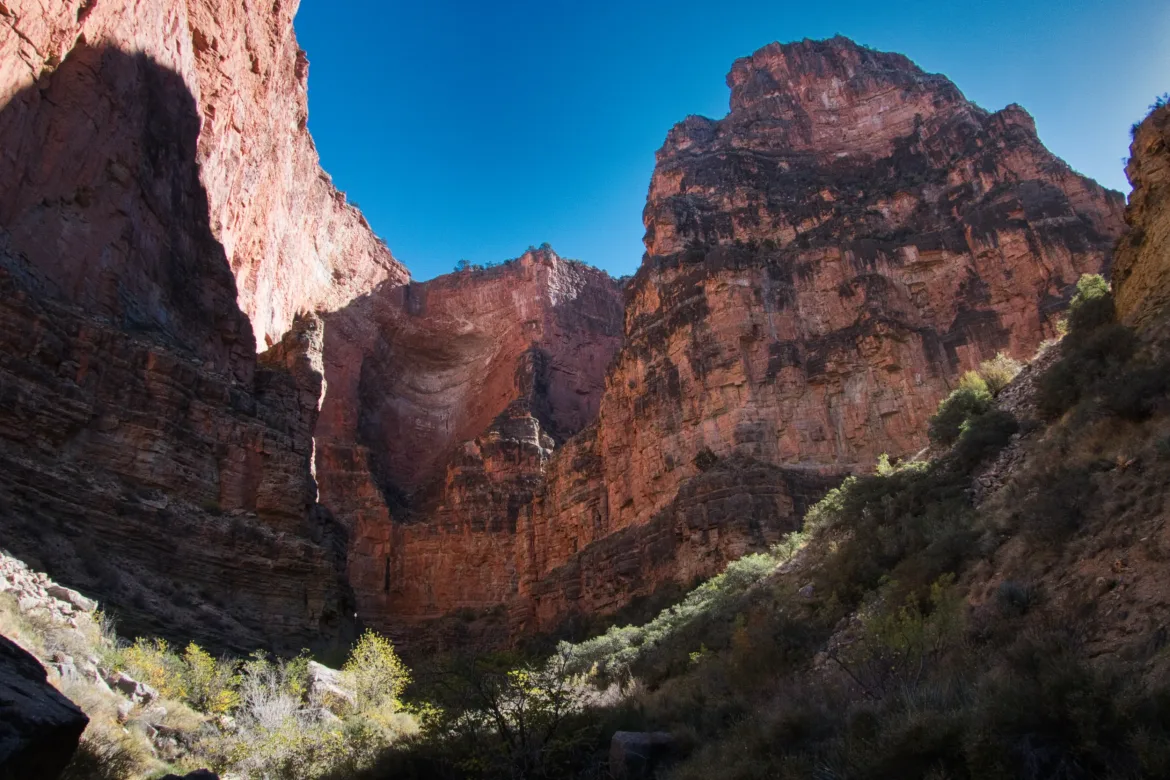
The wash got bigger as I went and became the obvious travel path where I was no longer leaving its course. I navigated around my first three or four pourovers, which just involved some light scrambling around the sides. I kept a sharp eye out for cairns which would guide me around a large pourover. I heard that many hikers missed it and had to backtrack. I didn’t have good data on my maps for this section since it isn’t trail, just pure bushwhacking. The guidebook is wrong, and the other GPS data that I could find is similarly wrong. I found a cairn right where I thought it would be which lead me along a cliff edge to a raised spit of land between two canyons. This was reported to be a very difficult and exposed scramble, but I thought it was pretty easy. Nothing too challenging about it or exposed at all.
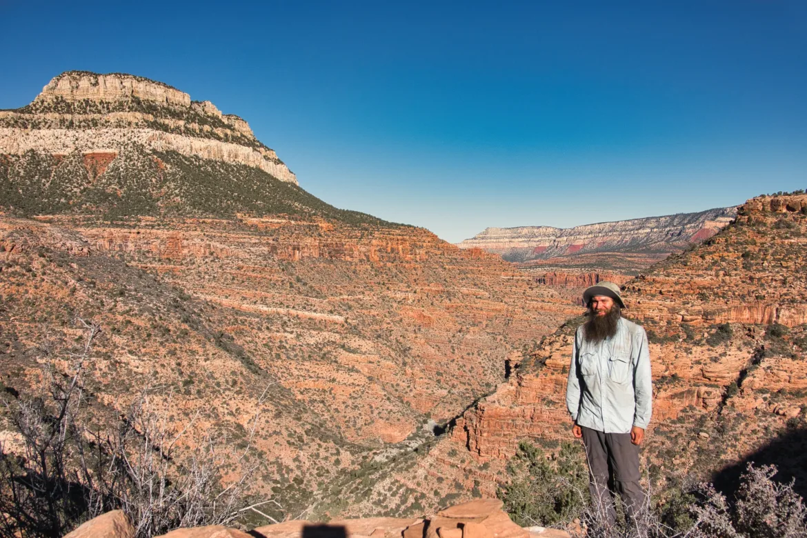
Once I got to the top of the spur, there were some cairns and a faint path leading down the spur back into the canyon. I looked at my mileage at this point and now was already about halfway through this trail section in only an hour or two! That led me to take a break to take in the canyon.
It took some winding around to get down the spur but not too bad. At one point, I slipped a little bit and grabbed a bush which broke off in my hand, but luckily I grabbed another one to prevent me from falling down a cliff band. It was a lot of loose rock up there. I made my way down towards the end of the spur and got back into the wash for Saddle Canyon. In this canyon, since it’s trailless, I’ve been able to see Sloppy Joe’s footprints in addition to the mystery hiker ahead of both of us. It’s been a while since I’ve seen his footprints, probably a month or so. I don’t know if he skipped the middle of the trail or if the rain just wiped out his footprints at some point. It’s always good to see other hikers’ footprints that I know, especially in trailless sections like this.
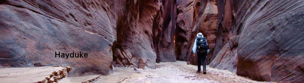
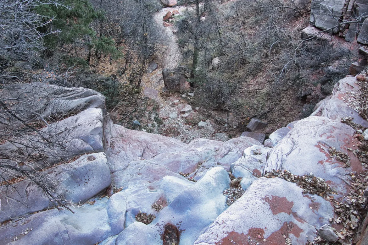
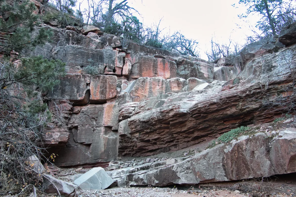
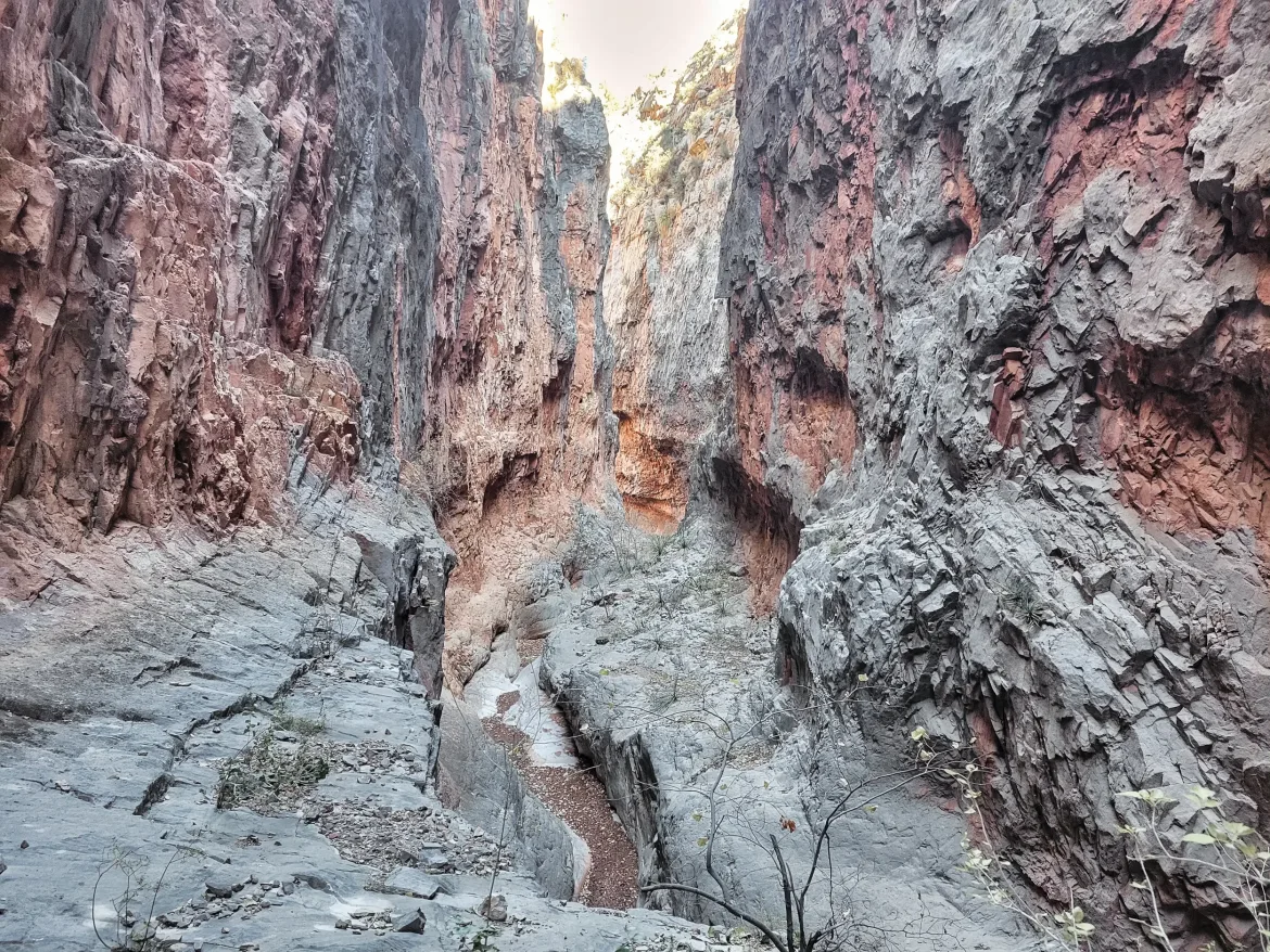
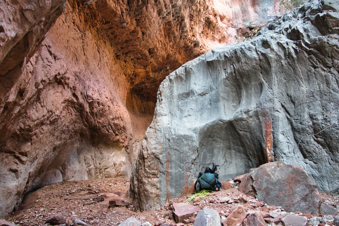
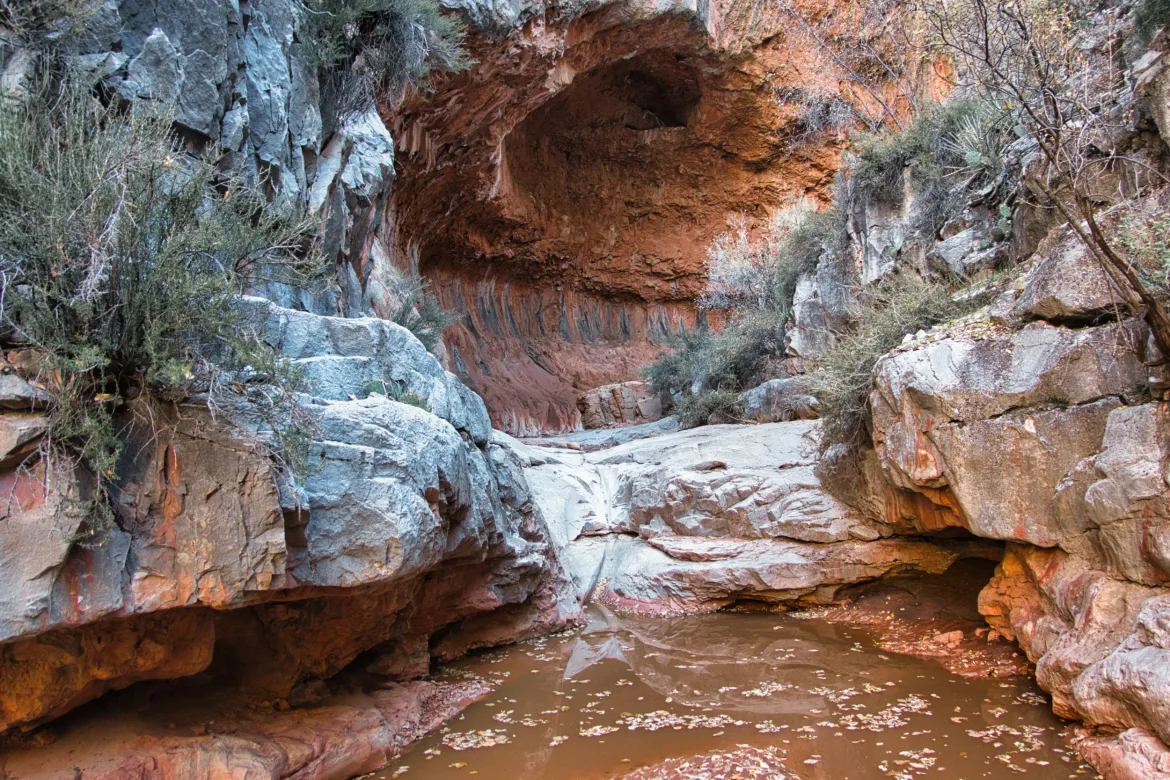
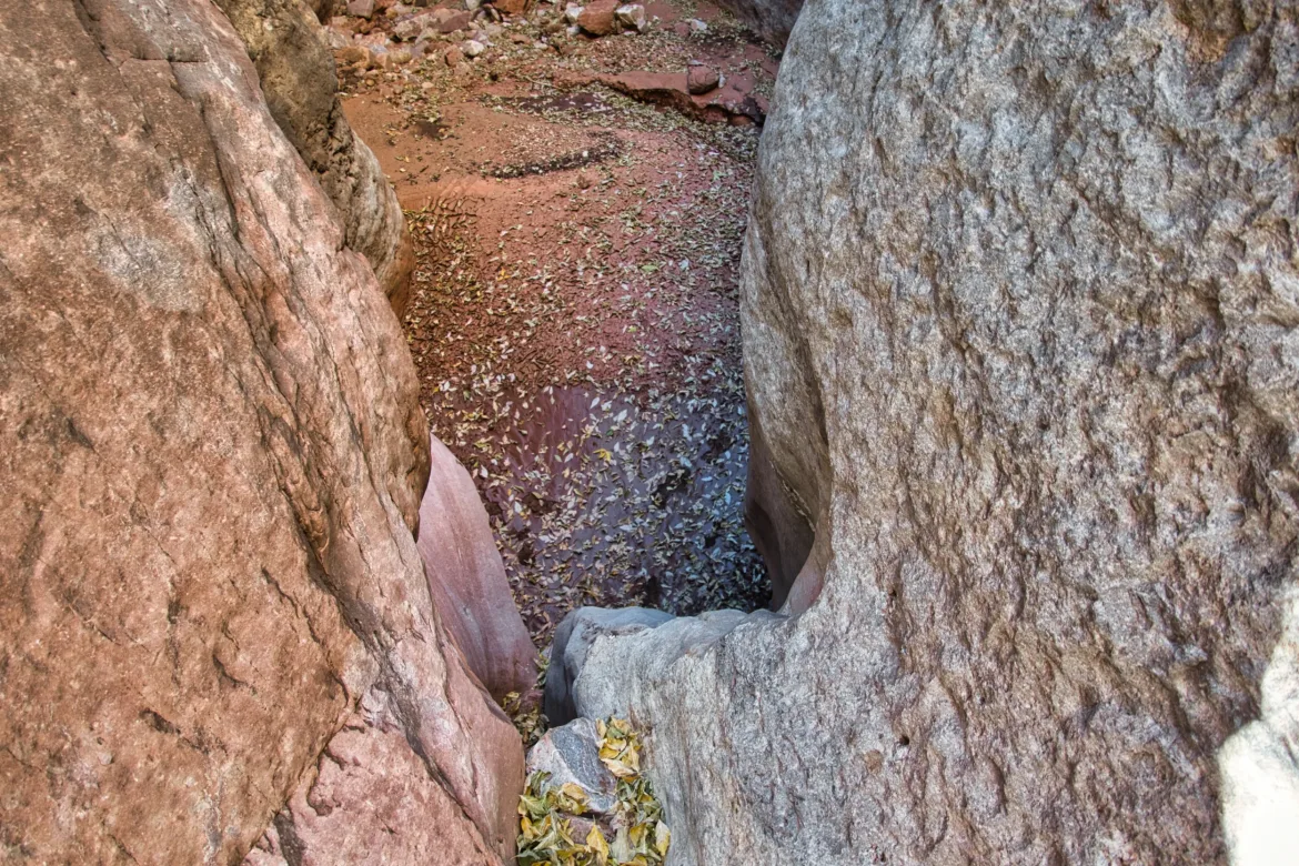
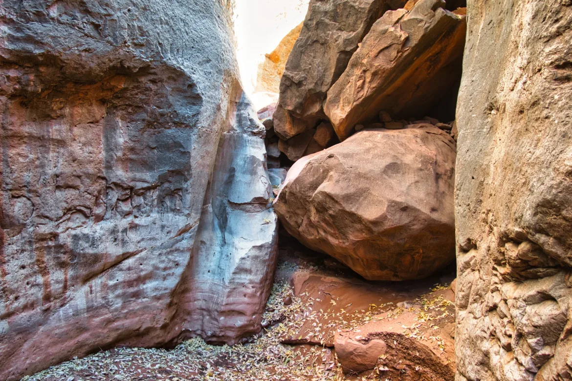
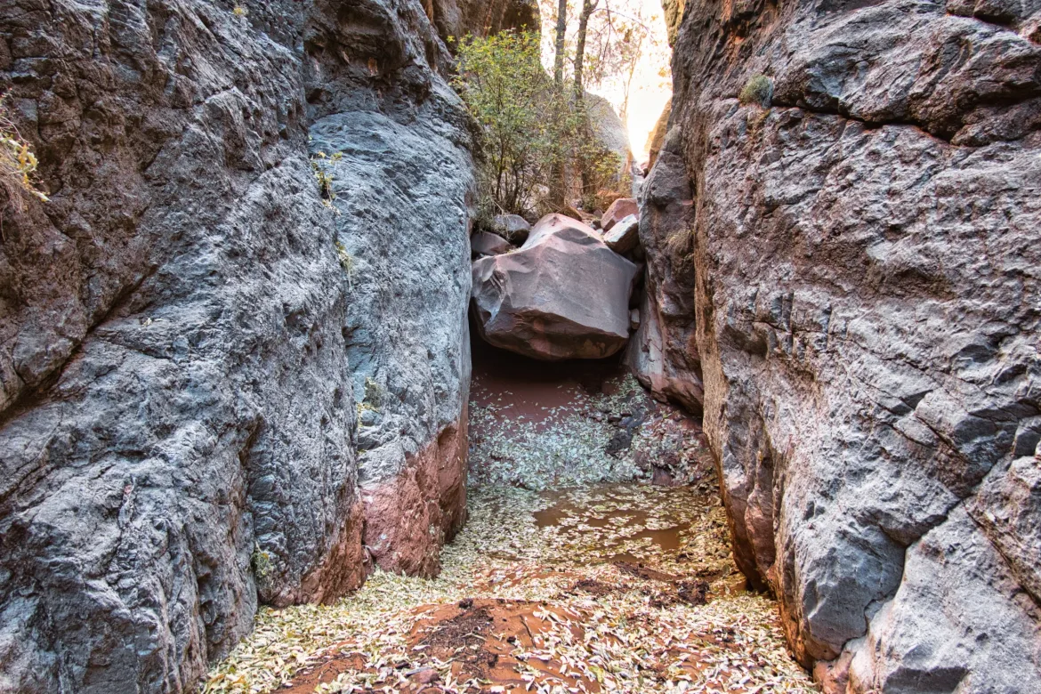
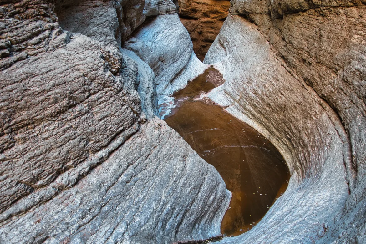
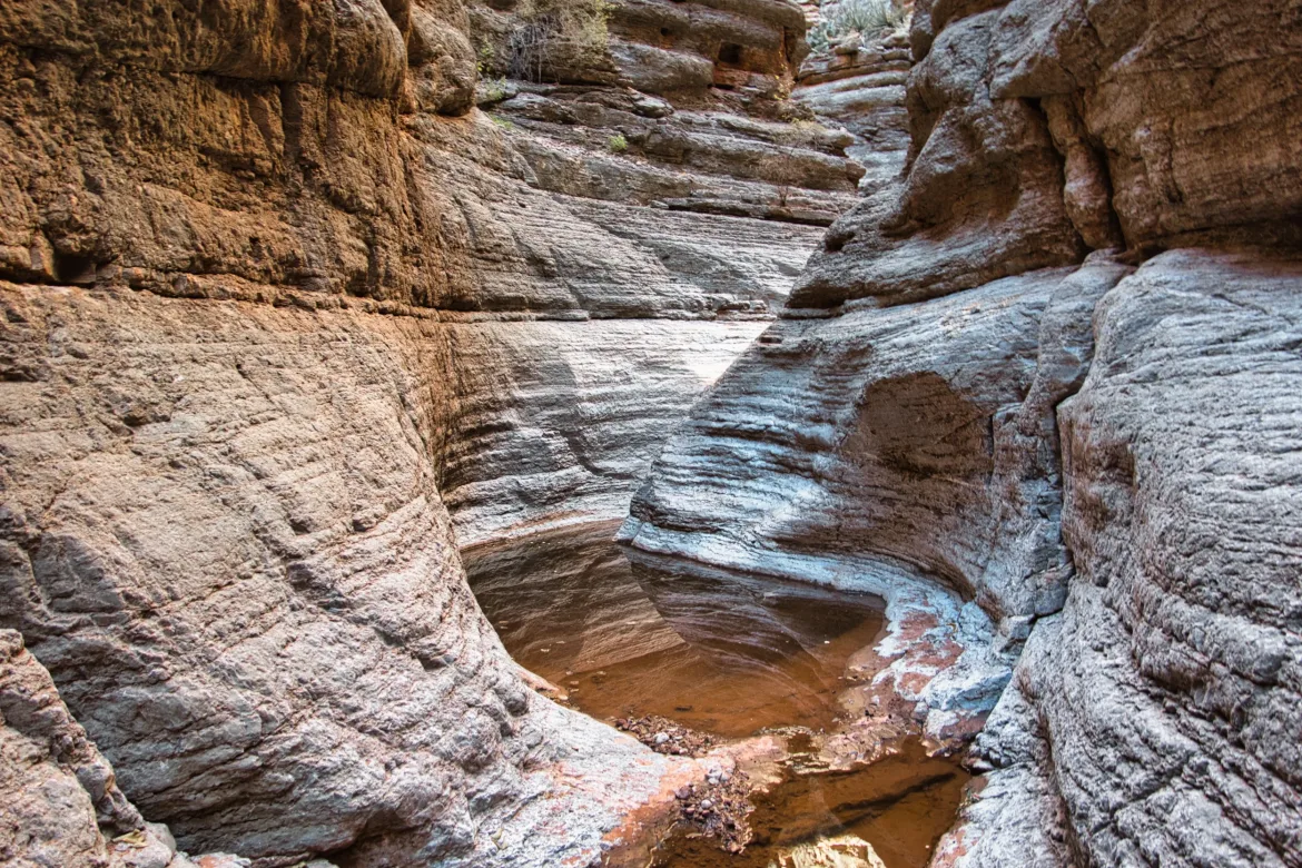
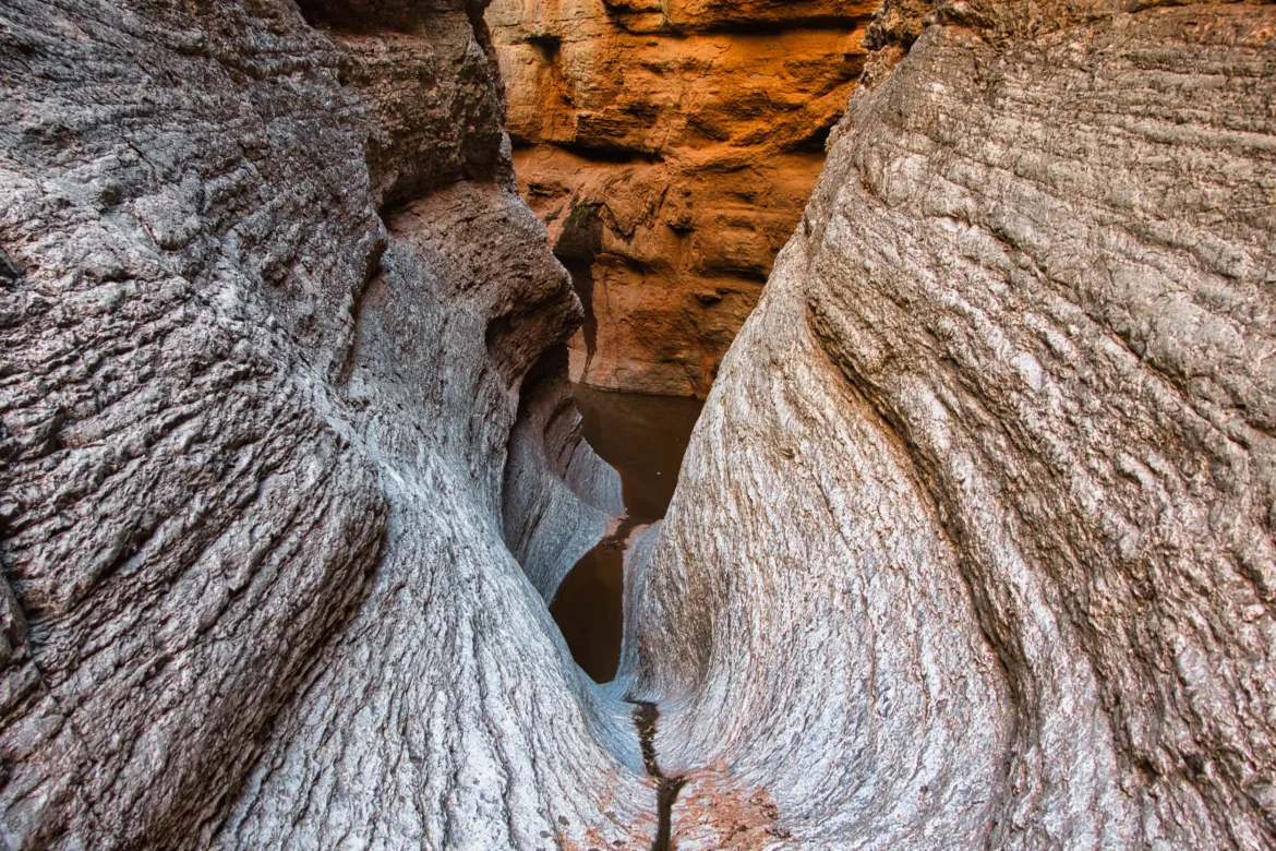
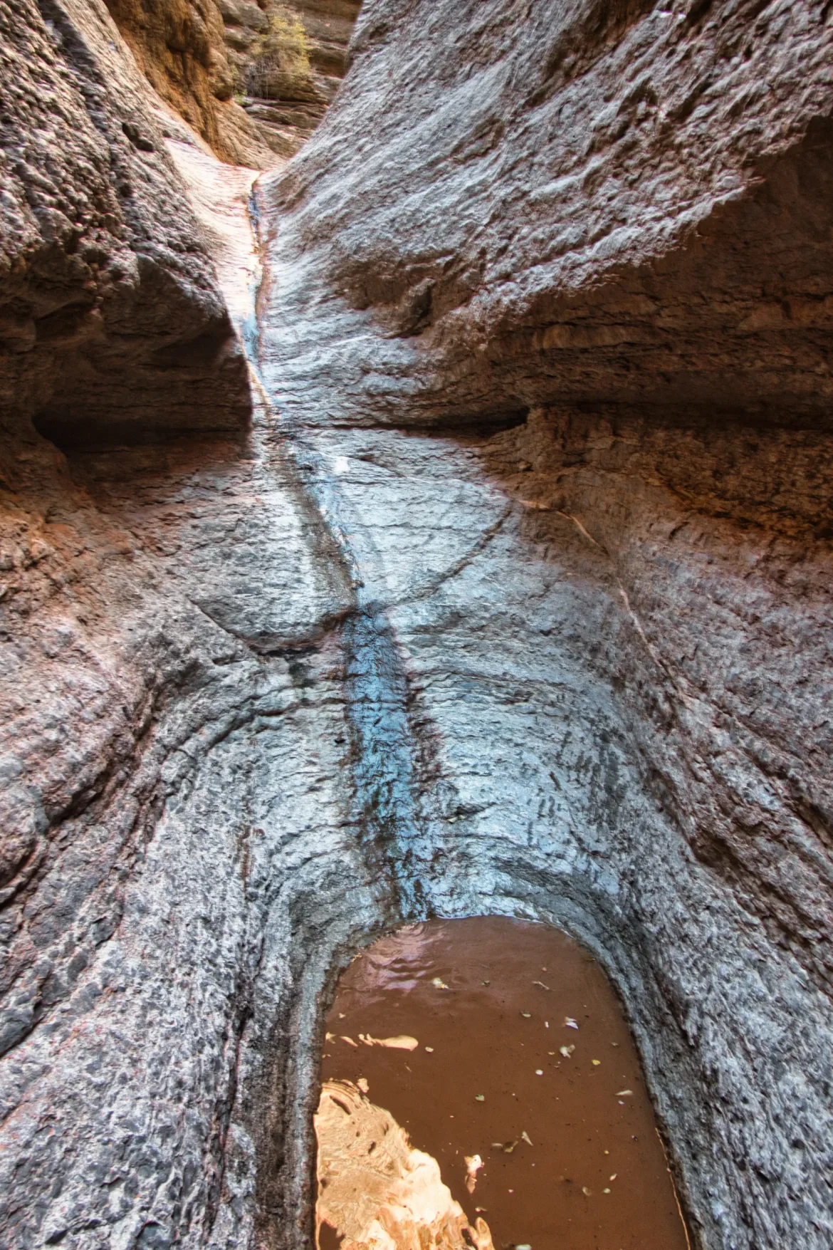
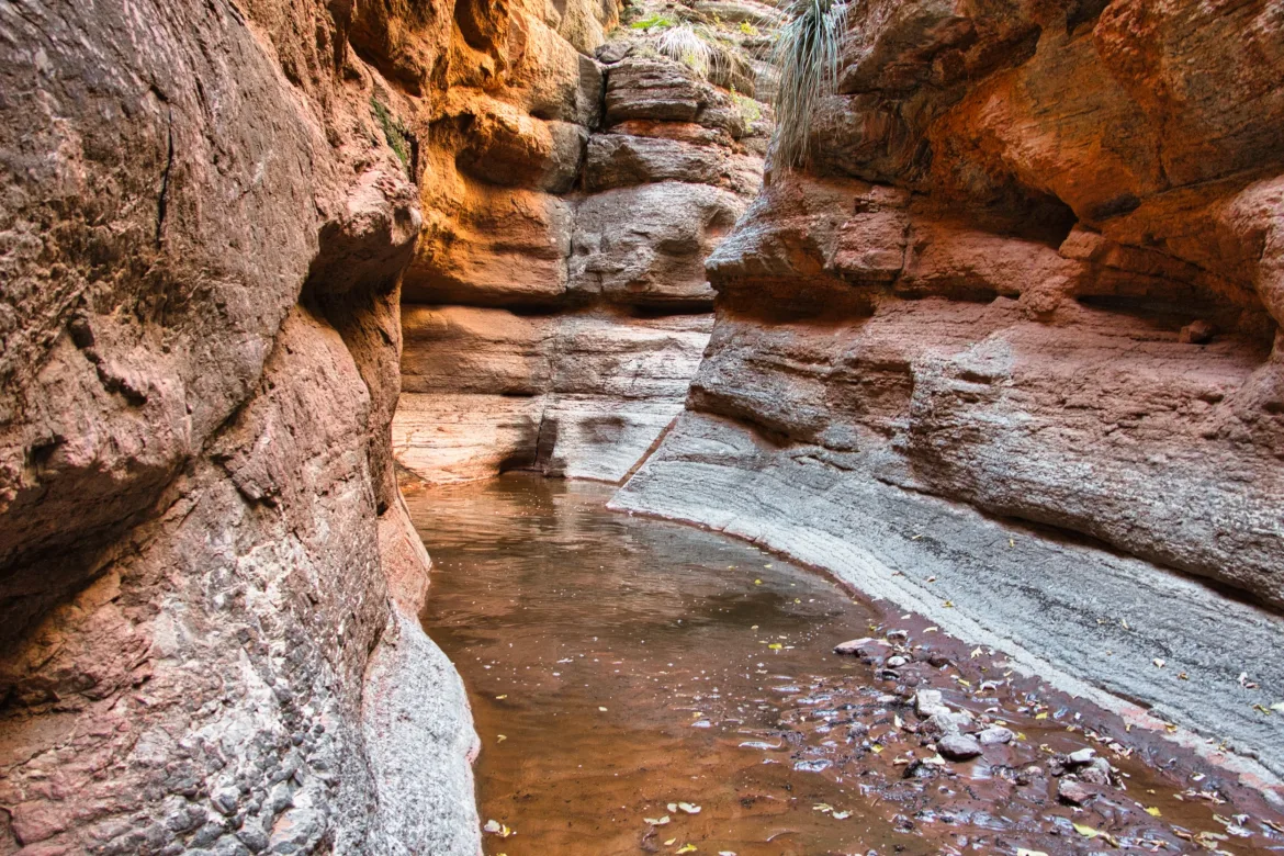
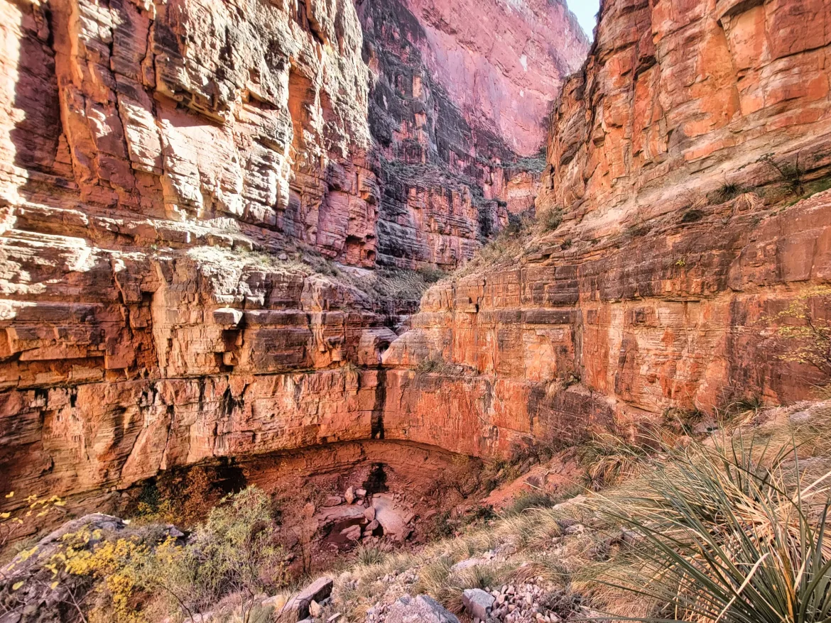
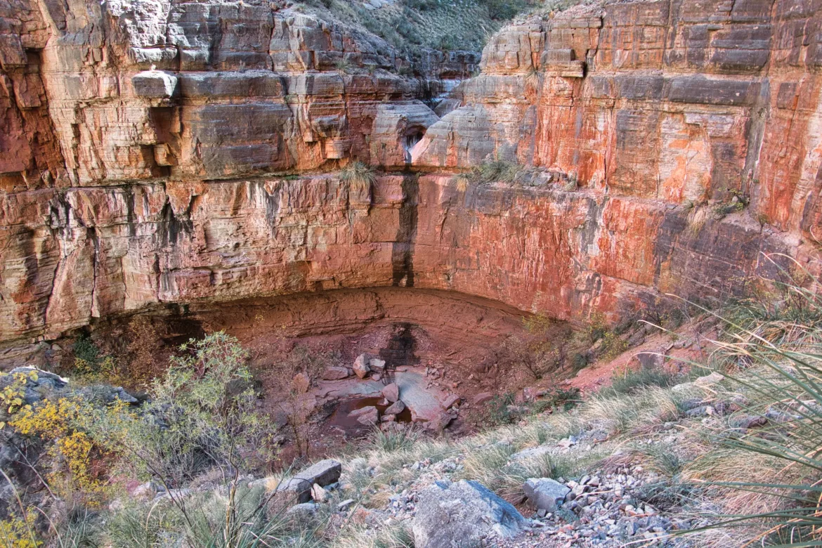
After I rejoined Saddle Canyon, it shortly narrowed down into a slot canyon. In the slot canyon, there were a ton of pourovers. These are the infamous chutes that I had heard about. A lot of the pourovers had a puddle at the end of them, but almost all of them had an easy way to scramble around. One I had to get out my haul line and lower my pack before I did some straight down climbing, but it wasn’t too bad.
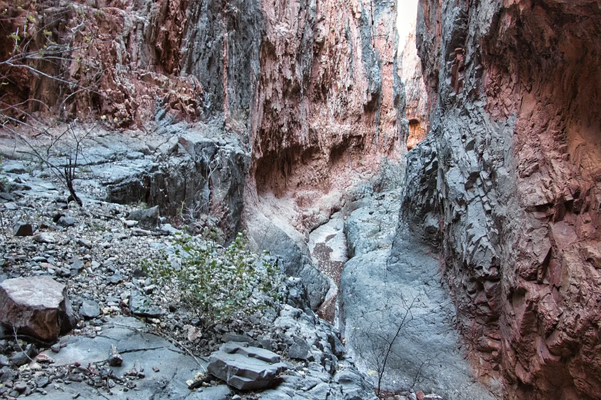
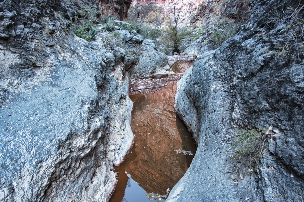
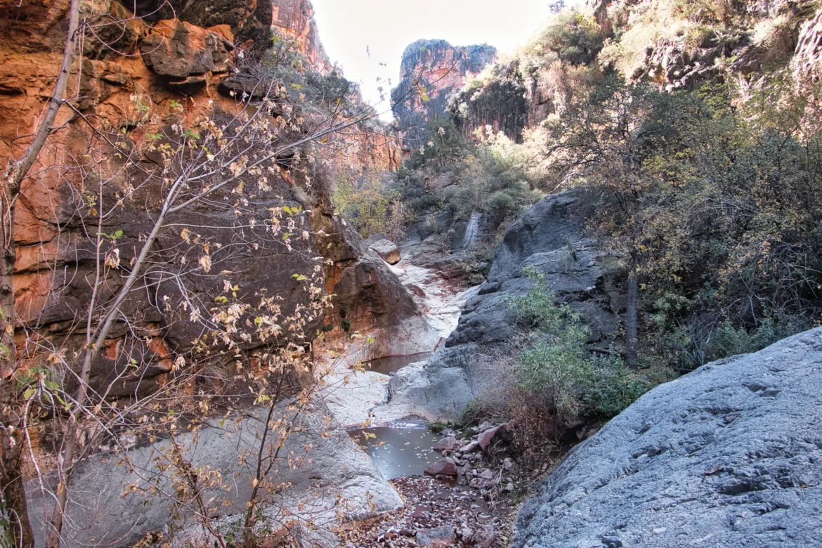
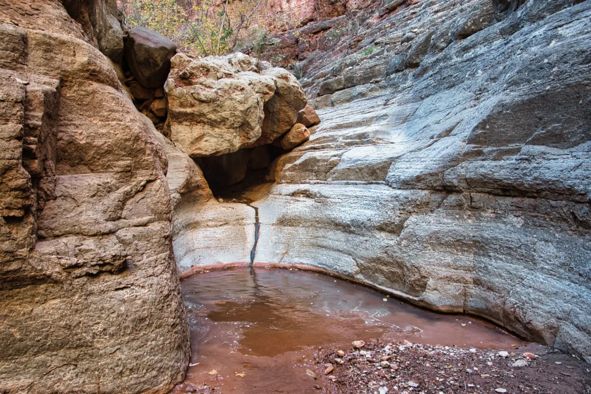
For a couple of miles, Saddle Canyon was just a moving puzzle. I constantly encountered obstacles and pourovers and puddles of unknown depths, and I had to figure out how to get around or through them. I kept my feet dry for a long time. Then I came to a pourover where the walls closed in on either side. I saw footprints going through the puddle at the bottom, so I supposed that the other hikers had scrambled on one of the walls, but it was a bit steep and exposed for my liking. So, I climbed down a chock rock which, in and of itself, was pretty sketchy. There was nowhere to even lower my pack, so I had to climb with my pack on. I was able to lower myself down, but the bottom was muddy and sloped away from me. I played slip and slide on the bottom until I decided to screw it and just ended up walking through the puddle, getting my feet wet for the first time.
The pourovers continued, and I came to a few that were basically water slides into a puddle. One of them I pretty much just had to sit down and slide down it into the puddle. I was able to wedge myself on the sides of the chute to have a controlled descent, but I still ended up sitting in the puddle at the end since it was slippery. I had packed all my stuff to where I could probably dunk my pack and be okay, but that was about the closest I got to wetting my pack today. A couple more tricky pourovers, and then I came to another big one. However, there was a trail up some sketchy scree to go around it and eventually drop down. The scree wasn’t too fun since it was really loose. I made it, though.
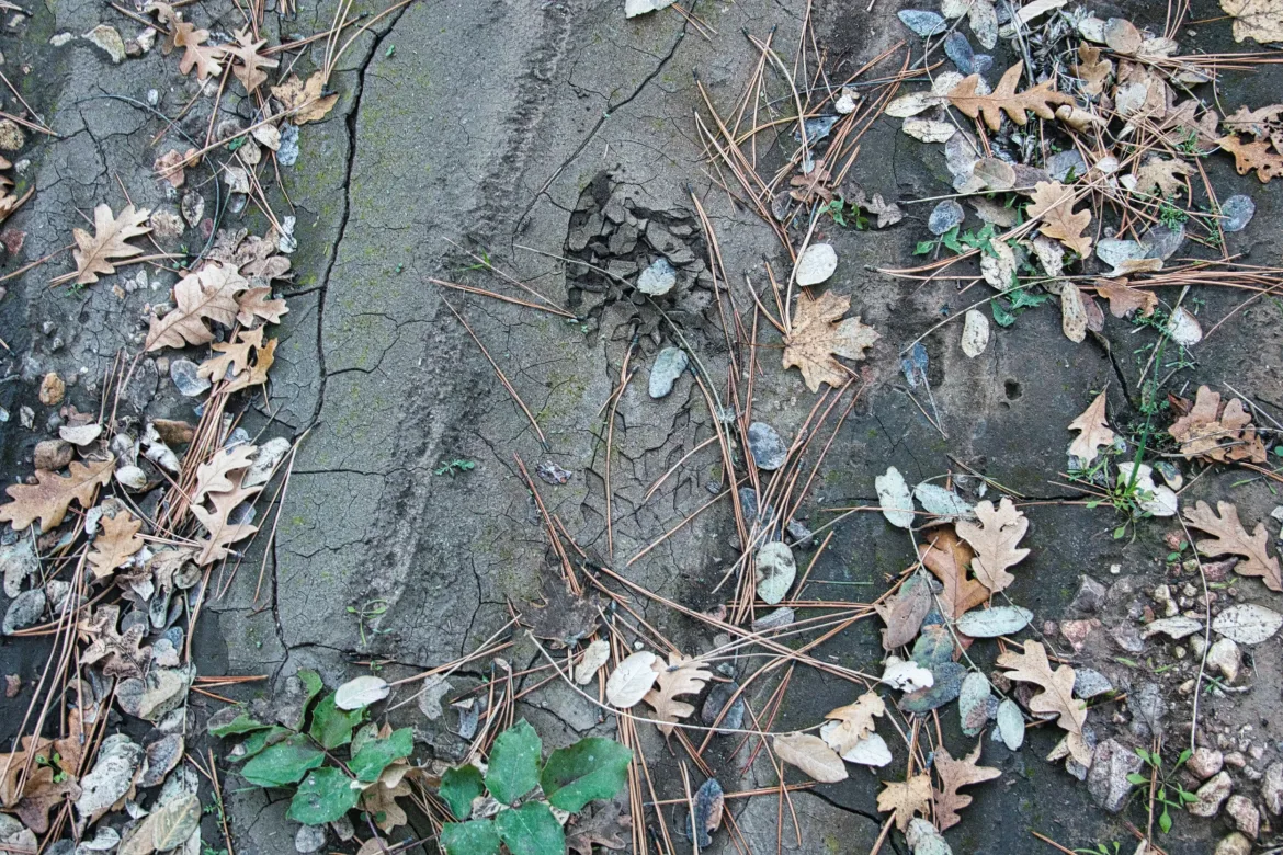
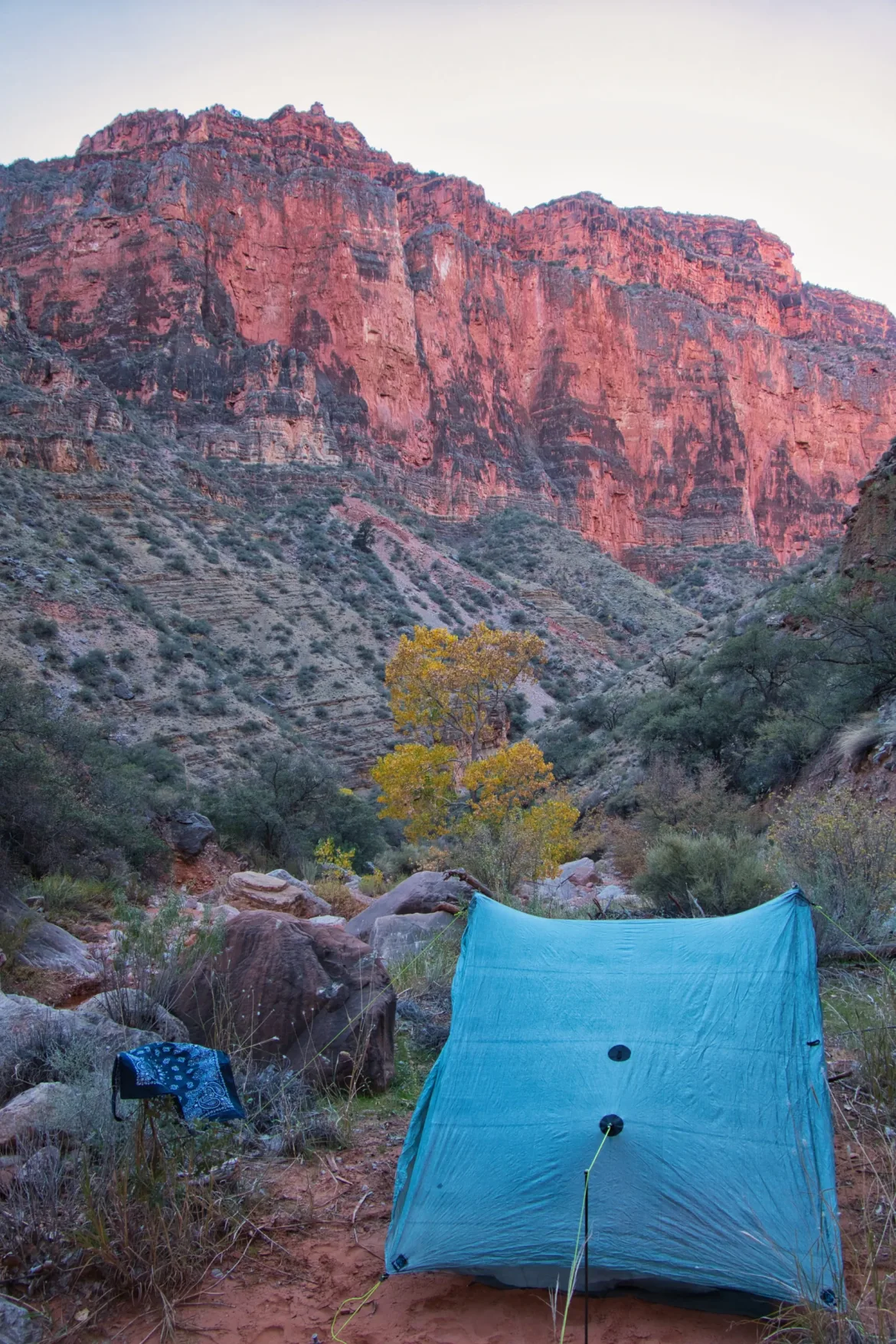
I was getting pretty close at this time to Crazy Jug but was also starving, so I took a quick lunch break. After lunch, as I was starting to approach Crazy Jug, I saw some big mountain lion prints in the wash. Awesome to see close to where I’ll be camping! I finished, I made it to Crazy Jug, which is where I had to stop for the day for my permit. It’s got a flowing stream, and I found a flat sandy camp spot not far from it. However, it was just after 12:00, so I had a lot of time to go today. Considering all of the daunting information on the internet, I’m amazed at how quickly this went for me today. I do like this type of challenging terrain that’s a puzzle that you have to put together on the fly. I really excel at challenges like this. However, I still don’t like exposed scrambling, though. There was a fair bit of that today. Most of the drops wouldn’t have been too far anyways.
I set up camp, and since I had a flowing stream, I washed my clothes as best I could and washed up myself as well. Then I set to repairing my pack. The brushy trail took a toll on it today. The water bottle holders on each side failed, so I sewed those back up, and my left hip belt pocket got a hole too, which I also fixed. That’s the third time I’ve repaired both of my water bottle holders and hip belt pocket. This trail is just not nice to stuff like that, though it is also an old pack with old material. I had planned that this trail was this pack’s last.
The sun set behind the canyon walls in very early afternoon, and I just relaxed by my remote stream, likely the only person for many miles.