
Start: Moab Hotel
Finish: Hunter Canyon Dryfall
Daily Mileage: 17.3
Trip Mileage: 23.6
Elevation gain/loss: 3453/2866ft
Kate and I were parting ways today. She had to go back home and resume her normal life as it was going to be a while until I got into some civilization again. So, it’s now just me solo for the rest of this trip. I had carried all of my food for the next leg of the trip from the start, so I did not have to deal with resupply.
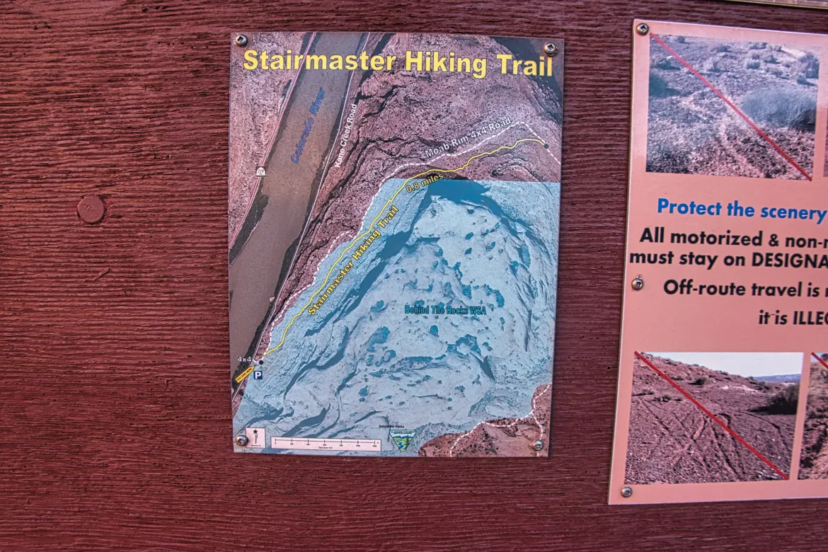
I got packed up and hit McDonalds of all places for breakfast. It was the only fast food place on the way and I wanted to get hiking quickly because it was going to be another hot day. The Hayduke did quite a bit of road walking leaving Moab along the Colorado River, but I had decided on an alternate route that would let me avoid a lot of that for a much more scenic and difficult adventure. And a lot longer too but I didn’t care about that. After I finished the initial road walk on a paved road being passed by many side by sides, I got to a trailhead for a 4×4 track which I thought I was going to be walking up. Turns out there was actually a hiking trail next to the 4×4 track. The trail was called Stairmaster so obviously I had to show that trail who was boss with my heavy pack with 5 days of food and 6 liters of water. The trail was relatively steep, but comparable to Washington standards, so it wasn’t too bad especially since I was in the shade of the canyon for most of the climb.
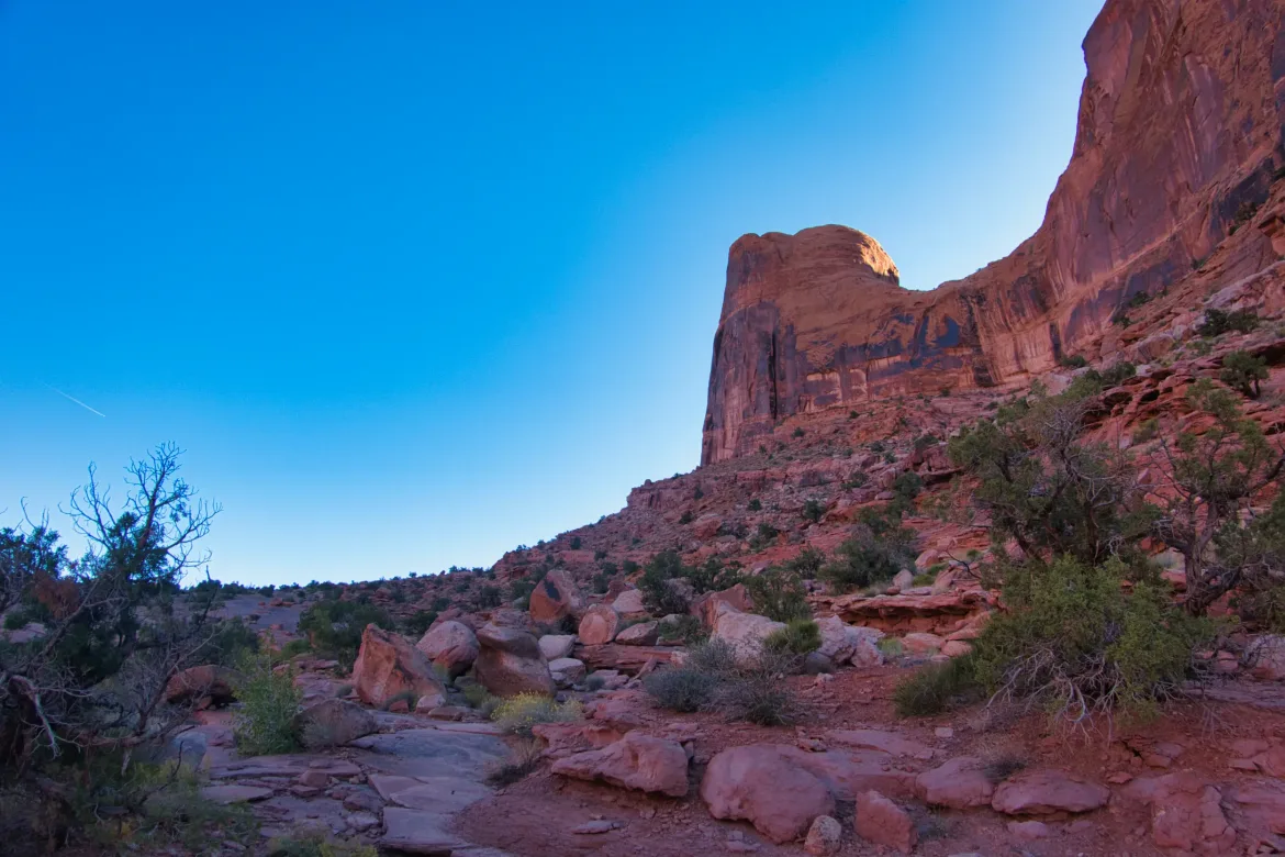
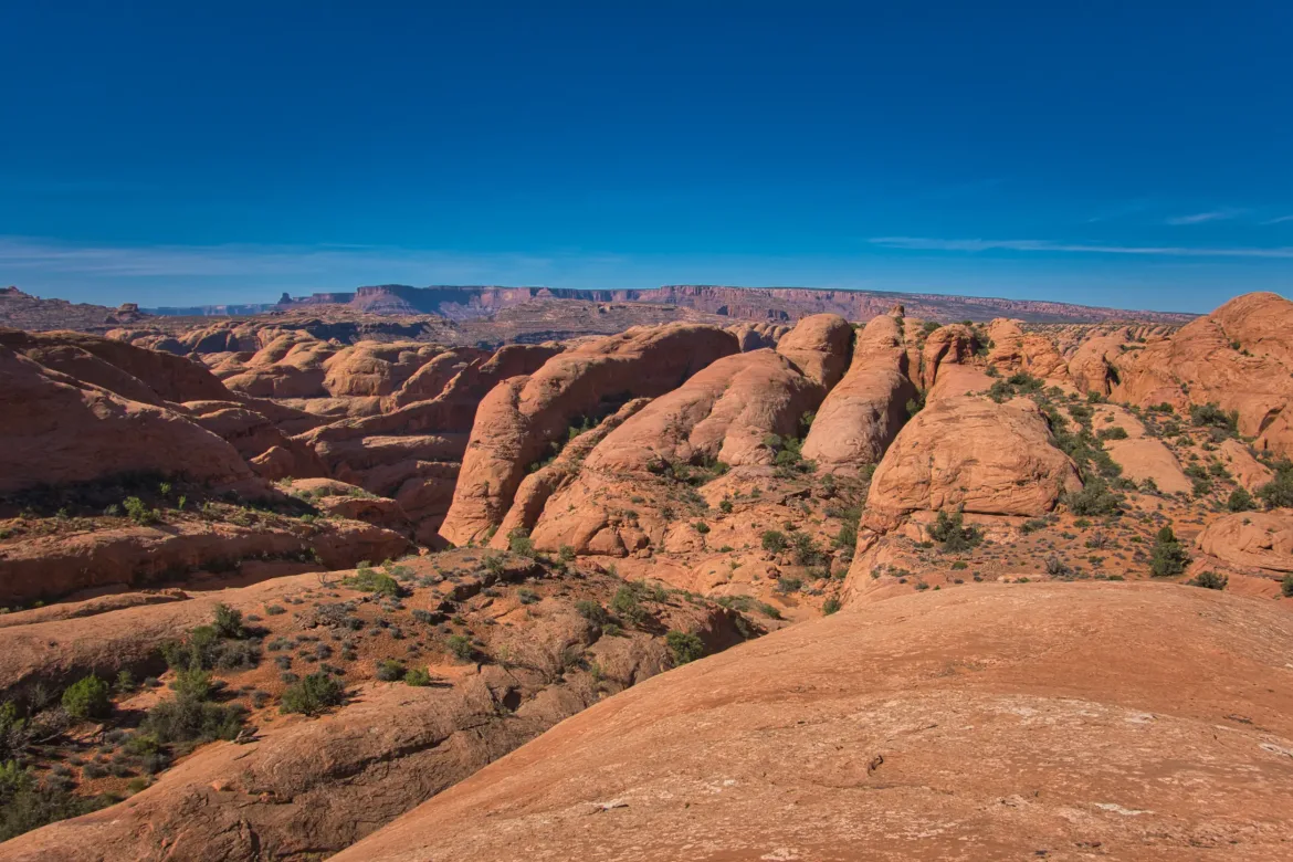
When I got to the top of the canyon, I rejoined the 4×4 track and followed it for a while. This took me to the edge of the rim of the cliff’s surrounding Moab and I was able to see the expanse of the entire area including arches in the now distant National Park. It was quite stunning and euphoric for me just seeing that view and vastly different landscape from what I’m used to.
I continued on the track for a while through various desert rock formations until it came time to part ways and make my own path across the desert while doing my best to avoid the cryptobiotic soil. I descended a couple washes, but they weren’t going in the right direction so I had to just get out my compass and take a bearing to where I wanted to head. I really like just using a compass hanging around my neck to sight where I’m going and keep myself on course. It is a simple but tried and true form of navigation. However, I am using a GPS for most of this trip.
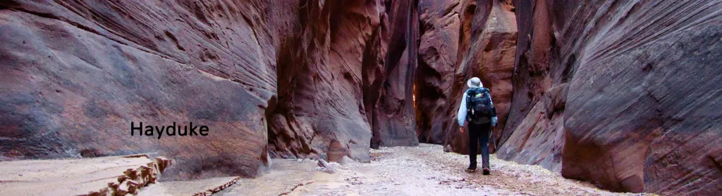
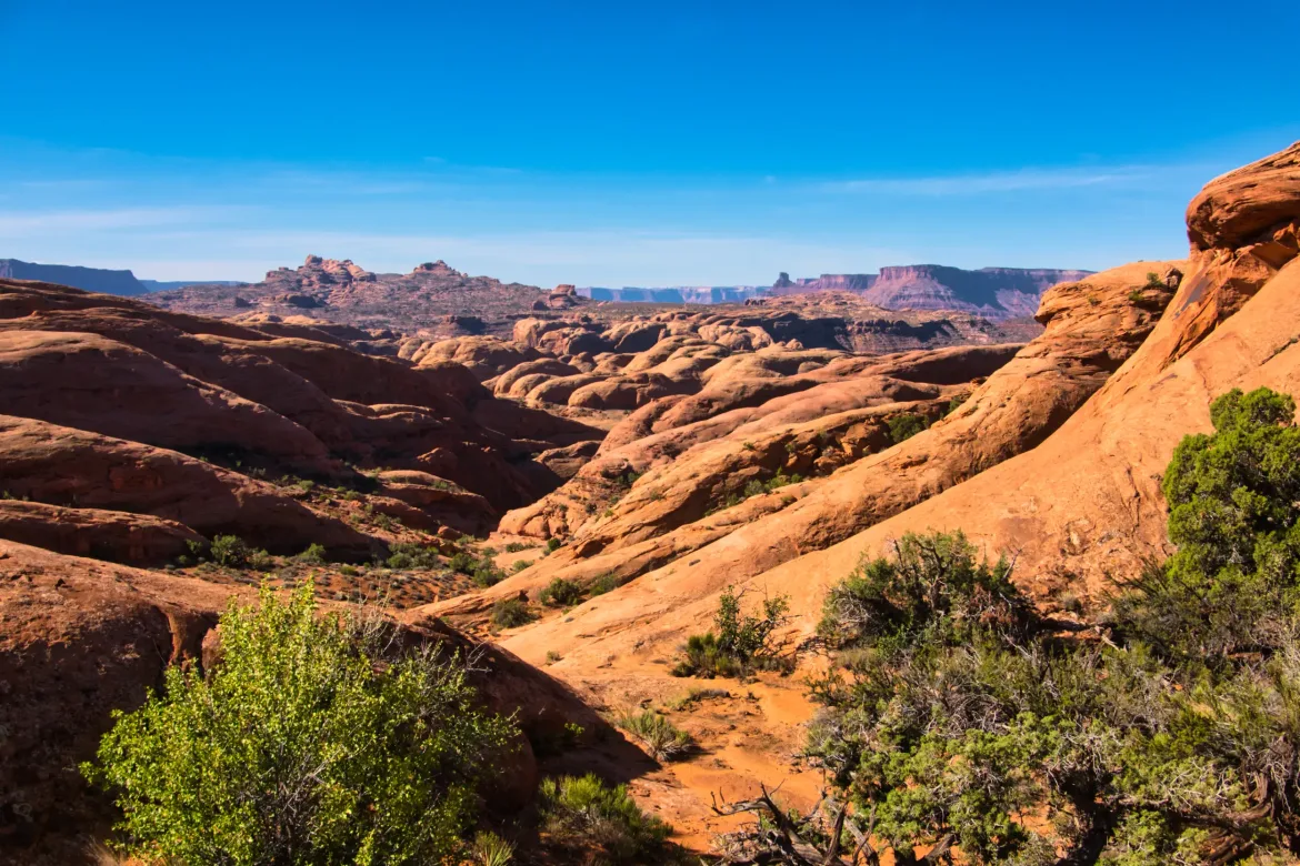
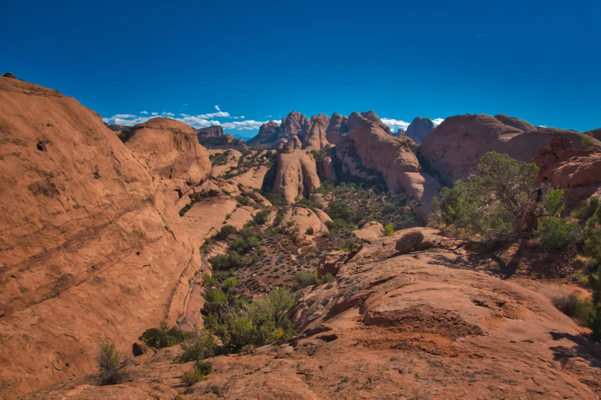
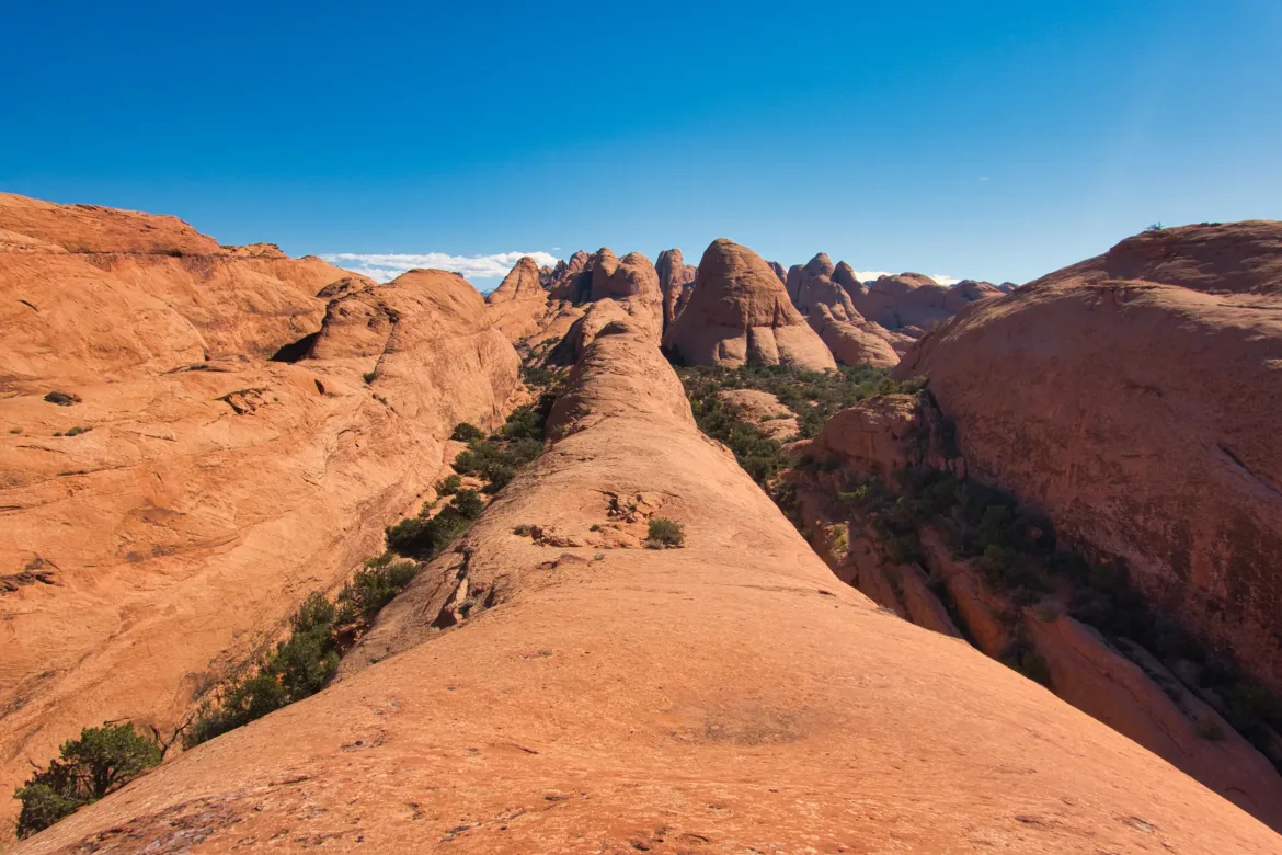
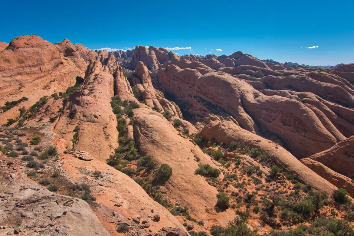
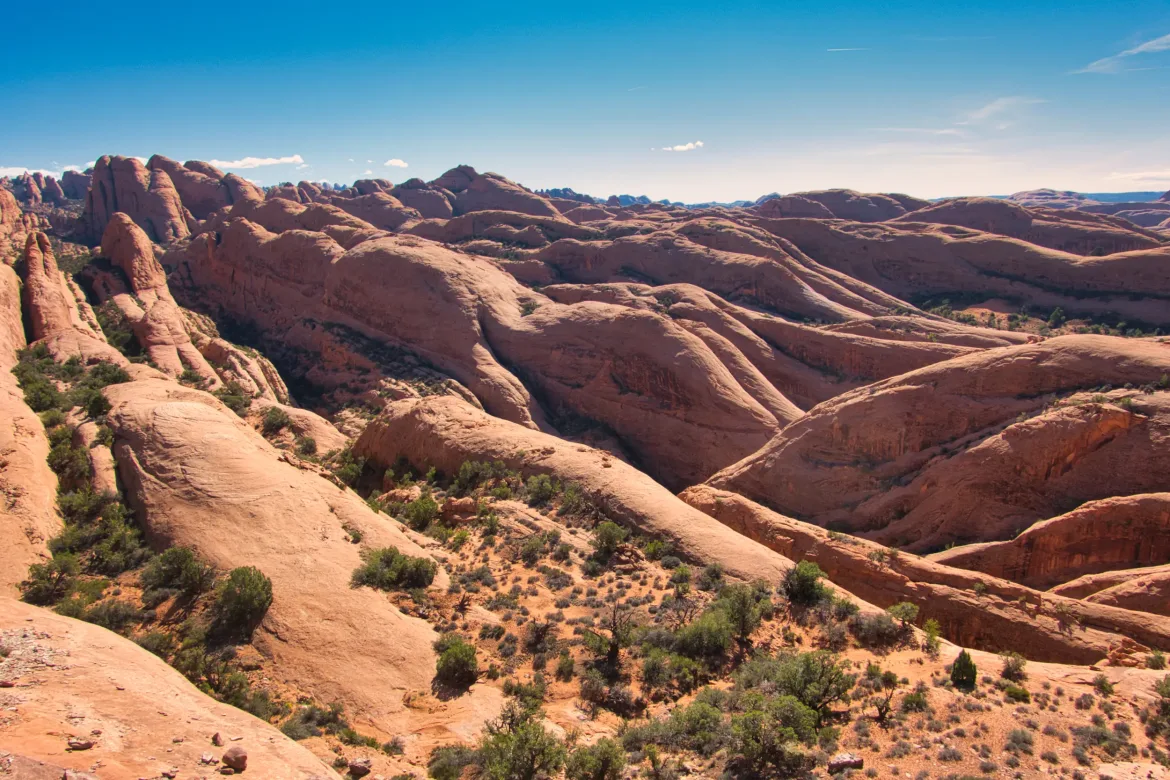
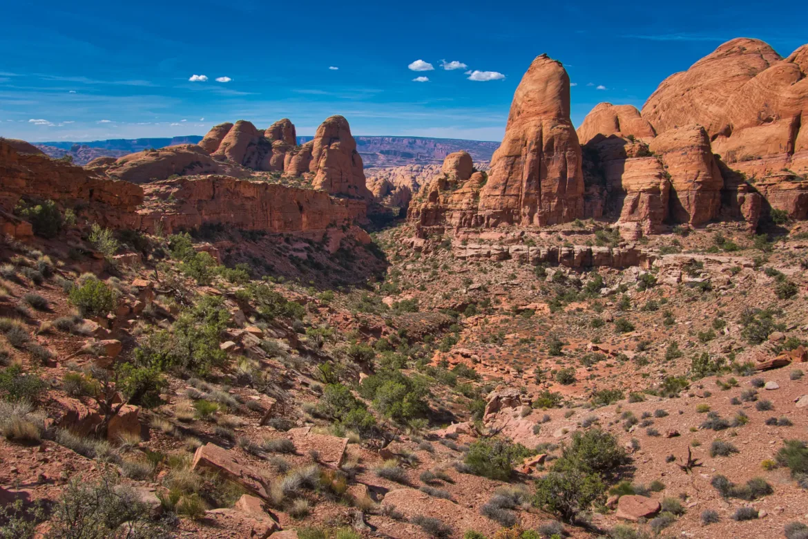
The main part of this alternate route was winding through a huge area of parallel stone ridges and spines. Sort of like a bunch of stegosaurus spines next to each other and offset such that there was anything but a direct route through them, and I was trying to cut across this terrain. Not the easiest thing to do as you can imagine. I had a GPS track for how to get through the area that was proven, and I did see footprints from time to time from presumably other Hayduke hikers, but I frequently lost the footprints and had to do most of the navigating myself. Due to how complex the terrain was and how narrow the spines were, it was hard to even use GPS because I couldn’t tell if I was supposed to be on a ridge or in the valley between them. This led to a lot of turning around when something just wasn’t panning out which you can see on the GPS track below. The route itself was brilliant and I’m not sure how it was mapped out initially but it was incredibly complex and you had to follow it exactly to make it work. It was very challenging but I got through it and it was incredibly scenic and well worth the effort and navigation struggle.
I got a lot of views down all these parallel spines and it was just a surreal and incredibly unique place to be, and unlike anywhere else I’ve ever been. Working my way through the terrain, it was just astounding that I could progress through terrain like this. There were definitely difficult parts where I had to figure out how to get around dryfalls or up to a pass or something like that but I made it all work and kept steady progress.
I had been following a pair of footprints for most of the hike through the rough area and it looked like they were not far ahead of me, maybe within the last day or so. I wonder if I will catch up to them at some point. I wasn’t sure if I was going to see other hikers on this trail since it isn’t the normal season.
The sun once again got hot today and I drank a lot of water. I did manage to resupply in a pothole in a stream between two spines that I was following. The stream wasn’t flowing like most streams around here but sometimes there is a cavity in the rock that holds some water. After winding back and forth for quite a while I escaped the spines and headed down a river valley where I would rejoin a 4×4 track.
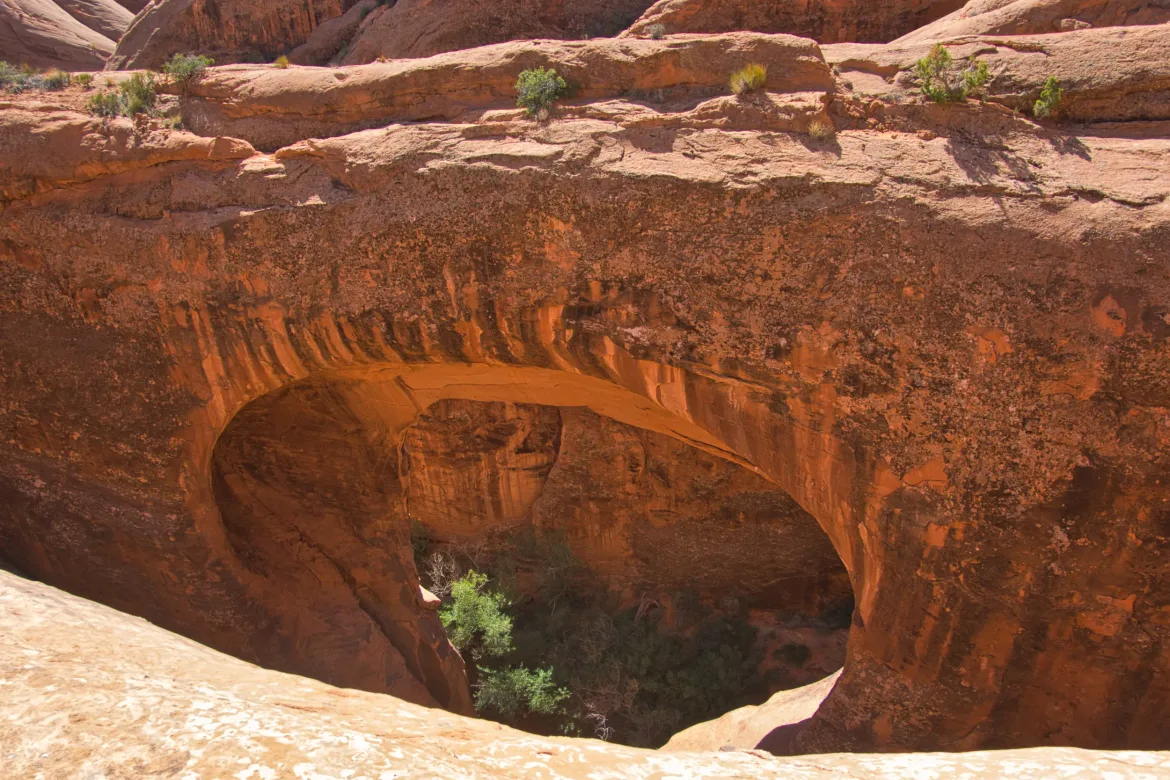
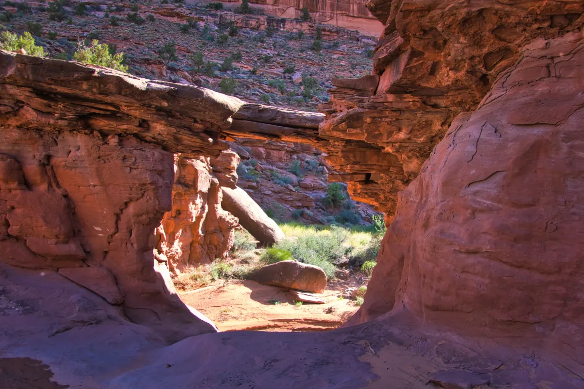
The river valley was also dry and I found a faint footpath that followed it down. It was hard to follow through with all the rock and I lost the track a couple times. I ended up on the other side of the river which is probably not where I was supposed to be, though there appeared to be a faint game trail on that side too. Not having much luck trying to follow the barely existent trails, I tried to follow the wash itself for a little bit but quickly came to a pour over (dry waterfall) that I couldn’t get through. However, above the pour over was a natural bridge called Troll Bridge. I would have missed that completely if I hadn’t been on the wrong side of the stream.
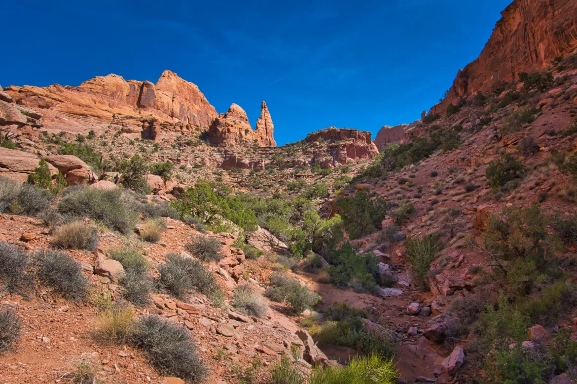
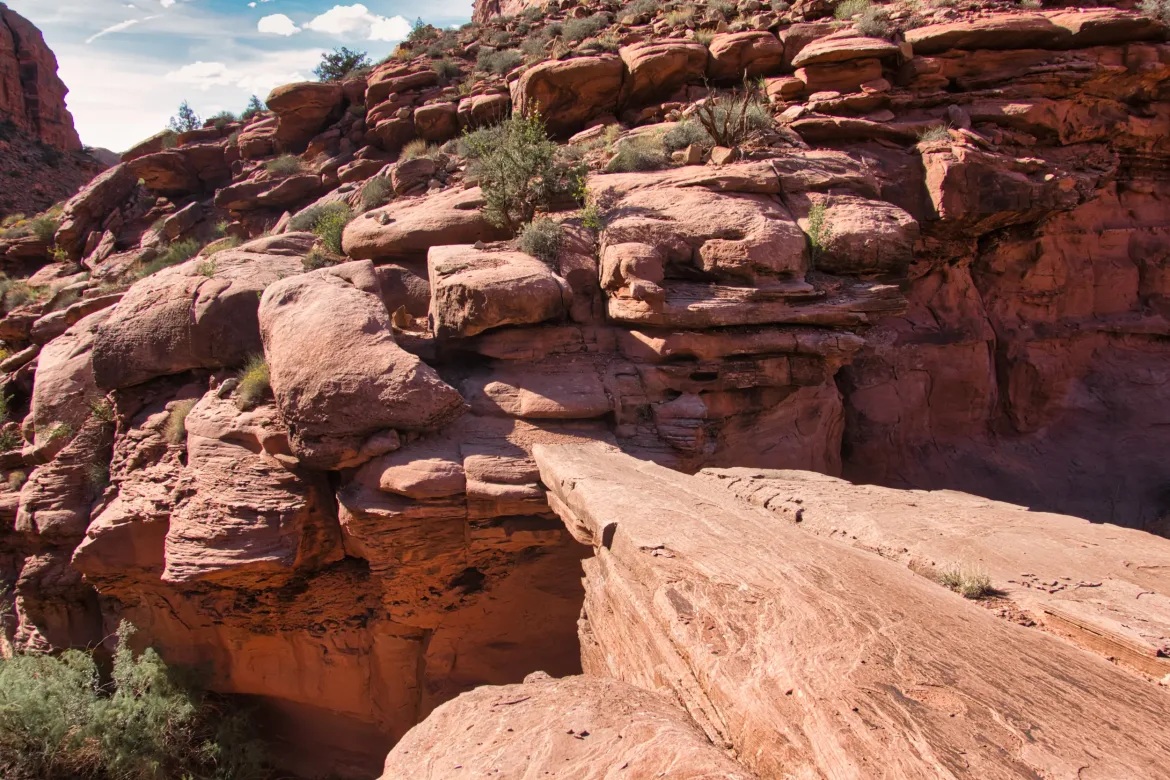
I got back up the bank of the wash and ended up crossing Troll Bridge to get back on the correct side of the wash where I was able to quickly find a disused 4×4 track before I joined a more heavily used 4×4 track. The rest of the day was following 4×4 track. It was a very rough track with some big ledges and steep walls for the trucks to go up or down. I’m not sure how they did it because it was challenging for me to do the same thing on foot.
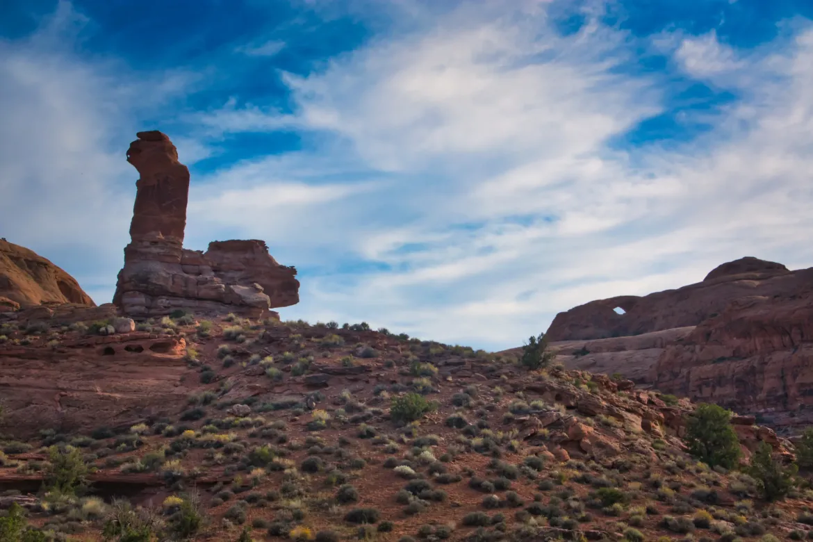
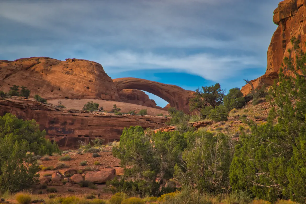
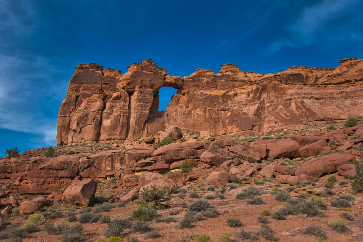
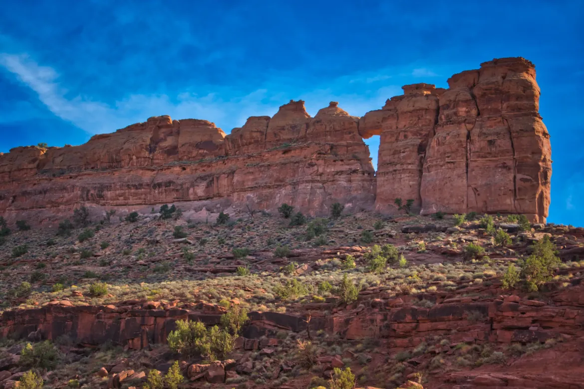
I was in the afternoon sun and it was hot, so I was relieved that I had found that pothole water halfway through the day. There were a couple puddles on the road but I didn’t want to touch those because they looked nasty and who knows what they had in them from the trucks. I slowly made my way along the 4×4 track climbing past some arches until eventually it leveled out and made for some easy hiking.
As I was approaching where I wanted to camp for the night I actually found a pothole with some water in it to the side of the road so I was able to fully refill my water to six liters for the night. Can’t beat that! Shortly after that I found a flat to camp and pitch my tent for the first time this trip since it might rain overnight. I’m out here by myself haven’t seen anyone since this morning and it’s dead quiet except for the sounds of the crickets.