
Day 56
Start: Tyndall Creek
Finish: Kearsarge Lakes
Daily Mileage: 14.4
PCT Mile: 789.7
My alarm went off at 3am, but I was already awake. I’d only slept a couple hours the past 2 nights, but now I had to get ready. We were hitting the trail at 4am to cross Forester Pass before the snow started to soften, making the hike difficult and dangerous.
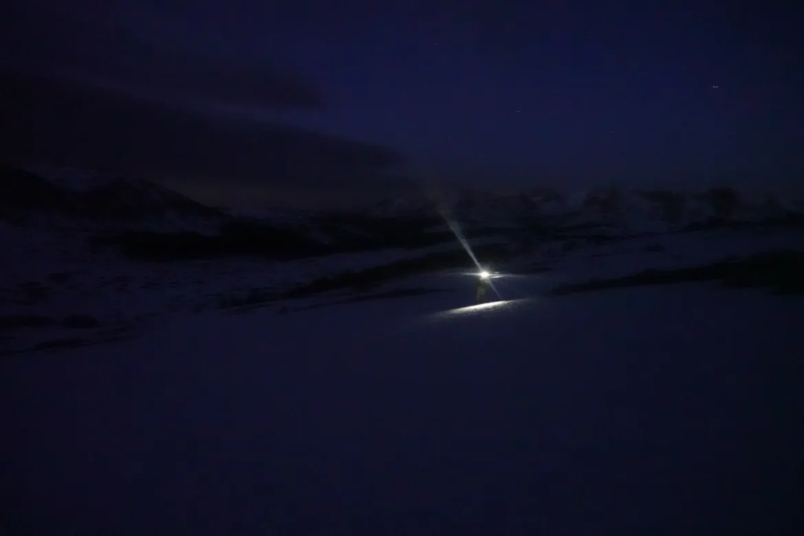
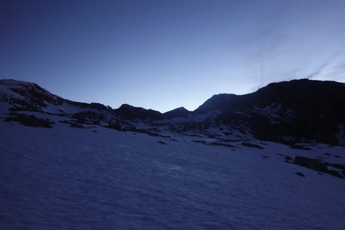
Cookie Monster, Lanyard, and I hit the trail at 4am as the last group to leave camp. The others had left at least an hour earlier. Our headlamps lit the way with their small circles of light in the vast landscape we were traversing.
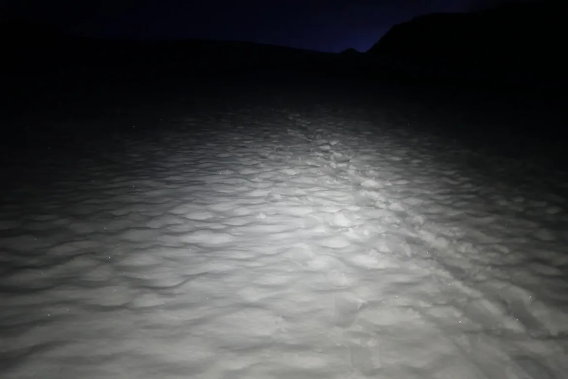
The route started out through forest with the same snow obscured trail we have been traveling in the Sierra the last couple days. We wound our way through the trees, occasionally checking GPS to ensure we were roughly paralleling the trail.
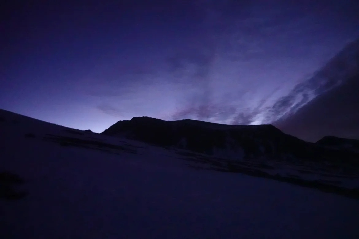
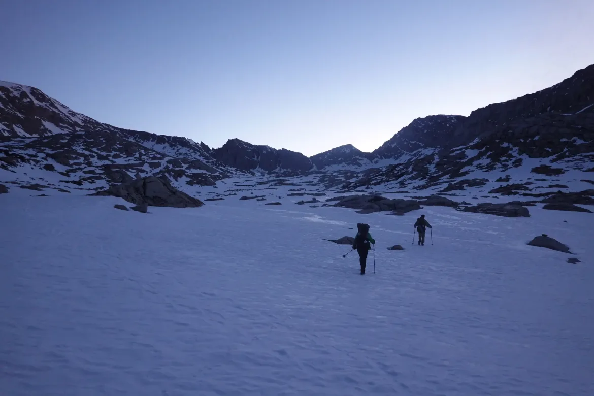
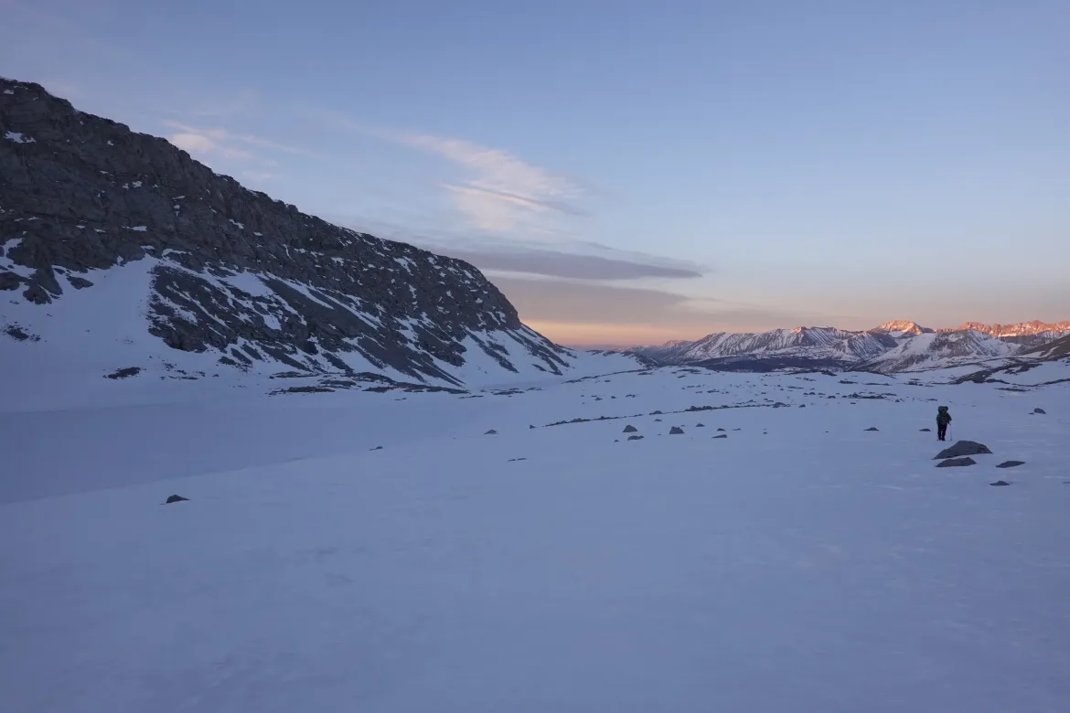
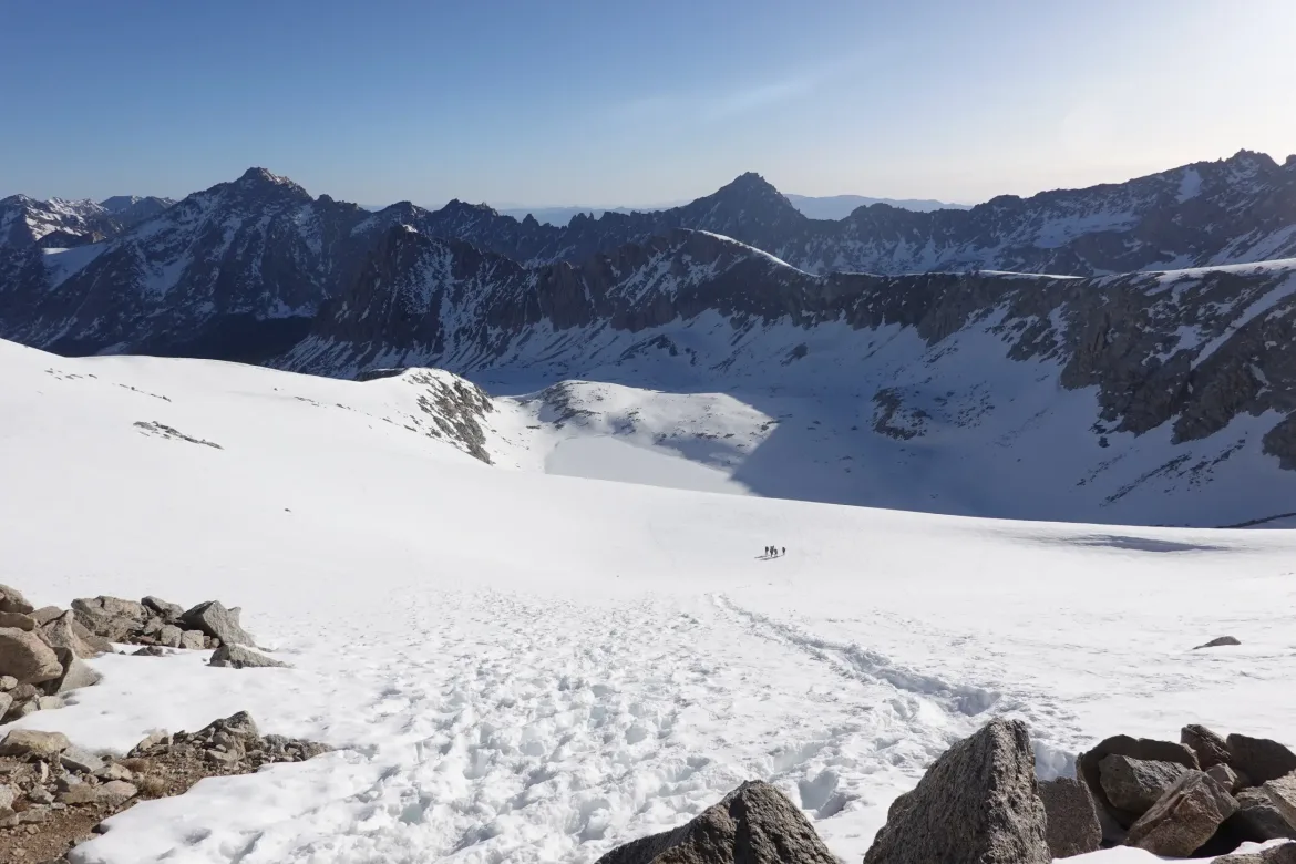
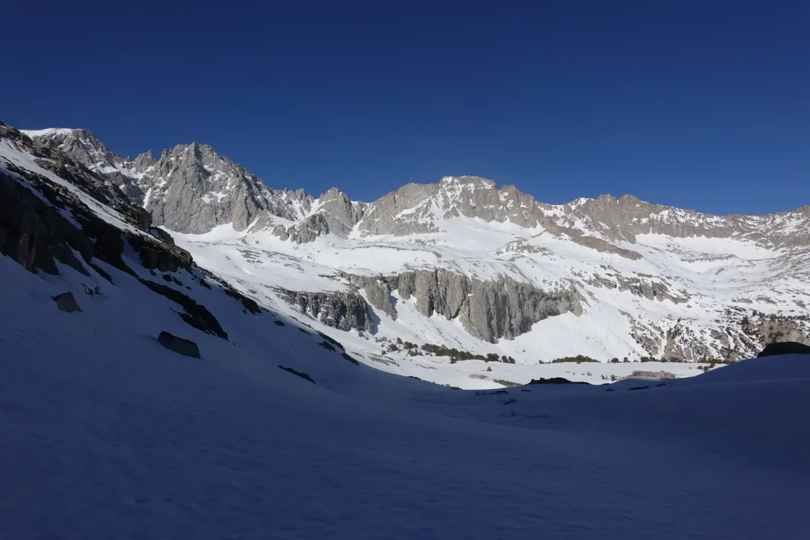
Soon the trees disappeared as we rose above treeline and we continued a gradual uphill on a wide snowy plain. We would either follow the footprints of others or make our own way in the general direction of the pass. Soon there were the faintest whispers of light and we were able to turn out headlamps off in the pre-dawn hours due to the snow reflecting any light it received.
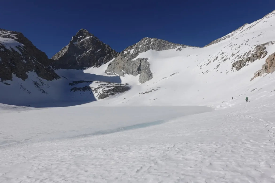
The light gradually revealed high mountains surrounding us and the undulating landscape we were traversing. There were several lakes and streams, but they were all completely concealed by the snow and we had to make sure we didn’t stumble onto one and fall through the ice or a snow bridge. Forester Pass also came into view as a tiny notch in a string of mountains, with the faint flicker of headlamps of hikers headed up.
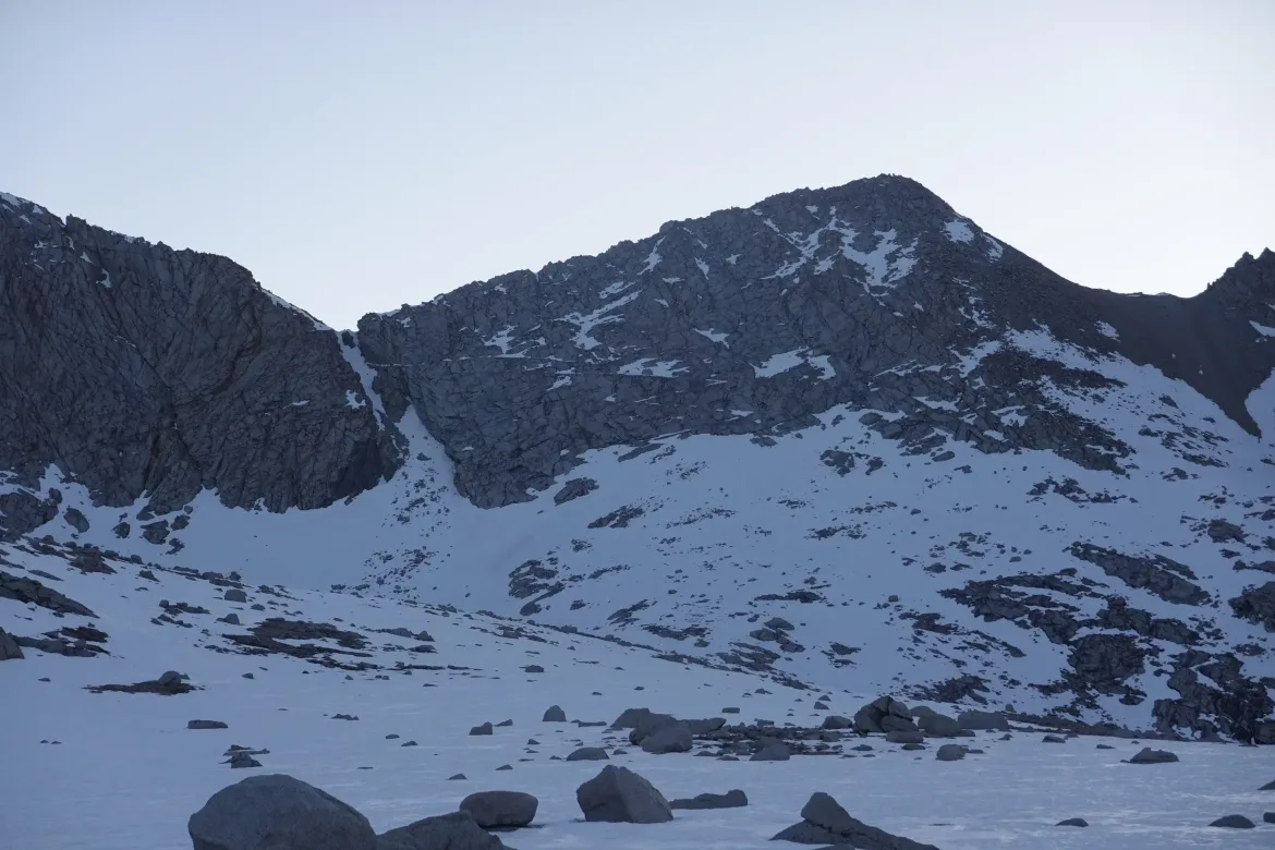
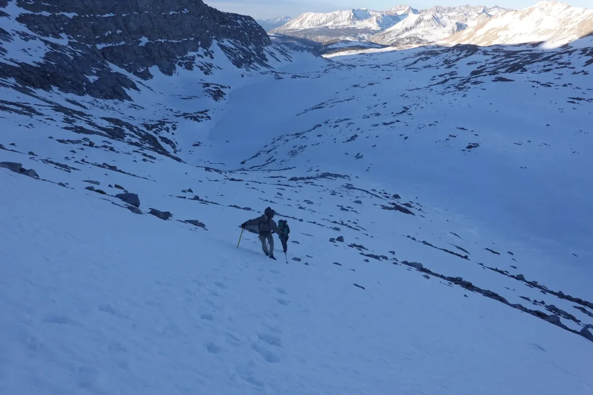
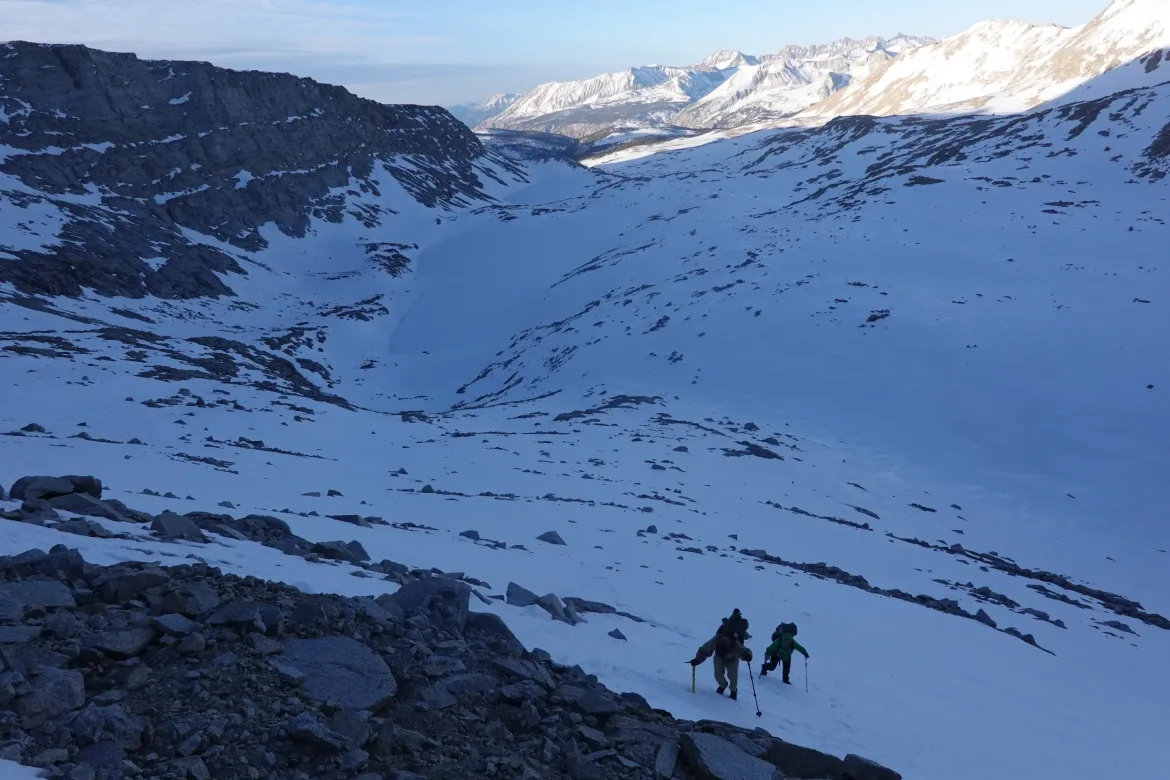
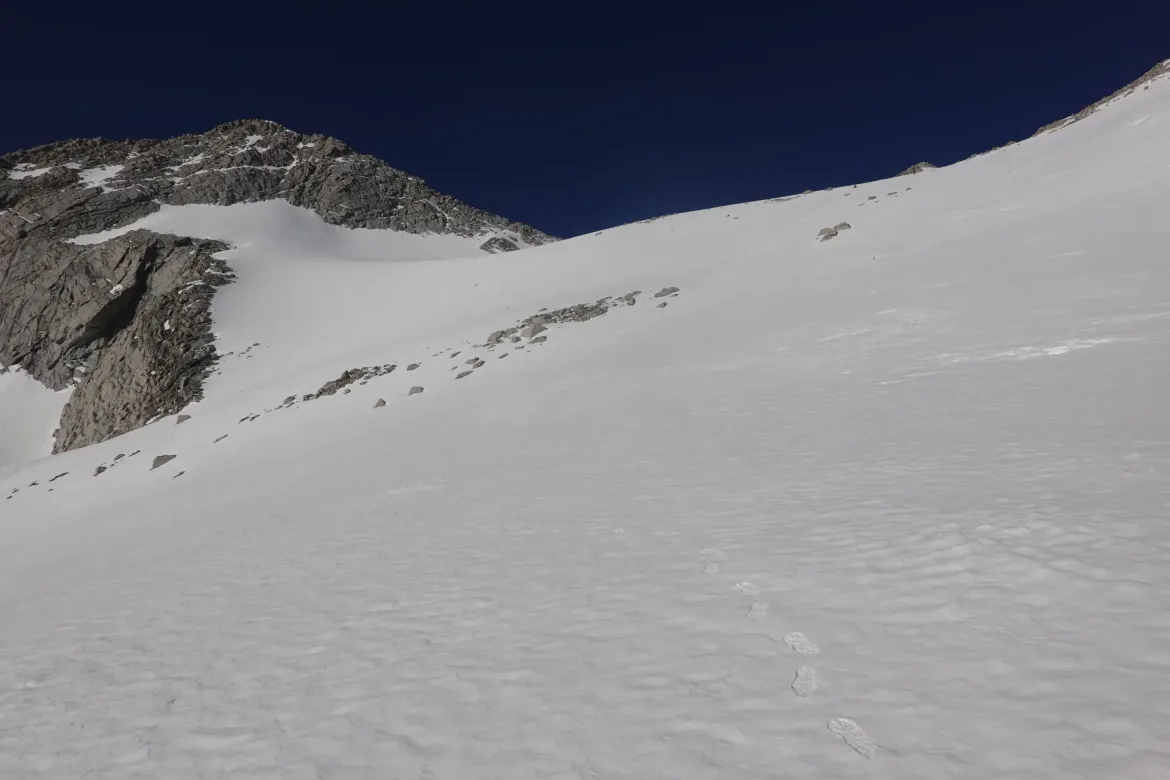
We reached the foot of Forester Pass. We had to climb 800 feet to reach the pass from the base, and the lower half of the trail was obscured with snow. Normally this isn’t an issue since it is easy to make your own trail in the snow, but this was a pass through a steep set of mountains with a trail blasted into it to allow hikers to switchback up it. Now, we had to make our own way up. Thankfully, since our side of the pass was south facing, we could see the trail switchbacks about halfway up the face. That appeared the way to go, but we first had to get to the switchbacks.
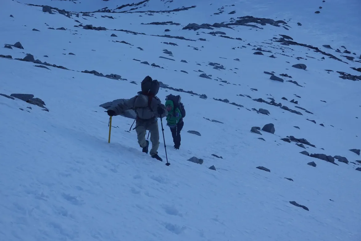
The slope was up to 33 degrees of snow and ice, with occasional rocks pocking through. There was nothing else to do but head straight towards the visible end of the trail. Cookie Monster and I had microspikes, and Lanyard had crampons, and we had ice axes. There was occasional faint bootpath up, but the tracks were all filled in with wind blown snow. They offered some, but not great help. I felt that the microspikes were a bit inadequate for the job, but they worked well enough as long as I was sure to let them get enough grip.
We all carefully made our way up, heading to the spot where we saw the Spicy Bandits disappear ahead of us after taking a wrong route straight up. We all made it with no issues, and I was happy to be on actual trail after the steep ice
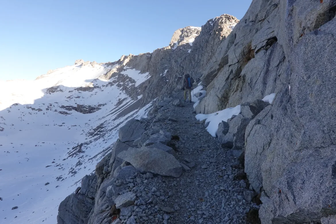
The trail was a relative cake walk, though the elevation we were at made us pause for air. The trail disappeared behind a snow chute, but thankfully there were great steps ready for us.
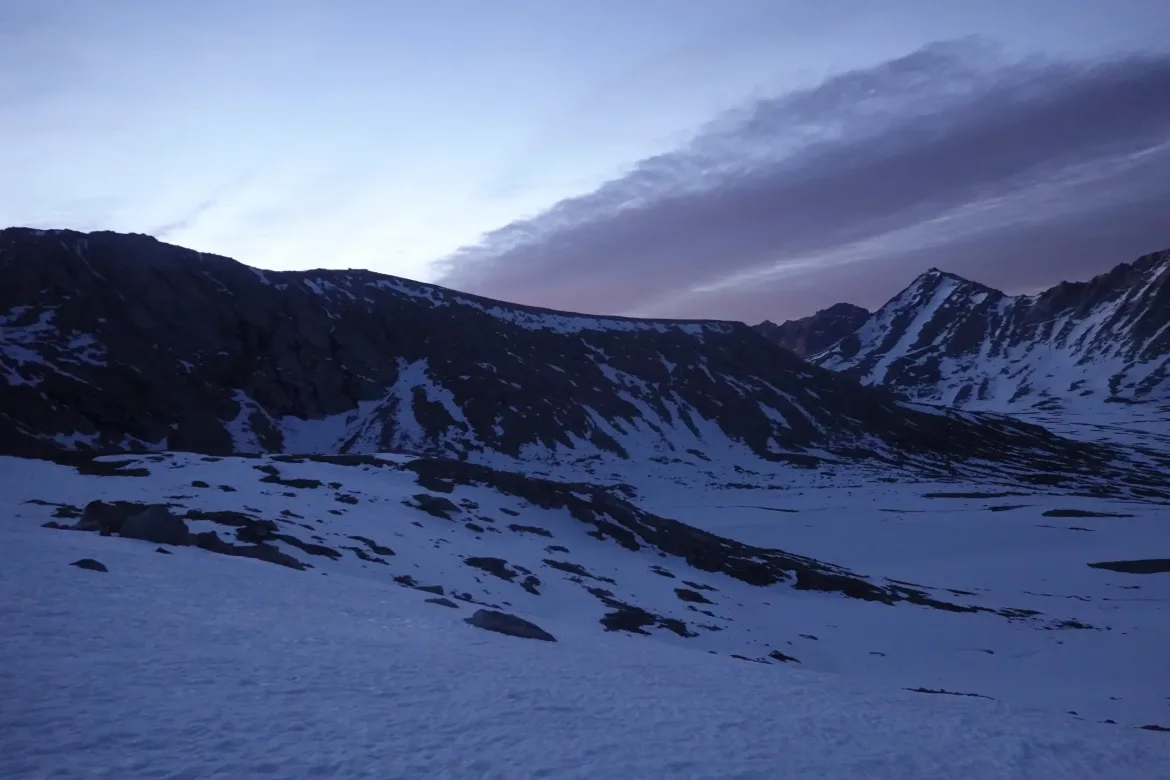
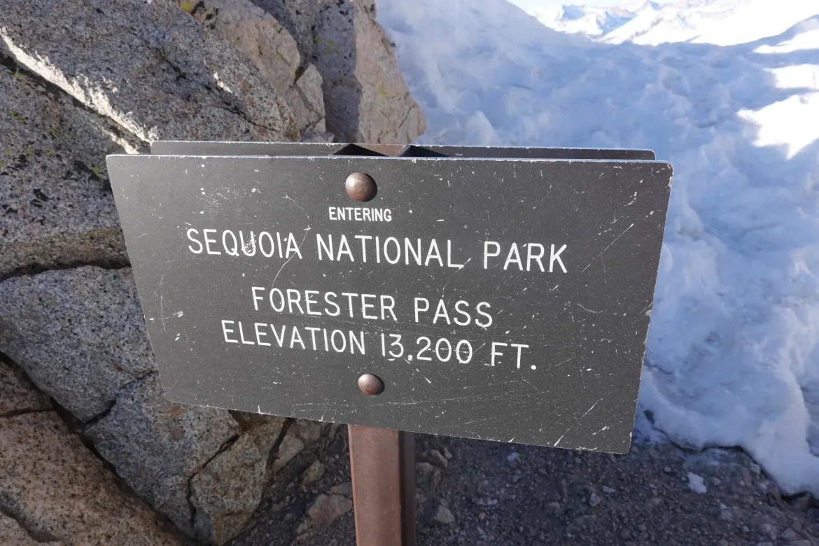
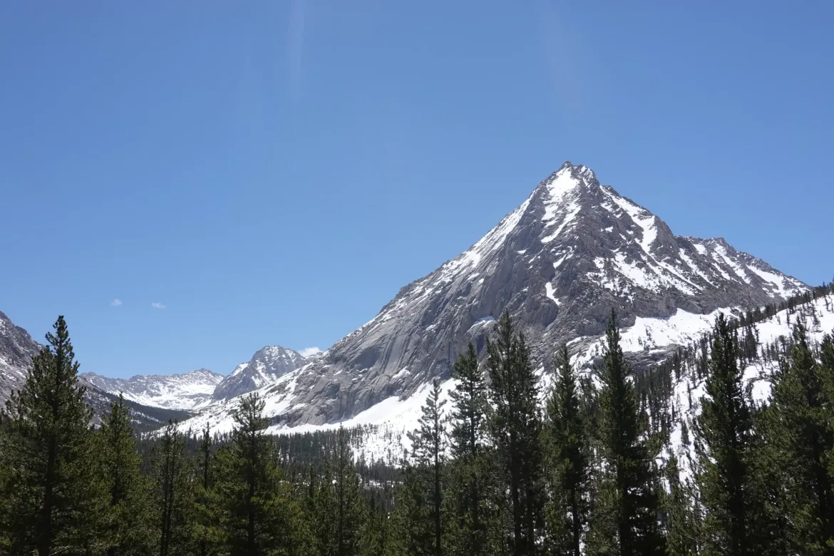
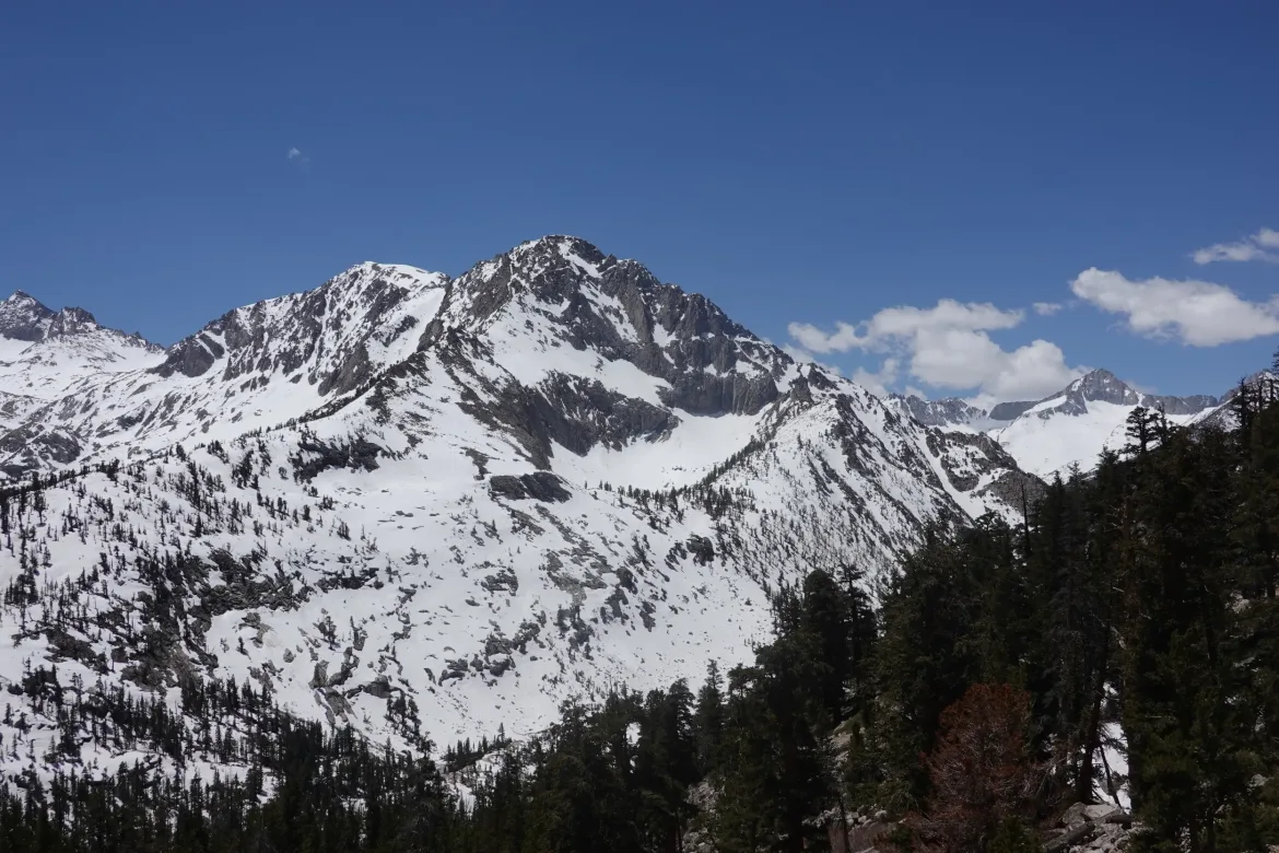
After the chute, it was just a few more short switchbacks and a quick scramble over a cornice and we summited Forester Pass! The Spicy Bandits were there to cheer us on. The view from the top was spectacular as you would expect, with mountains lining the two immense valleys that we had and would traverse. At 13,200 feet, Forester Pass is the highest point on the PCT, and it was quite an achievement to reach it and take it in.
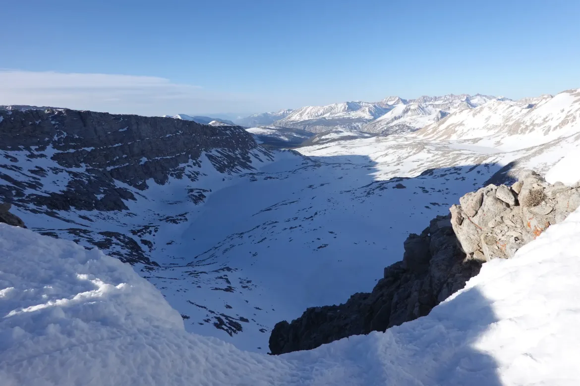
However, the day had just begun, and we still had a significant amount of snow to traverse before it got too soft, so we immediately started preparations to head down the other side. The north side of the pass was more gentle than the side we climbed, and there were a couple glissade chutes going down. We prepared our packs and took off down from the pass sliding on our butts and using our ice axes for braking.
There were two separate glissades, and we were able to slide down almost 800 feet, much more quickly than walking down. The second glissade was quite long. I couldn’t even see the bottom when I started but there was a track going down so I took off to see what would happen.
I had to put a lot of force into my ice axe to break, and it quickly tired me. I had to self arrest to stop myself twice on the way down just to rest my arm for a minute before continuing down. I got great speed on the way down, and the slope was very flat and even. I don’t think I have glissaded faster before.
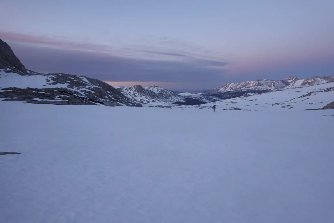
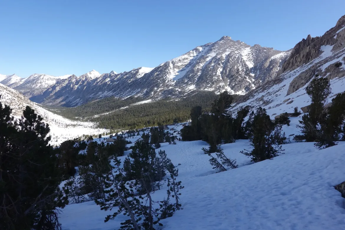
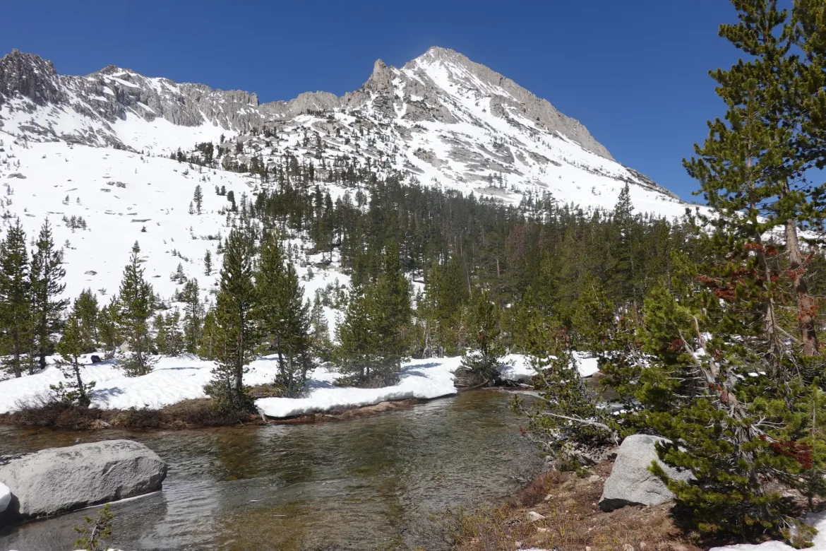
I thoroughly enjoyed the glissading, but soon enough it was over and we had to go back to the good old fashioned walking. However, the walking was glorious. We were still on a pure field of snow and the trail was wherever we wanted it to be. All we had to do was follow the valley down and keep the stream running down its center on our left after it emerged from underneath the snow.
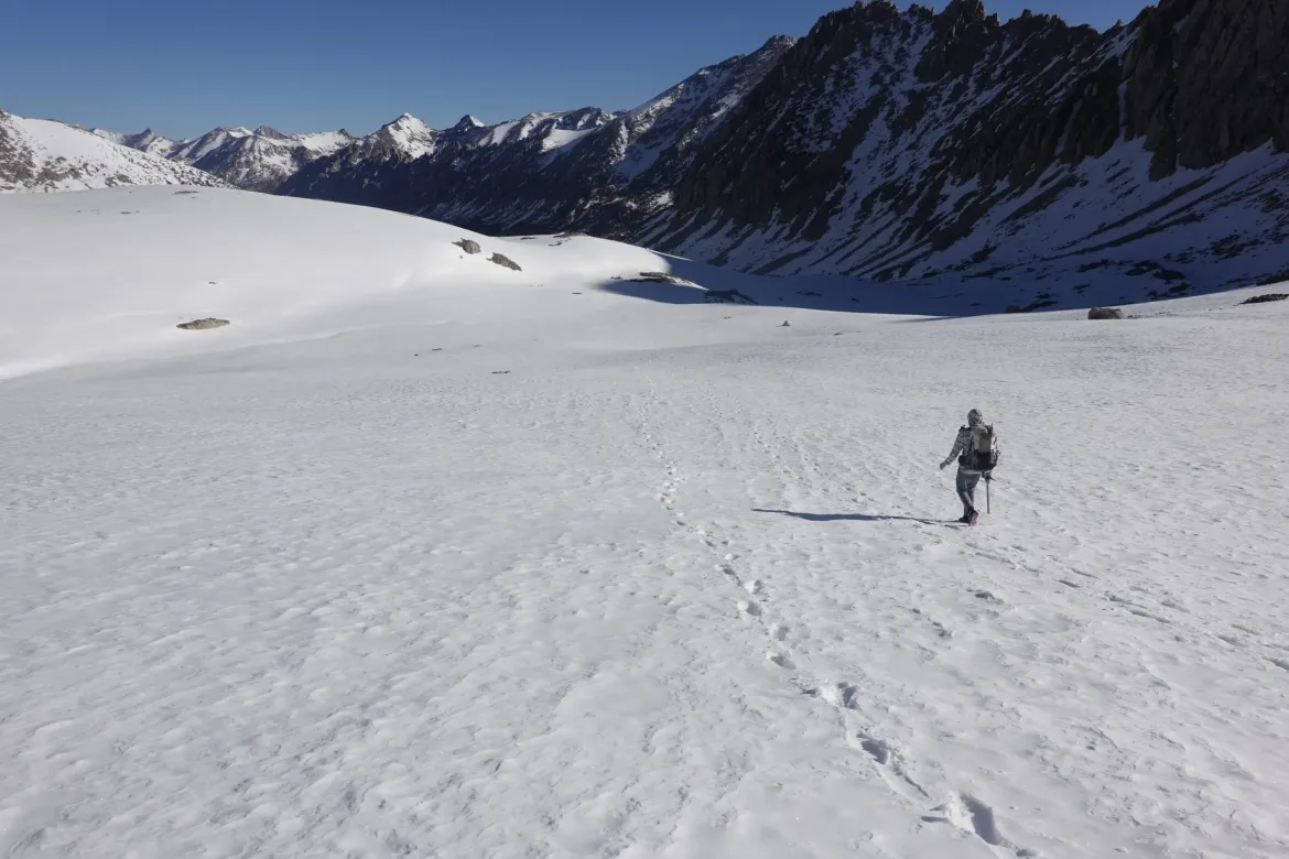
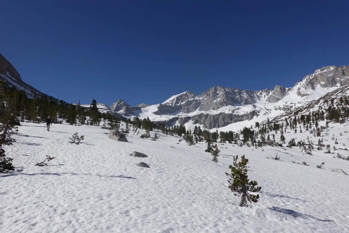
As always, I had great fun finding the way down. Sometimes following footsteps, and other times going off in an untouched direction when it looked like there could be a better way forward. There were also several more opportunities to glissade, though they were far shorter than the first glissades.
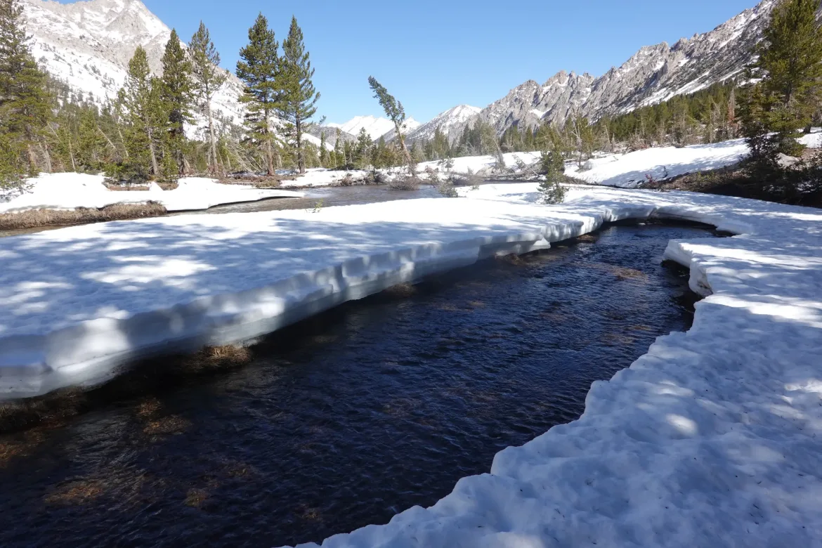
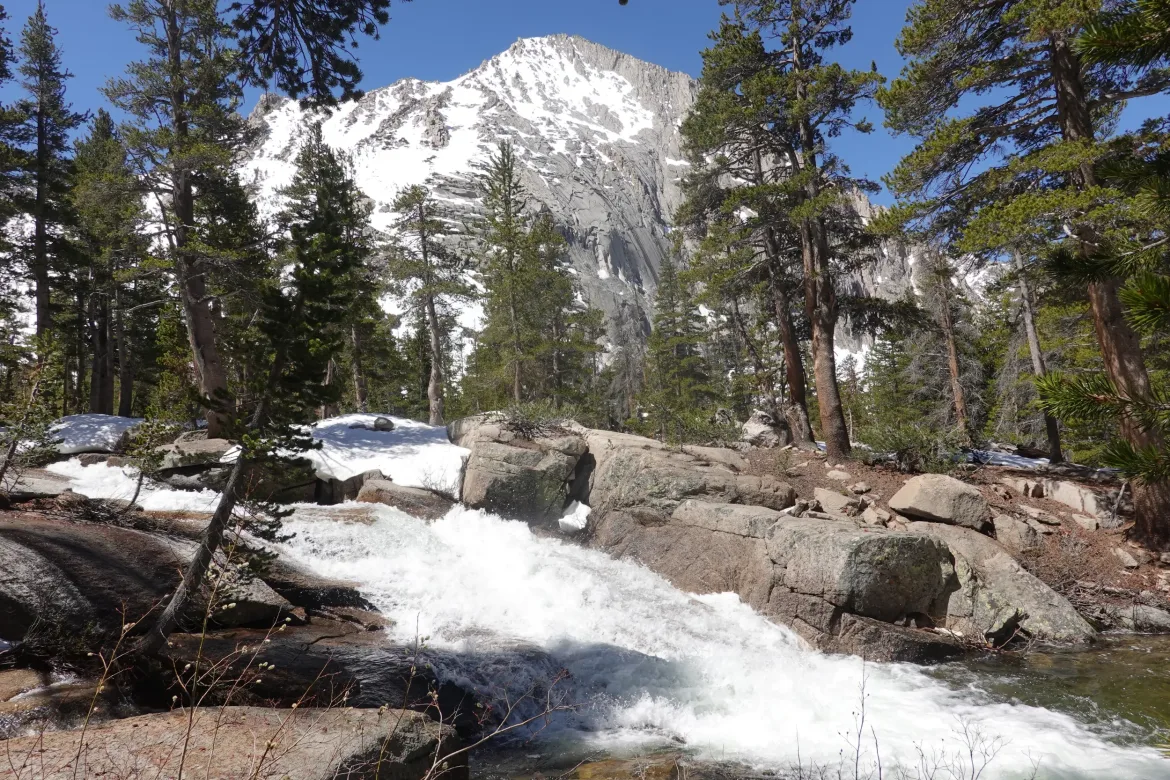
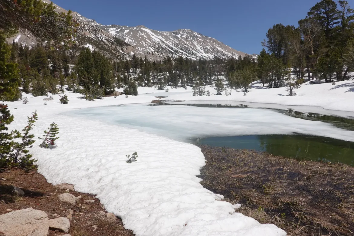
We wound our way down the valley with constant views of the spectacular mountains around us. We started crossing streams that were completely covered in snow, careful to not cross in a depression or area that could collapse below us. Soon enough, trees started appearing around us as we got low enough for them to survive.
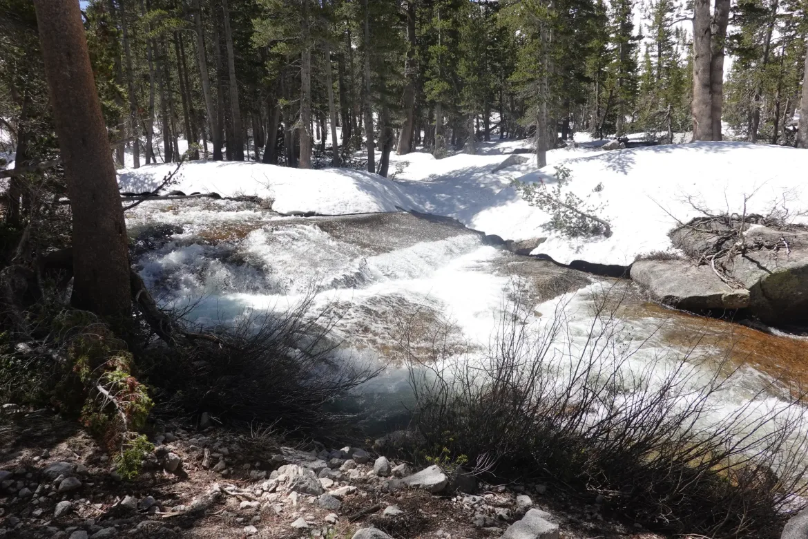
The trail always gets more complicated through the trees, but this time wasn’t so bad since there was the stream running down the valley on our left. The trail was never that far away, so we just wove our way through the trees wherever was easiest, and if we occasionally saw the trace of the trail, that was nice.
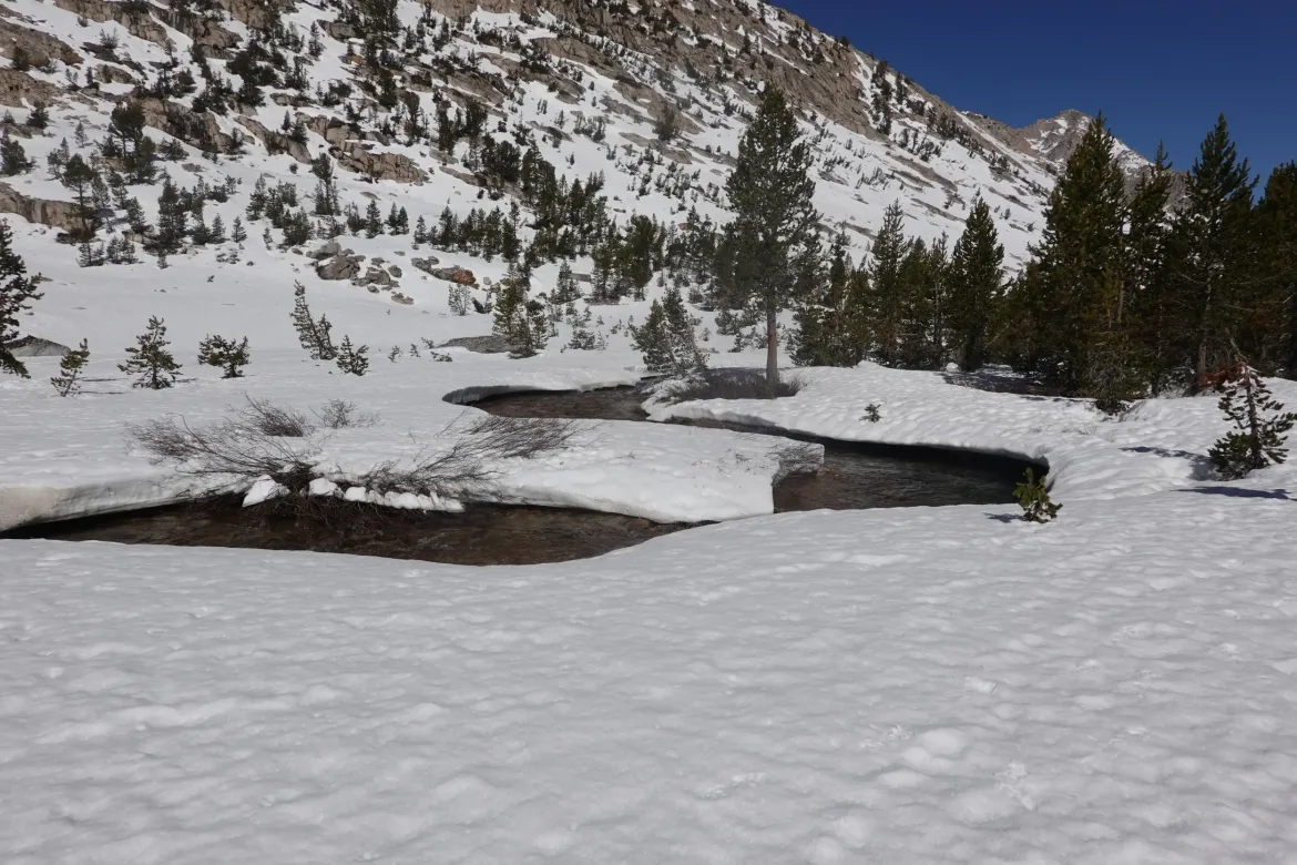
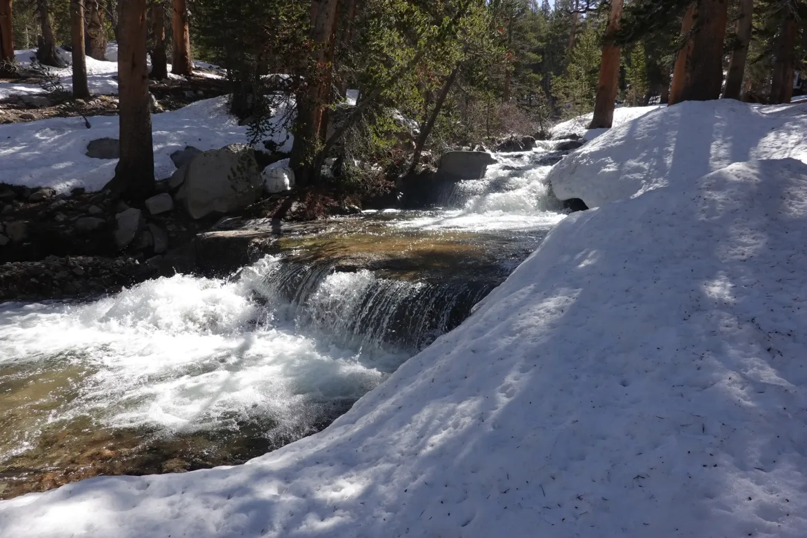
Streams started emerging from under snow bridges, and gradually the snow started to lessen as we continued down Eventually, it was about 50/50, but that was at a lower elevation than the snow we had south of Forester Pass. I don’t know how there could be so much more snow here sticking around in such a short distance.
The creek crossings on snow bridges ended, and we had to cross however we could. Despite walking on snow all day, my shoes were still relatively dry, and we rock hopped or crossed on logs. One stream was wider. We crossed part of it on rocks and a log, but then there was a large gap over the last channel to the other side. Cookie Monster and I decided to jump it and barely made it across. Lanyard tossed her pack, but then decided it was too far and just forded the stream.
We were then to around where we planned to stop for the day. It was still before noon, but the snow goes rapidly in the afternoon and we stop early before the going gets too tough. We made a last minute change in plans and decided to hike on uphill, hoping there would be some snow free spots for us.
It was a steep climb by PCT standards, and snow started half way up it. Not a good sign for camping. I took the climb really slow since suddenly my energy was waning after all the climbing and snow travel today.
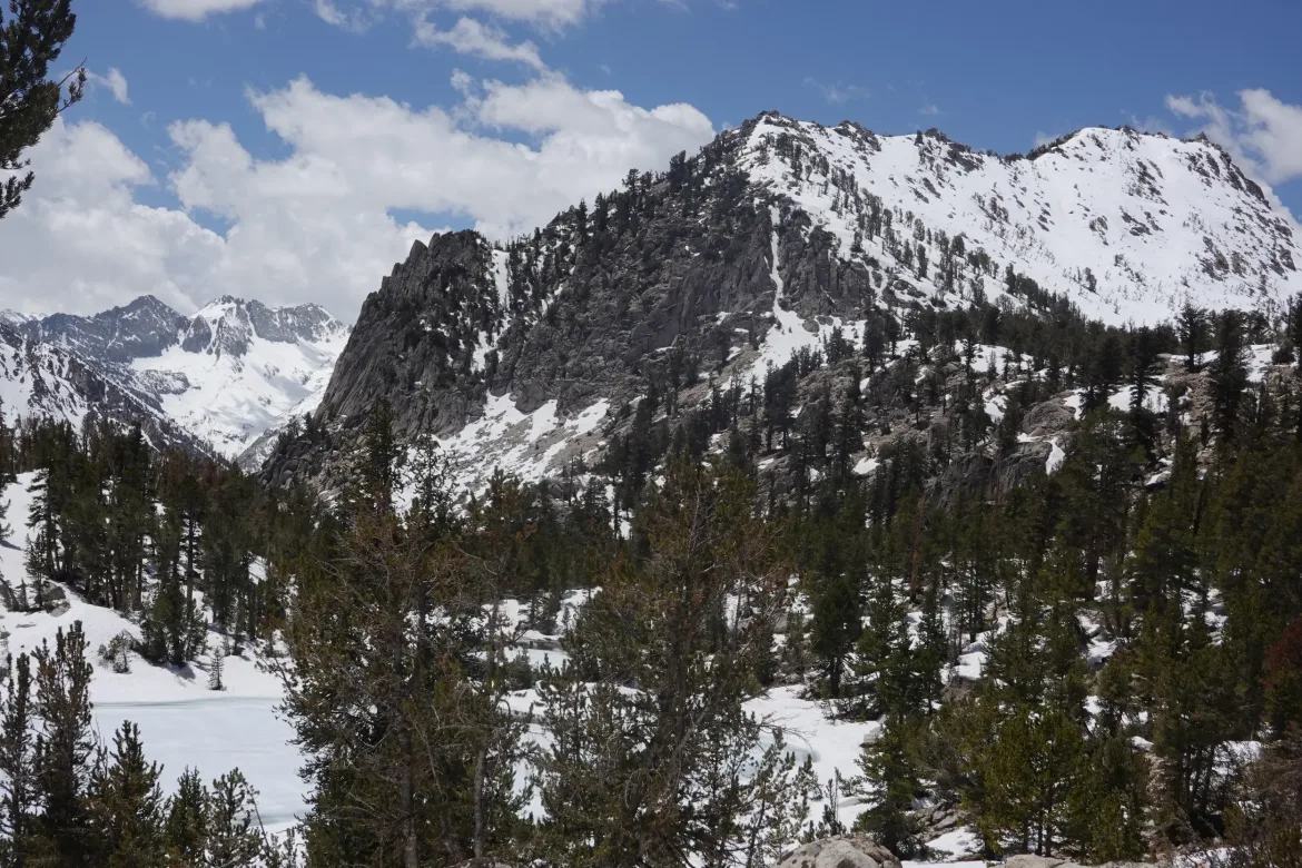
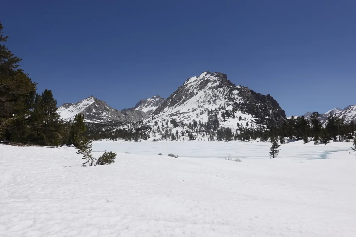
It returned to almost all snow at the top, and the trail was fully obscured in now soft snow. We turned down the side trail towards Kearsage Pass where we will do a resupply. It is a 7.5 mile trail each way, but there aren’t many options out here to resupply. We went a short way down the side route, and after much searching found 2 flat spots that were dry and good enough to pitch our tents.
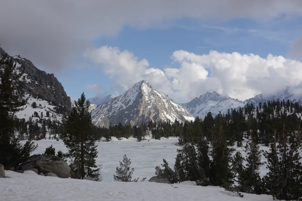
We had a long afternoon to kill, but the setting of the campsite was out of this world amazingly scenic with mountains looming above the lake. Not a bad way to spend an afternoon after a hard day of hiking.