
Start: Wire Pass Trailhead
Finish: Paria Canyon between Second and Third Crack
Daily Mileage: 19.9
Trip Mileage: 599.2
Elevation gain/loss: 1692/2541ft
The wind performed an audible early last night, coming from the complete opposite direction for the rest of the night from when I set up camp. It was early enough that I reversed my gear inside my tent to shield me better from the wind. It didn’t actually get too cold, though. Since I was close to the border with Arizona and daylight savings time will be ending this weekend, I preemptively set my devices to Arizona time which will effectively give me back to West Coast time with no time zone shift. I’m just going by the sun anyways; that’s all that matters, but I needed my alarm to go off at the correct time so I didn’t miss an hour of hiking time.
I was ready to hit the trail when the sun rose. That was about the time that others started arriving in the trailhead parking lot for the Wave. I was the first one at the gate. I repeated a bit of trail that I did yesterday since I couldn’t camp in the wilderness, and it was pretty easy for the most part. There was a little bit on the Wire Pass Trail that I had not done yesterday, and it involved one spot with down climbing on a rope and a sketchy log. But plenty of people do that every day, so I was more than capable.
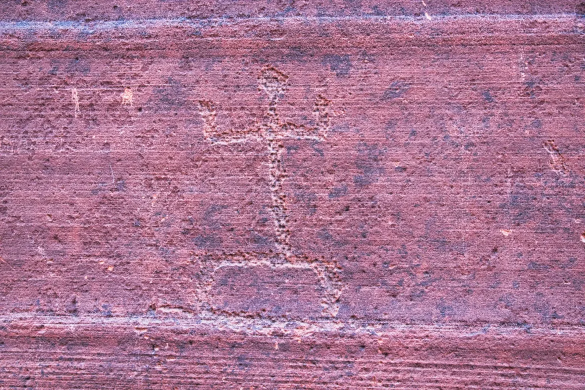
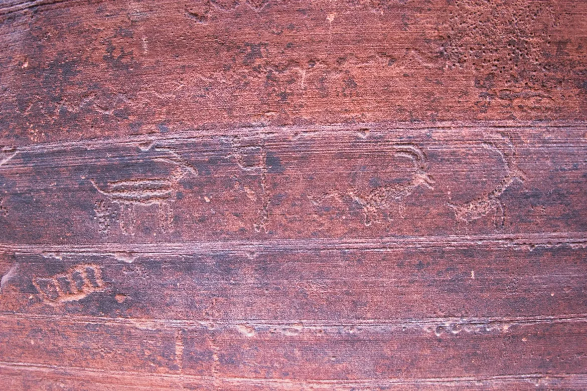
I got to the junction of the Wire Pass Trail and Buckskin Gorge, and I immediately saw the petroglyphs that I missed yesterday. I was looking in the wrong spot, and the light just caught them as I walked past them in the other direction. It looked like a big, flowing river design with animals and people.
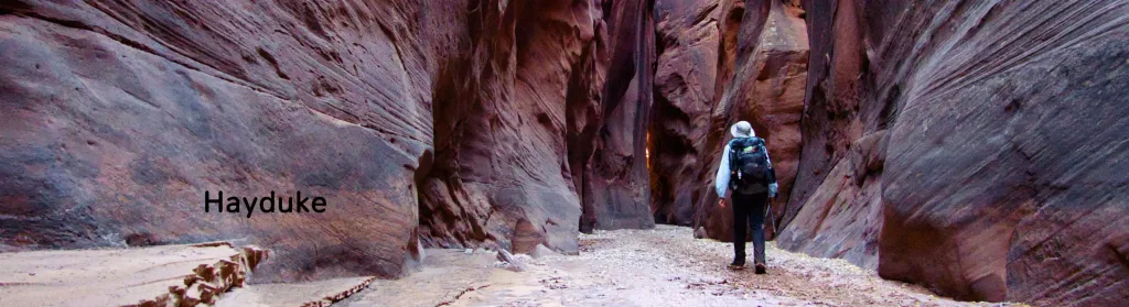
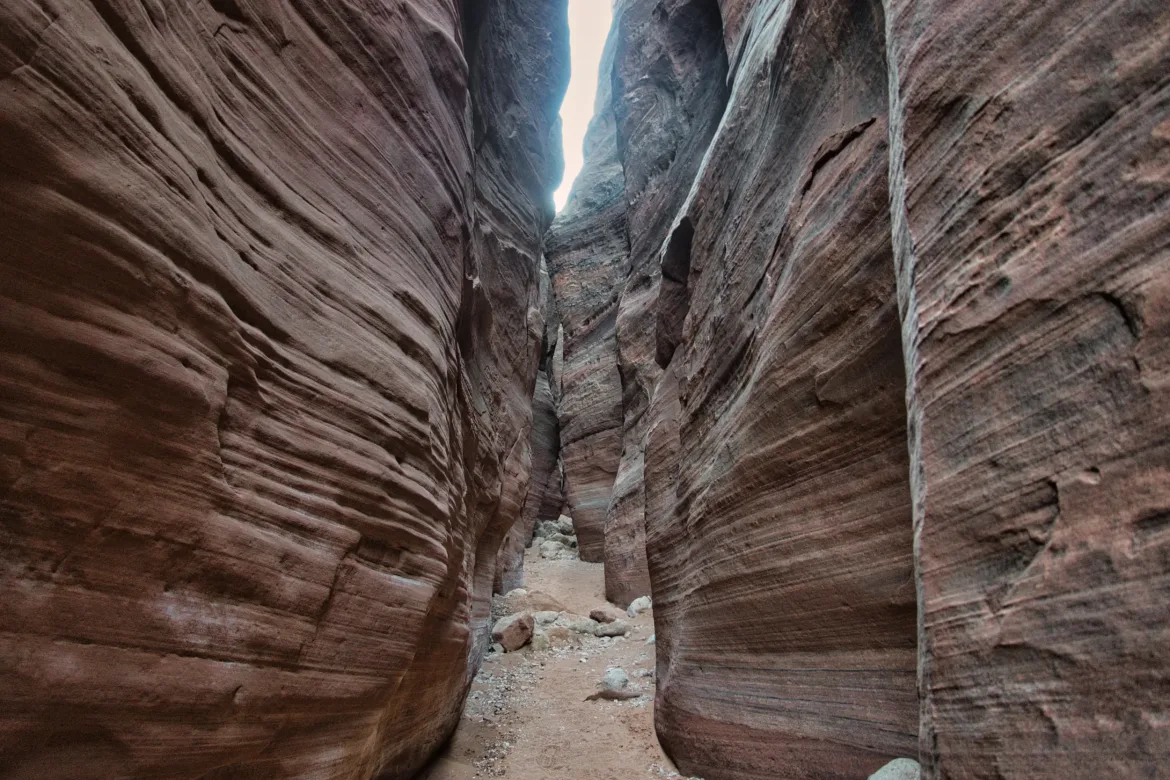
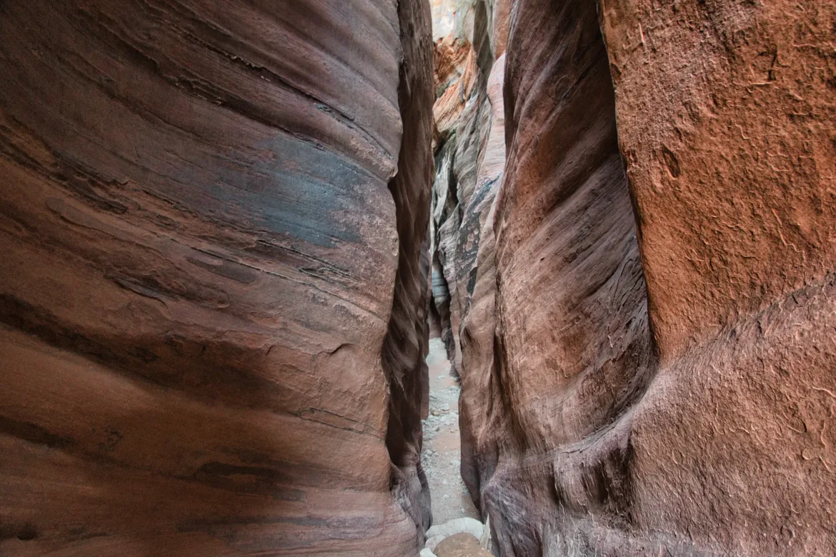
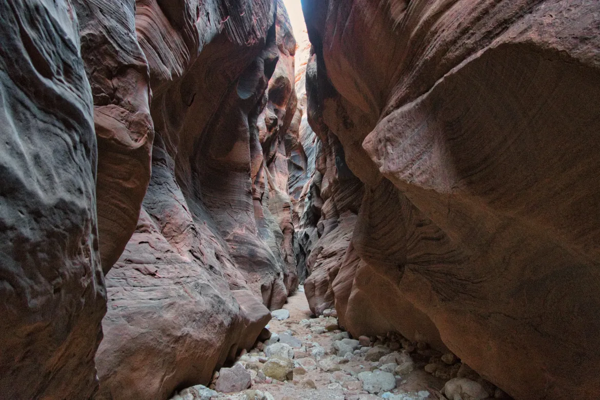
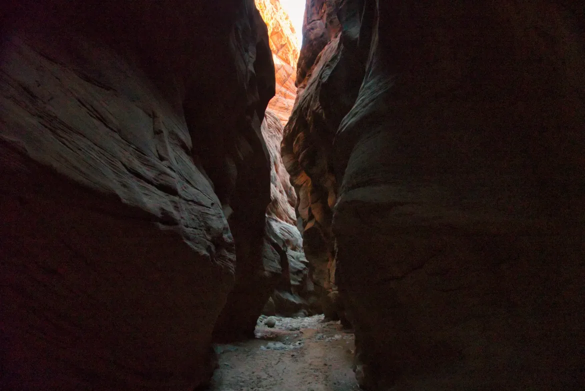
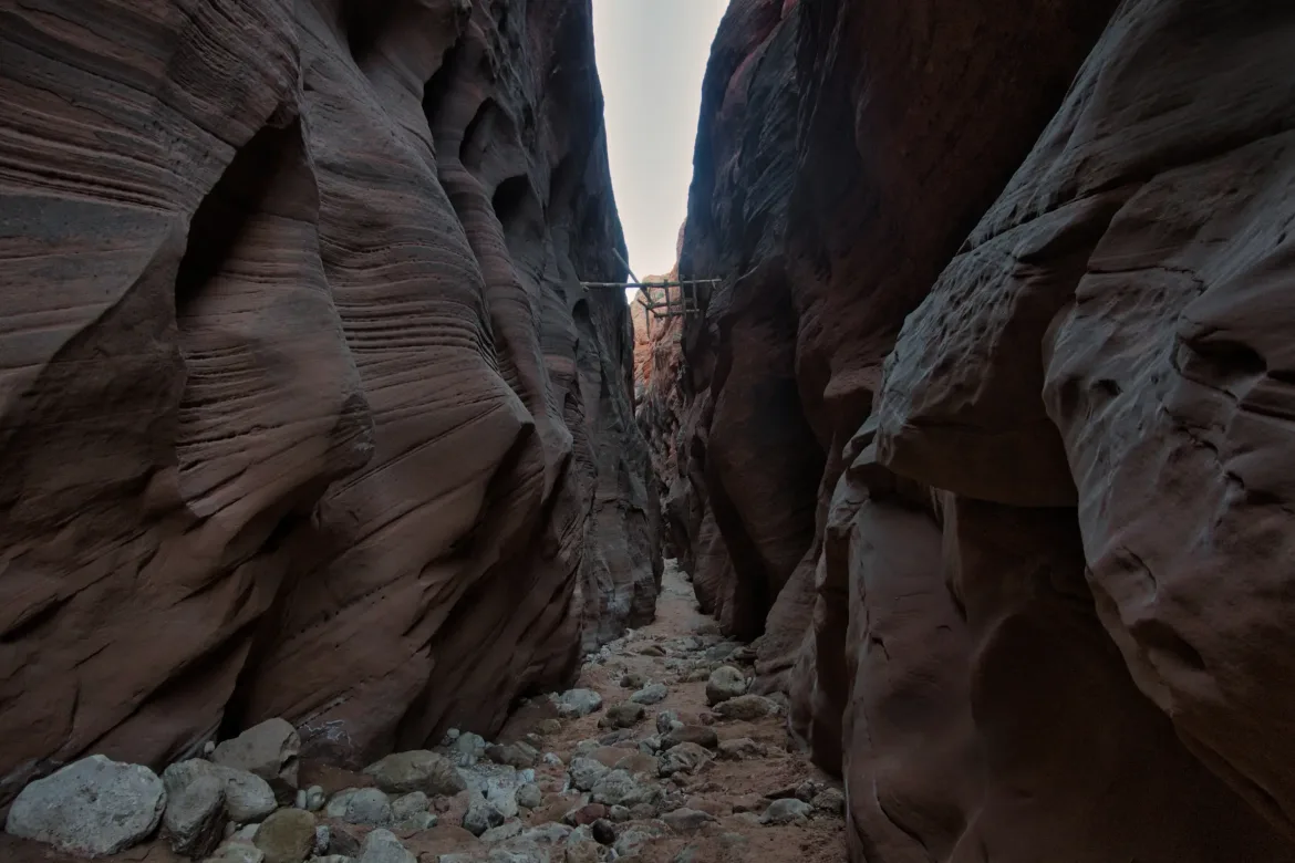
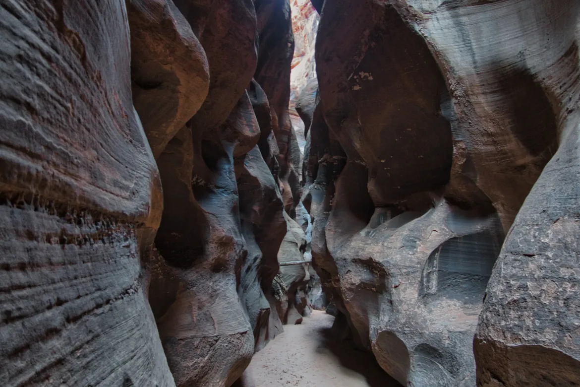
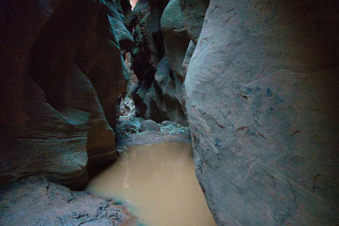
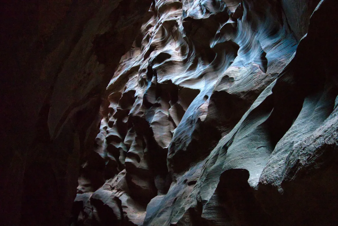
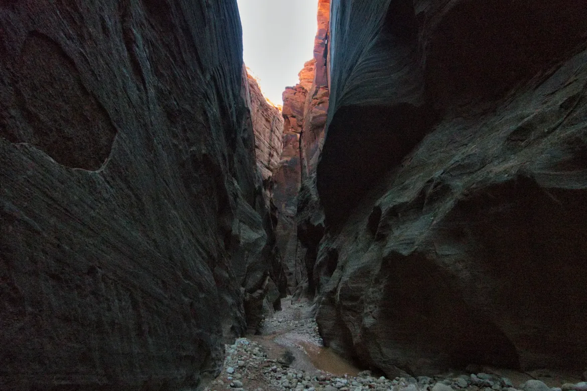
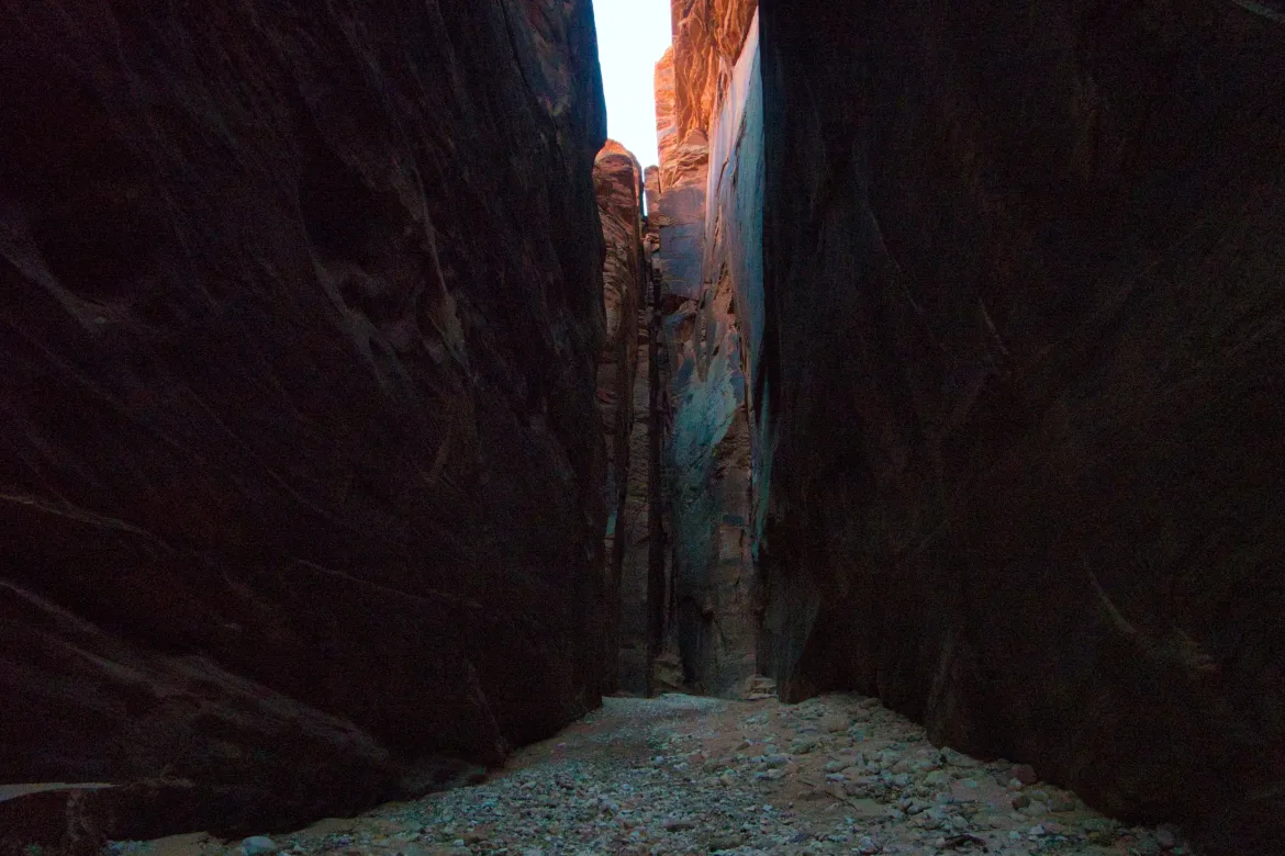
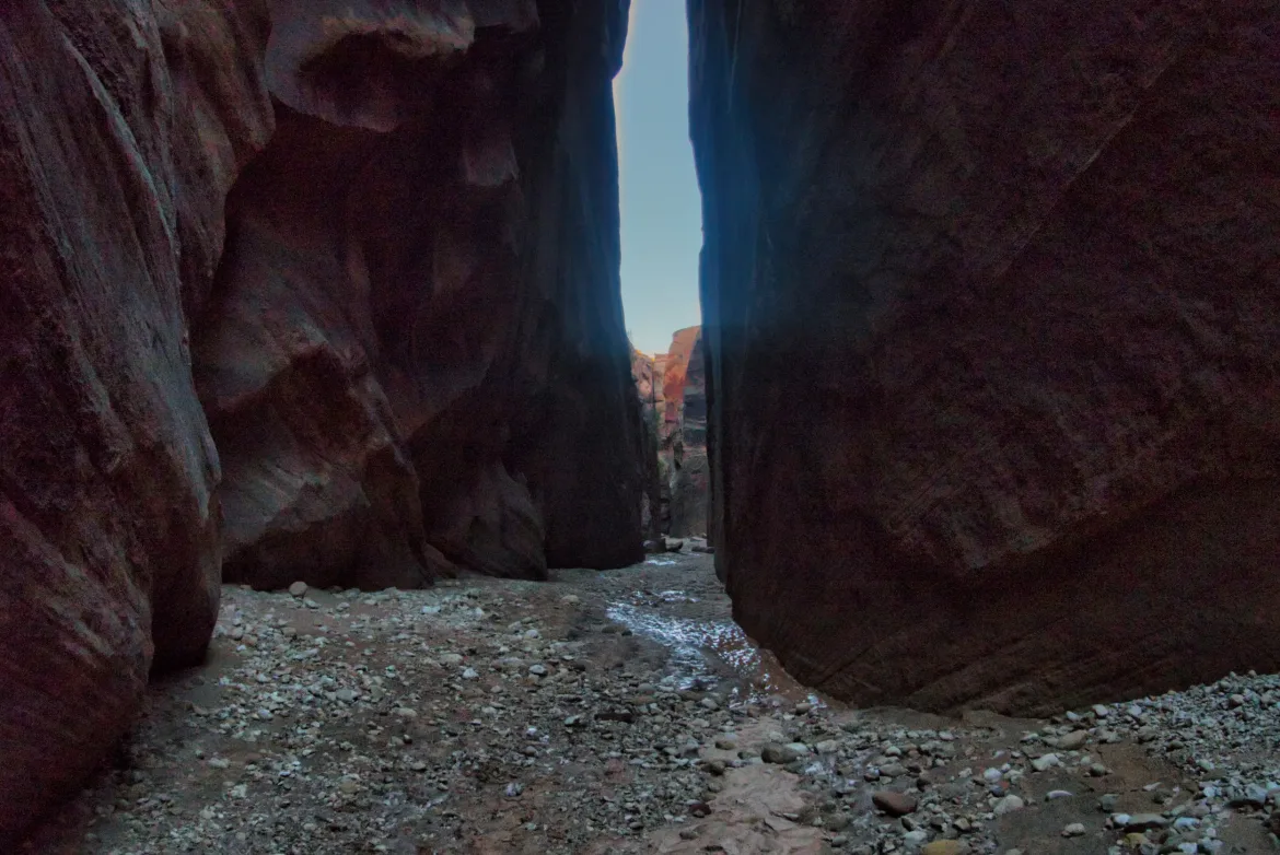
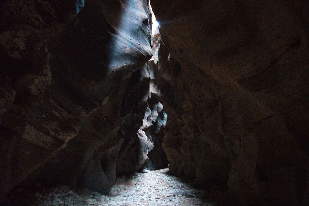
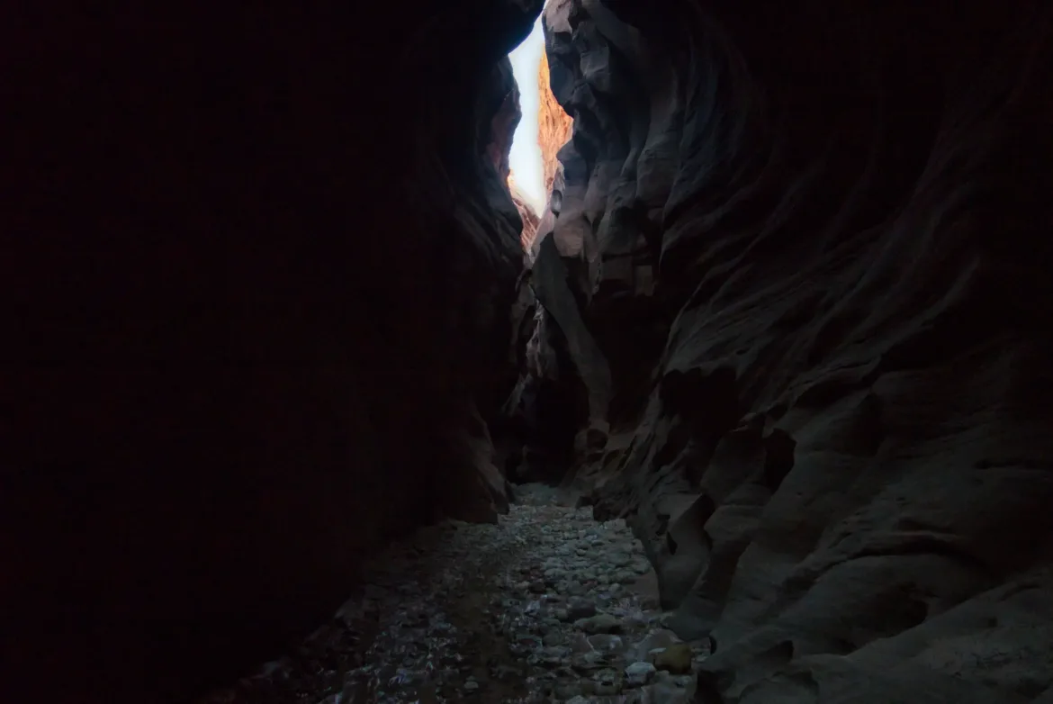
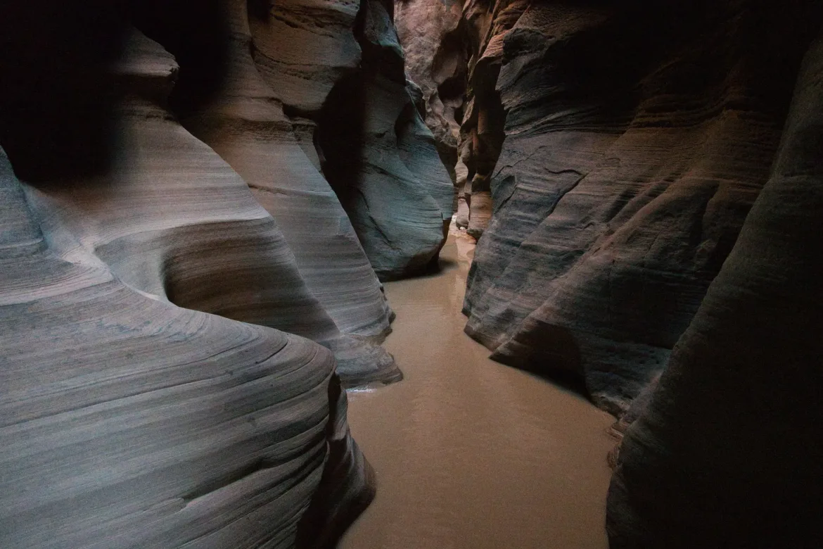
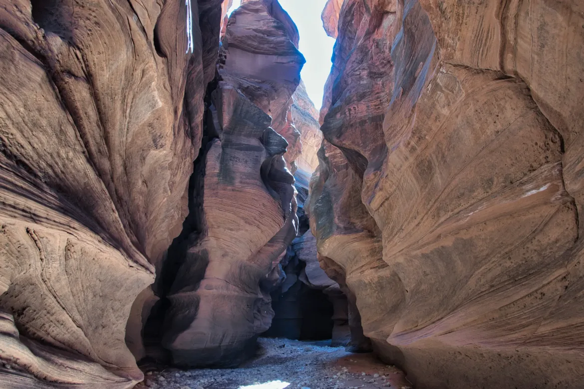
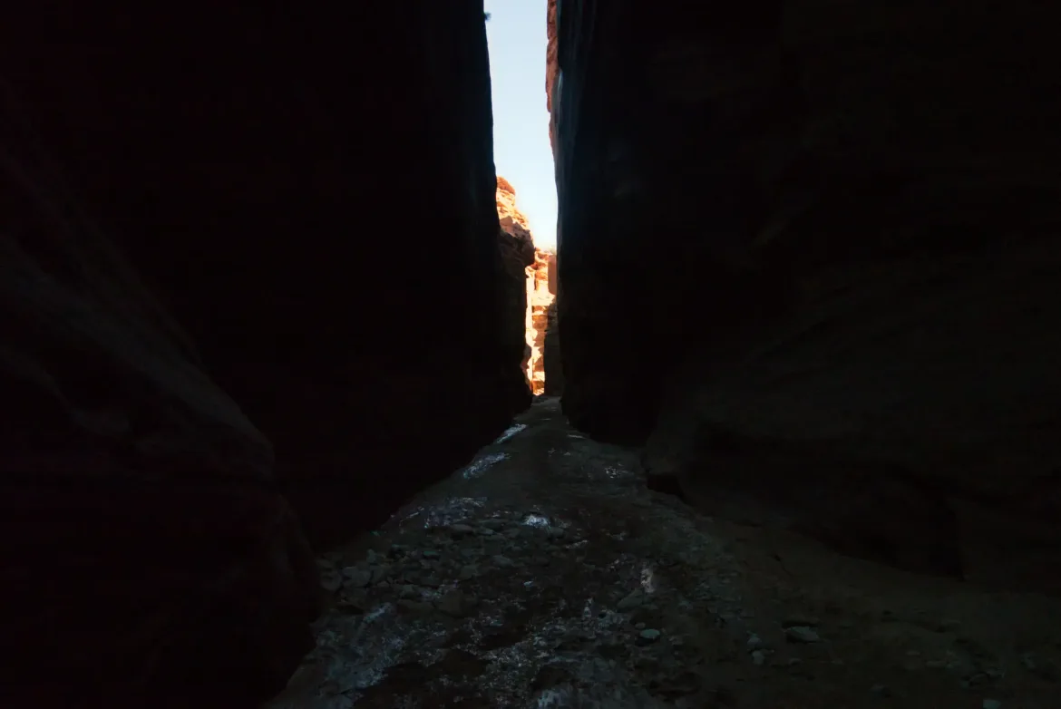
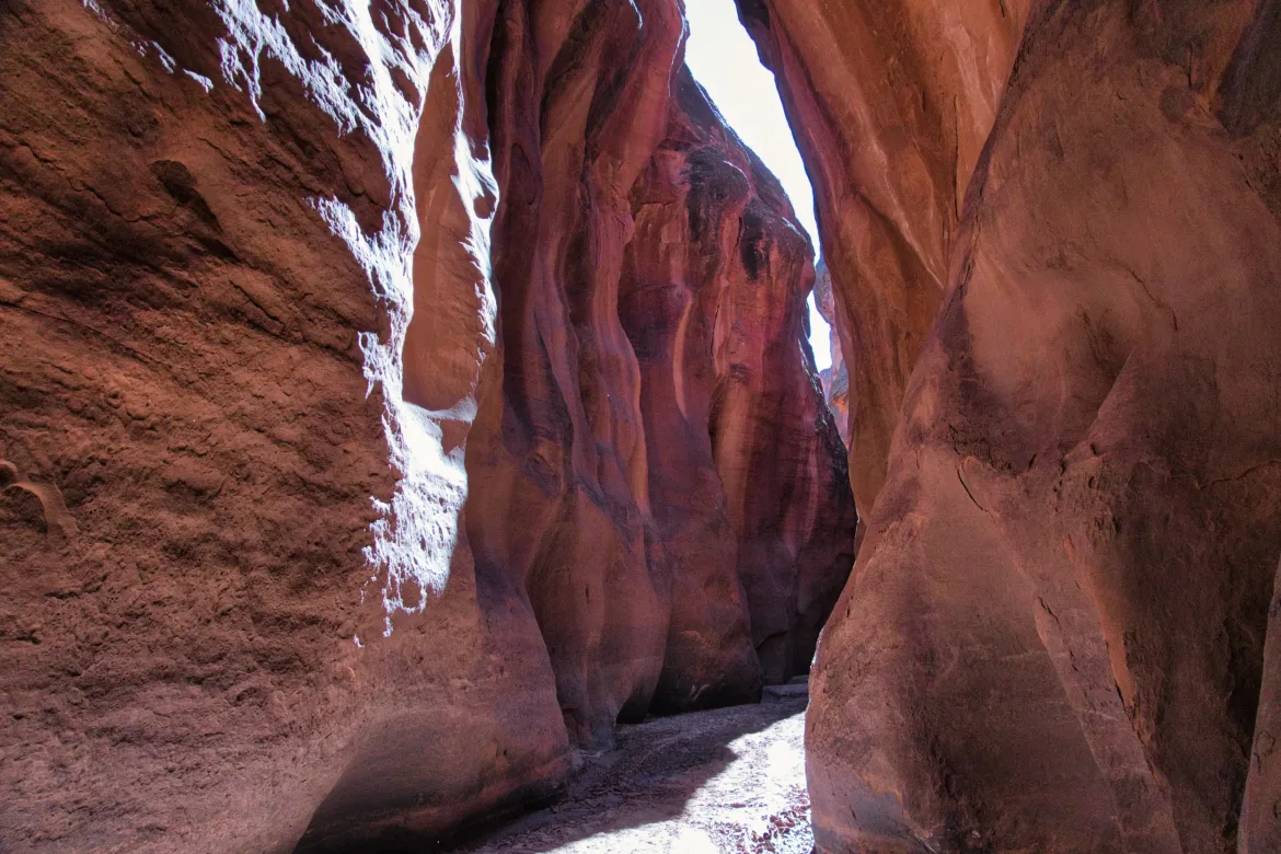
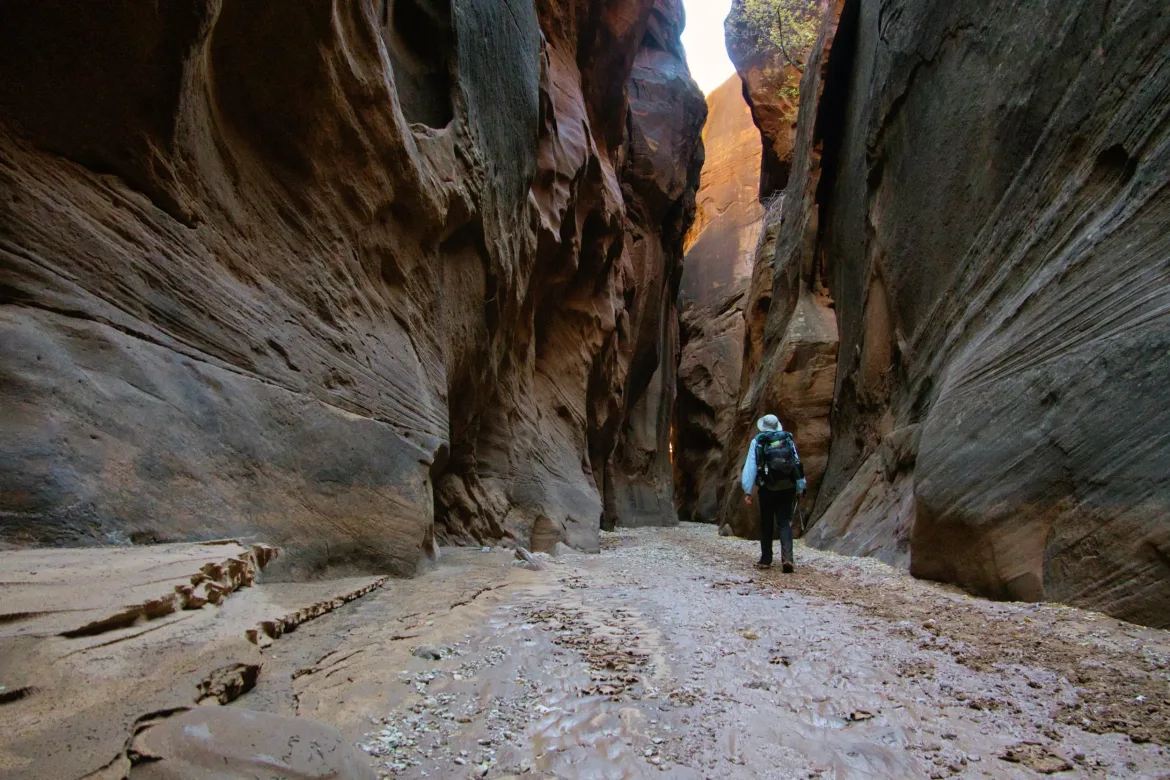
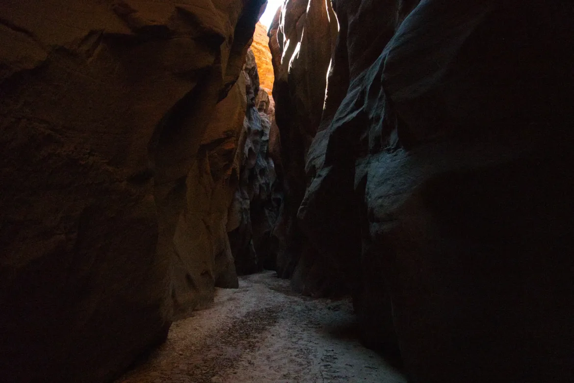
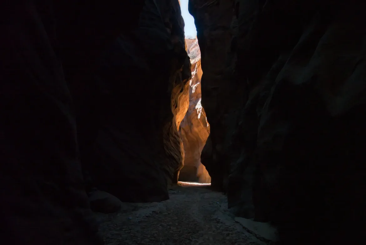
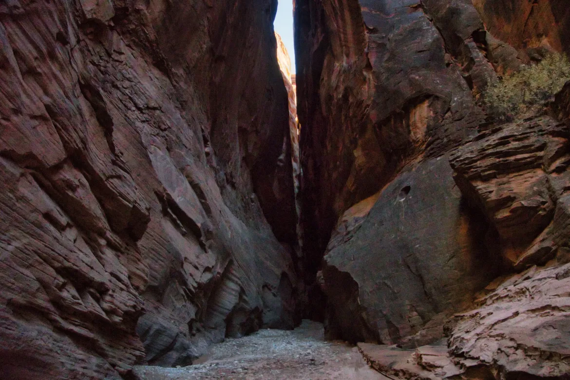
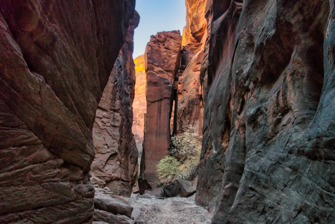
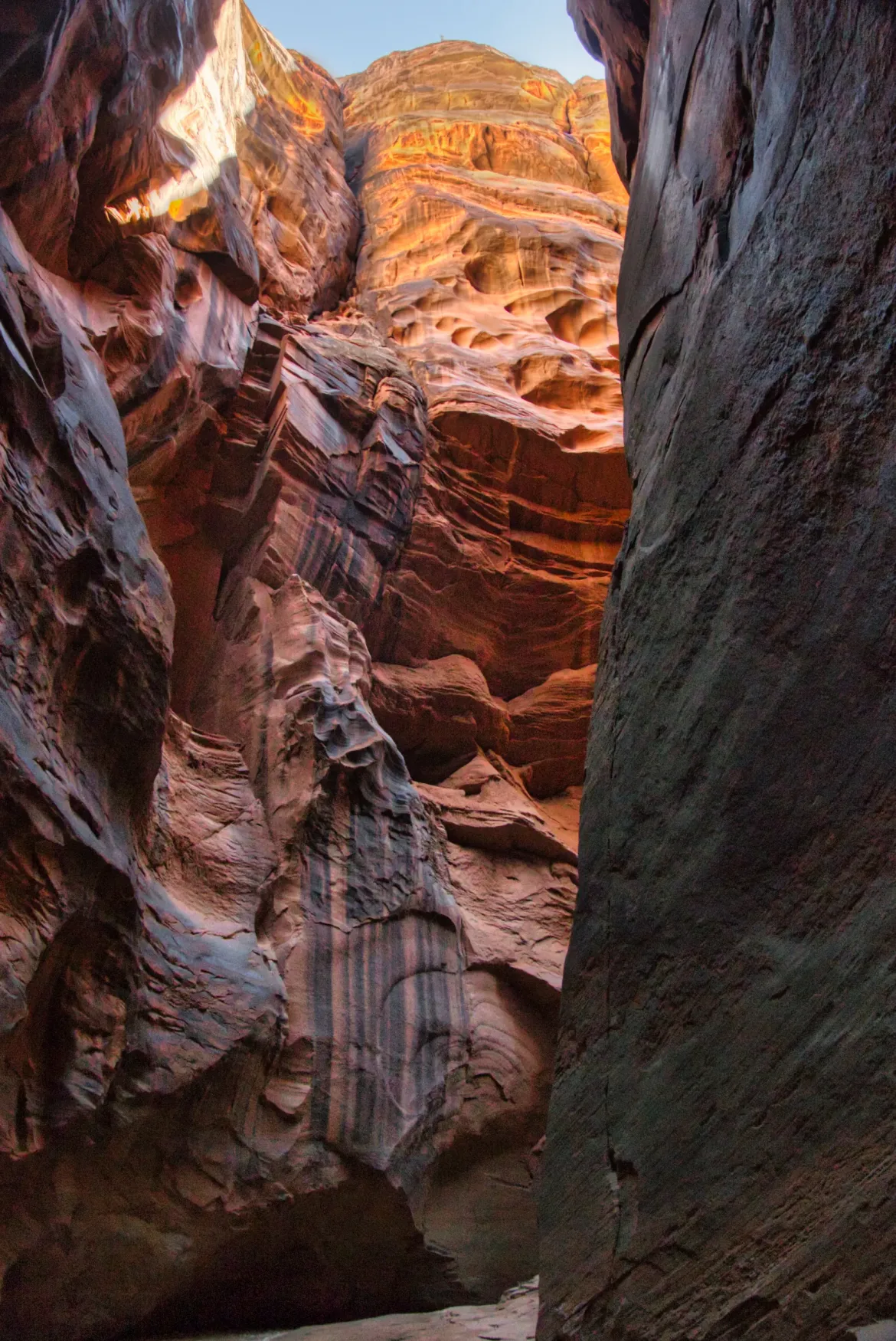
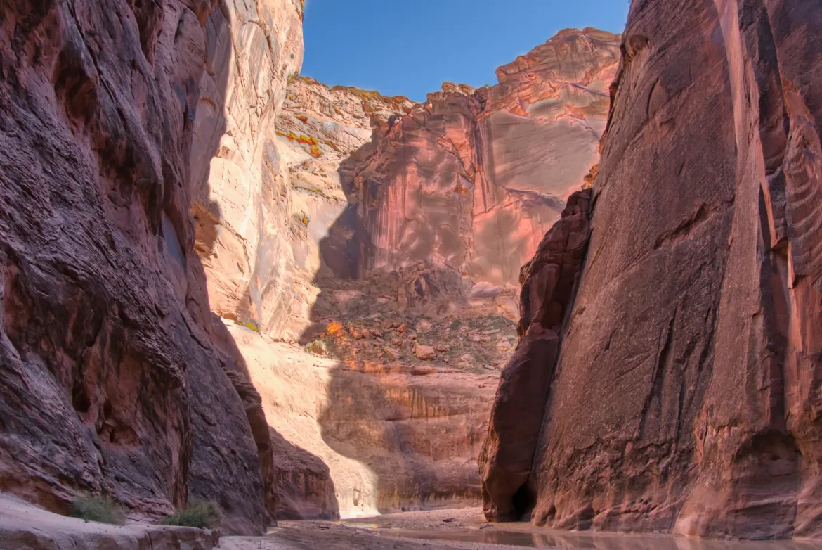
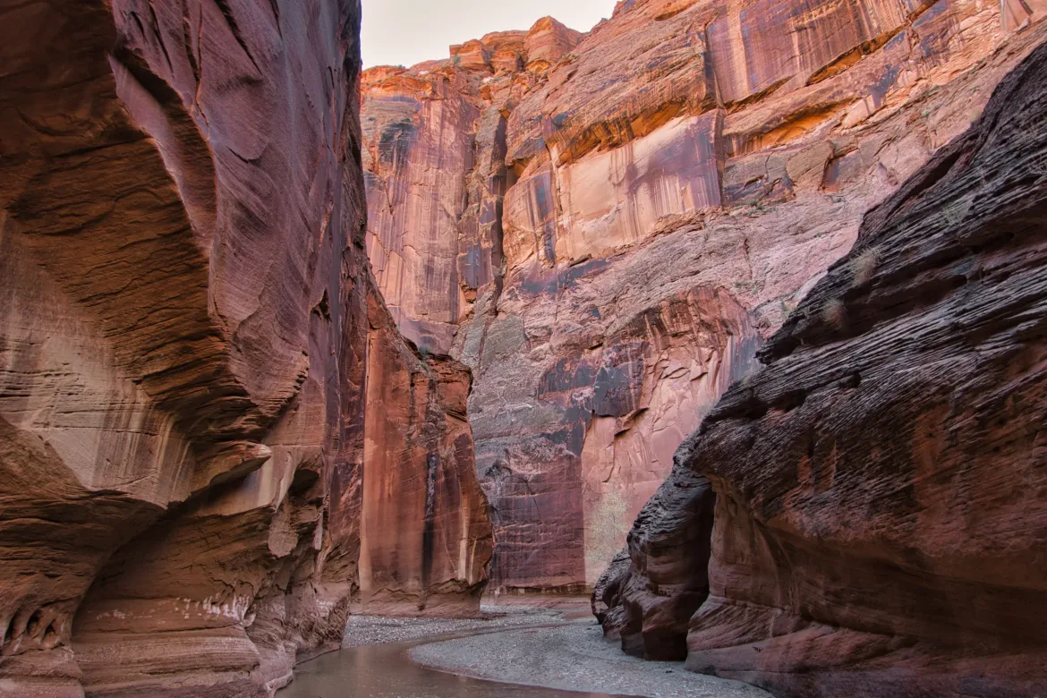
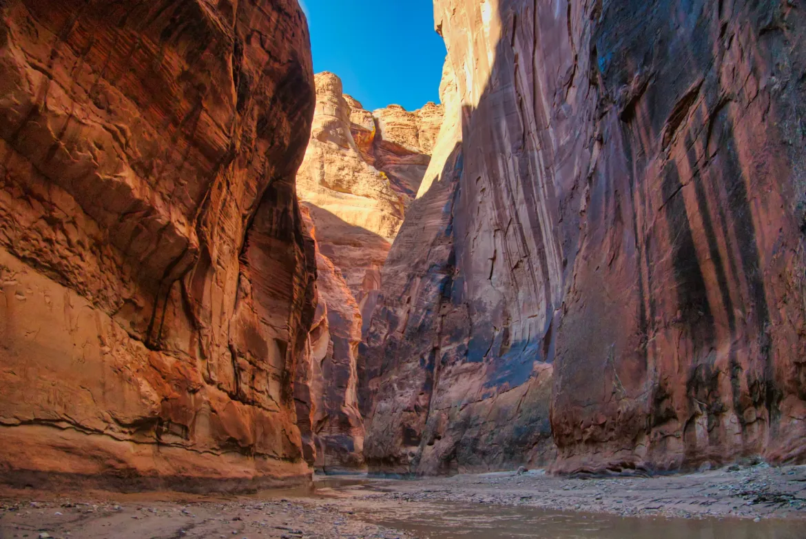
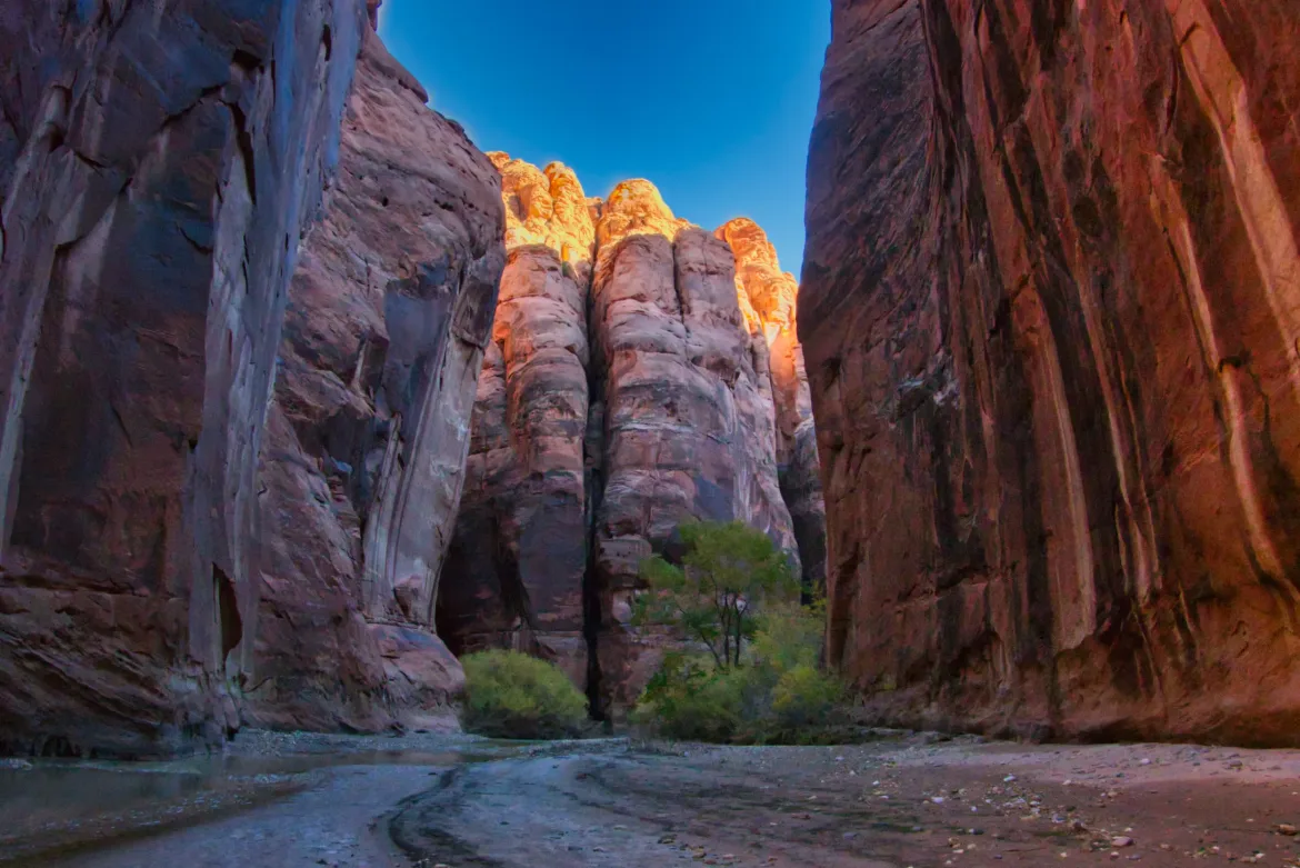
I headed down Buckskin Gulch, which is a slot canyon that went on for 11 and a half miles. That’s quite a stretch for a continuous slot canyon, and it’s one of the longest in the world. That’s one of the reasons I wanted to get this other permit to do this other trail since I love these slot canyons. This diversion will take me well off the Hayduke for a few days, but hopefully it will be worth it. The canyon immediately narrowed in, and it was generally between arms’ width and up to 50 feet or so in a few places. For the most part, it was one or two arms’ width. That’s quite a slot canyon for the distance.
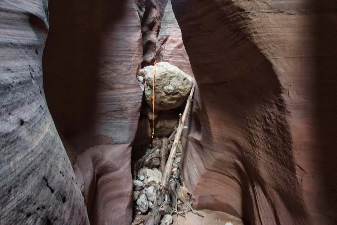
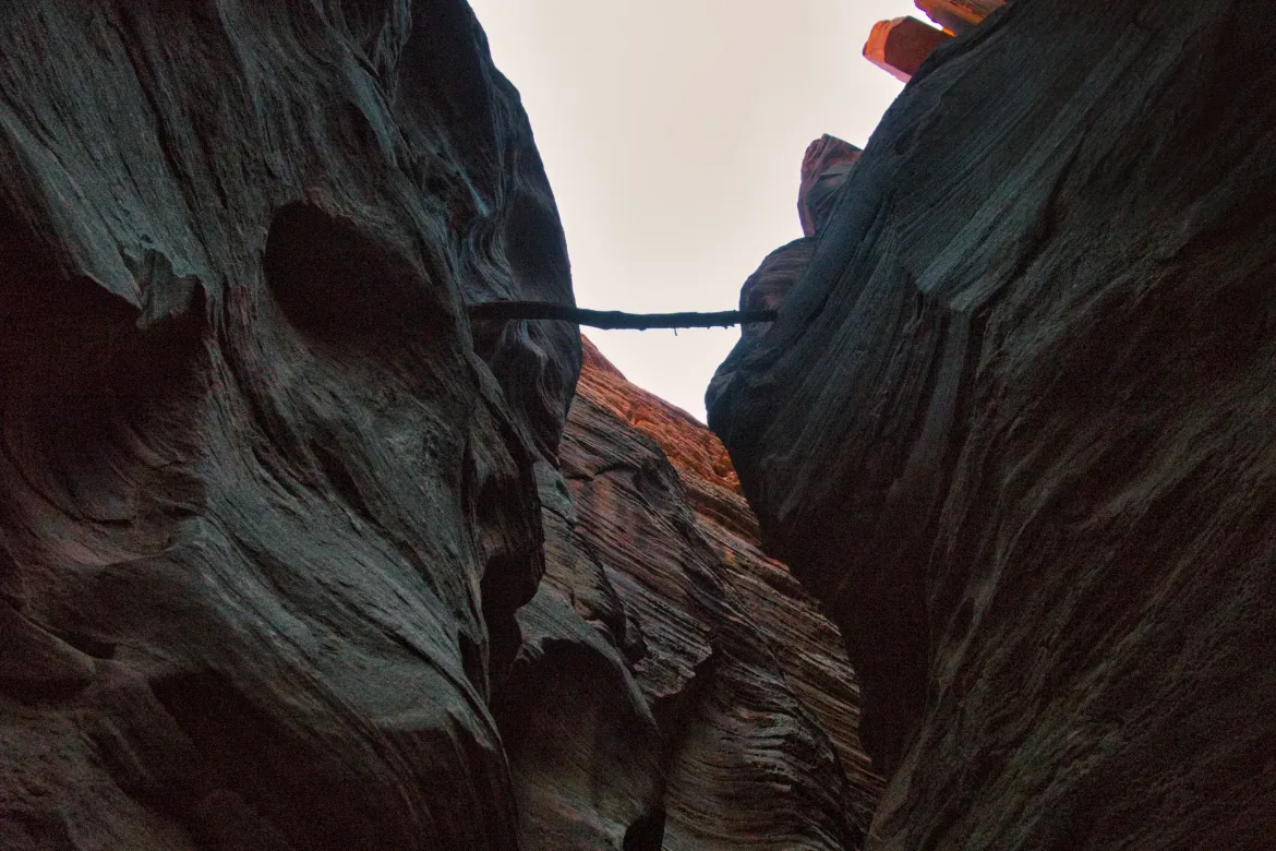
One of the things I love about canyons is just seeing the effects of past flash floods. There are many places in this canyon where there will be a log lodged 30 feet or more above my head. It’s just hard to comprehend what it would look like to see all that water rushing down the slot canyon, though obviously I wouldn’t want to be here for that. There was even a ladder lodged about 30 ft. up at one point probably from that scramble in Wire Pass. Just amazing what the water can do in addition to carving the entire canyon flowing a couple times a year.
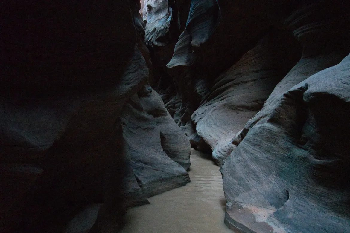
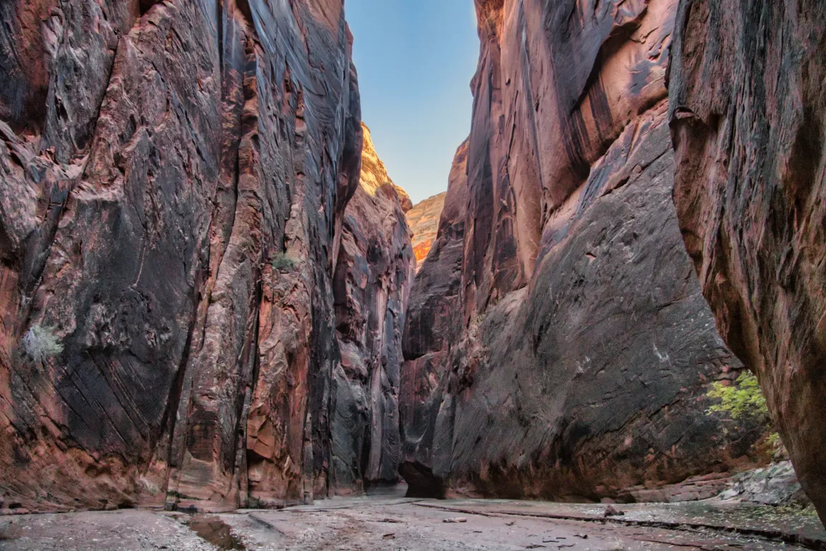
The canyon started out pretty easy, just a stroll through the winding passages. There were some pools with water, and some of them spanned the slot canyon, but early on there were rocks placed so you didn’t have to get your feet wet. However, that soon ended, and I came to my first wade. I knew I would be getting my feet wet today later on for sure, so I decided to just go for it in my shoes. It turned out to be a wise decision since there were widely spaced potholes that had to be waded, and it would have been a hassle to take off my shoes each time.
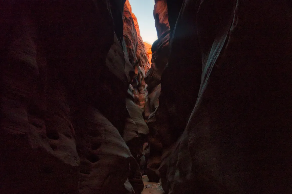
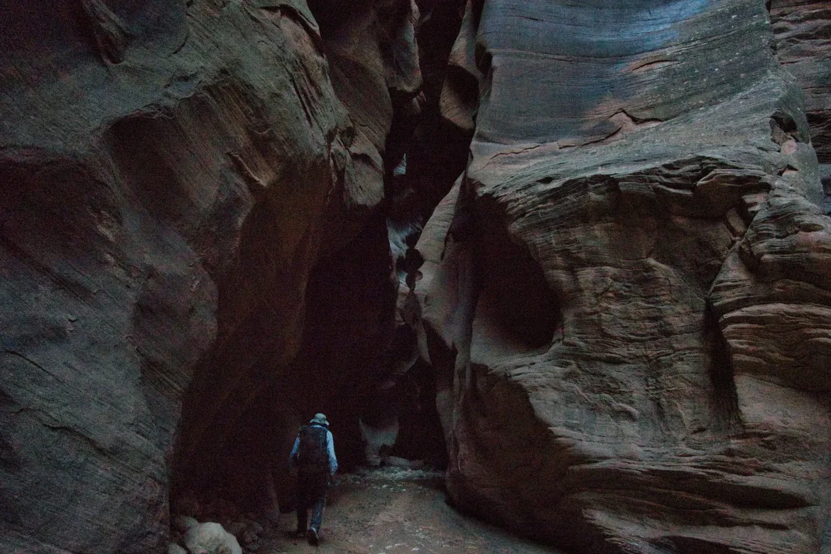
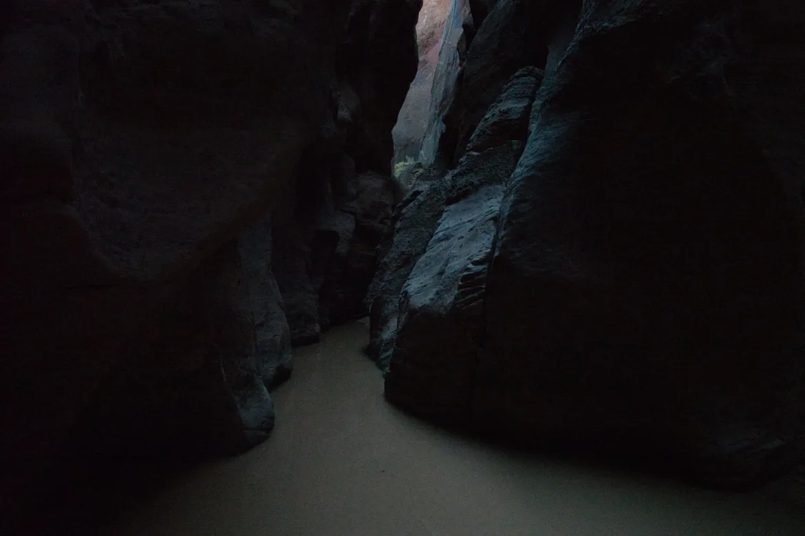
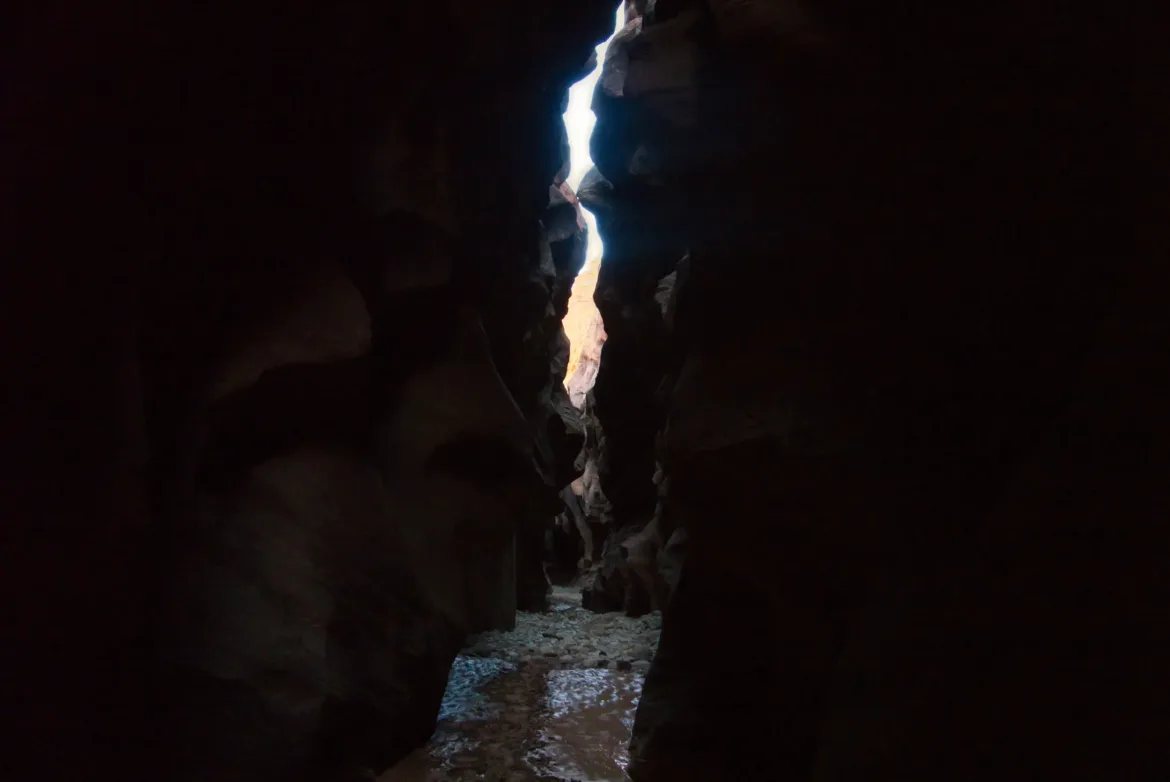
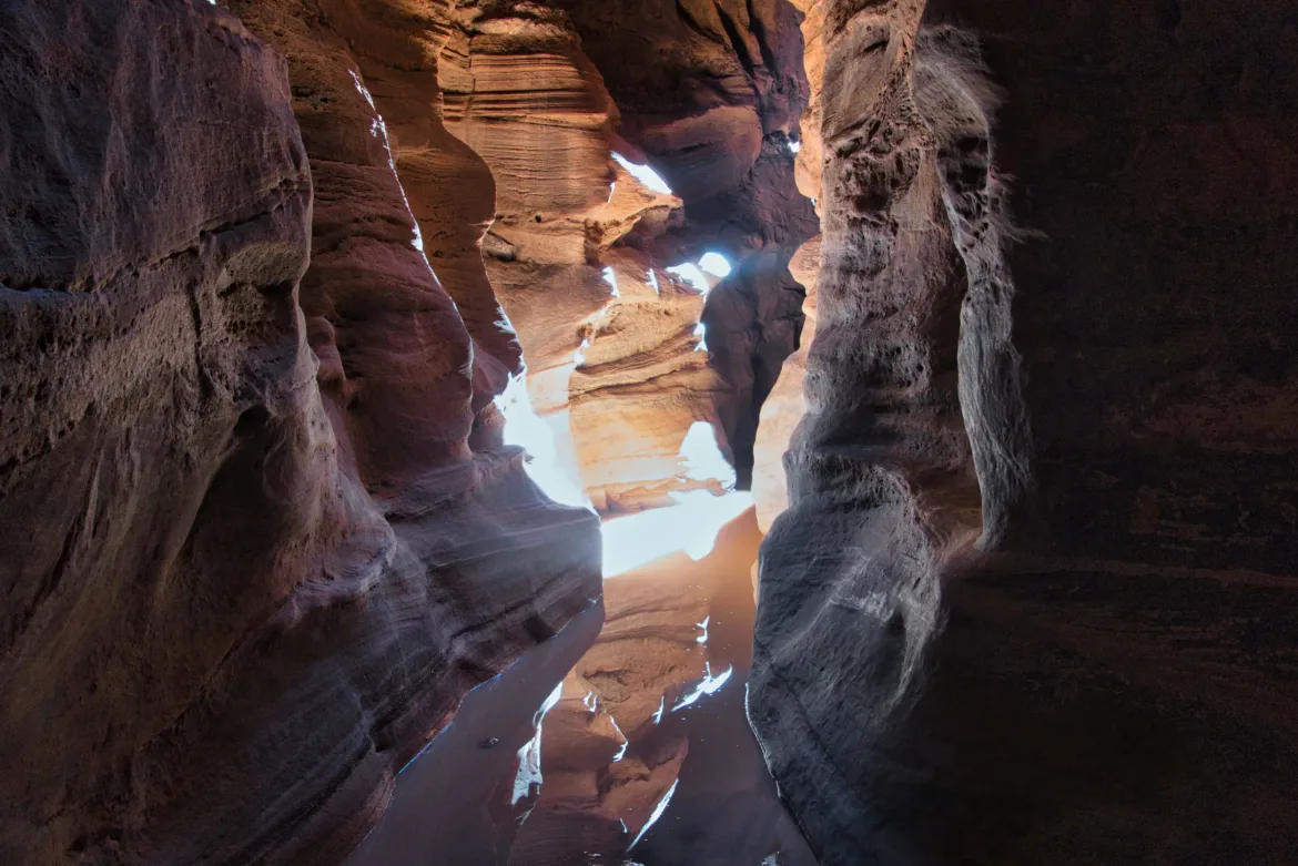
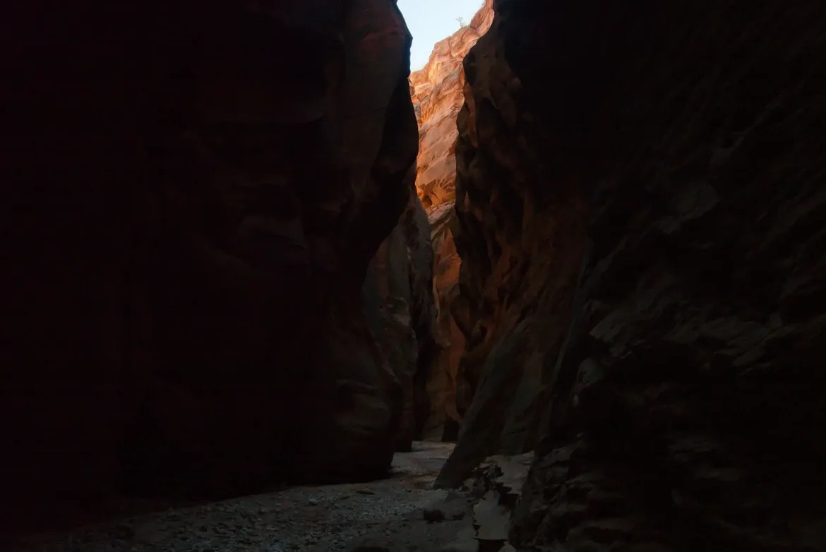
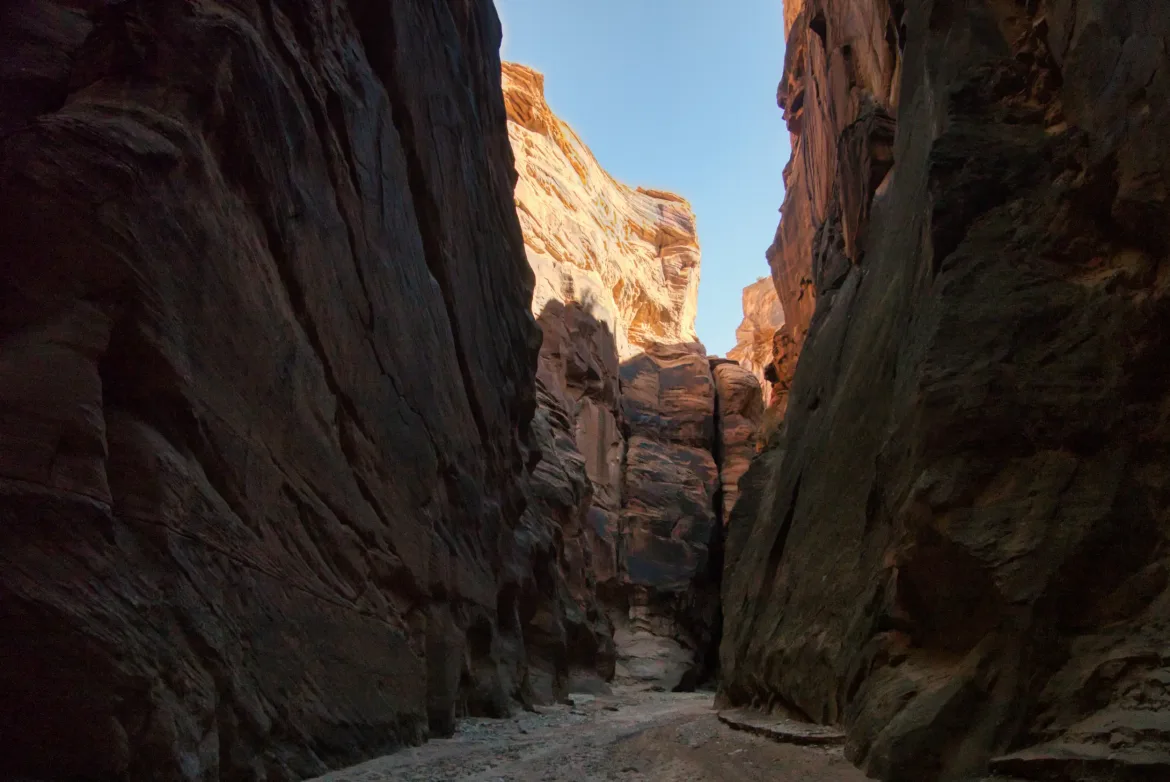
The slot canyon was just amazing, though. At times it was so tall that it was dark where I was walking, and I couldn’t see the sky above me. That did get a little bit dreary after a while, though. For the first half of the trail, I only saw the sun once for less than a minute. As I progressed down the canyon, there were more and more wades. I went almost to my waist twice and was getting ready to lift up my pack before the ground started rising. My hiking poles were absolutely imperative to feel in front of me to find the shallowest route. Towards the end of the first half of the route, the wading got very frequent. With the darkness and all the wading, I started getting cold even moving as fast as I could. I rounded a corner, and there was a huge patch of sunlight and three guys taking a break that had passed me earlier. A great spot to stop and warm up!
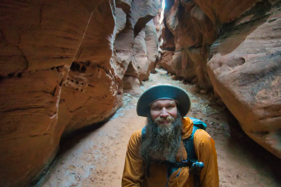
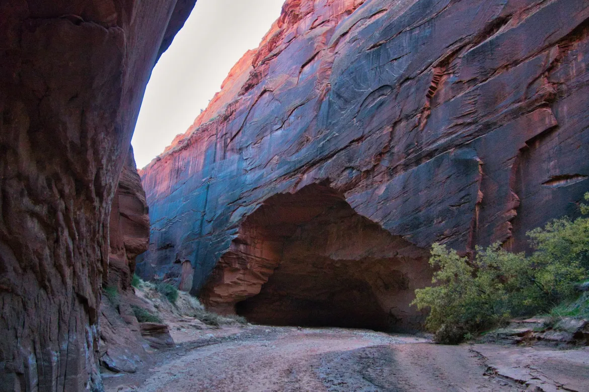
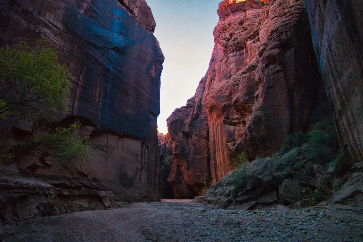
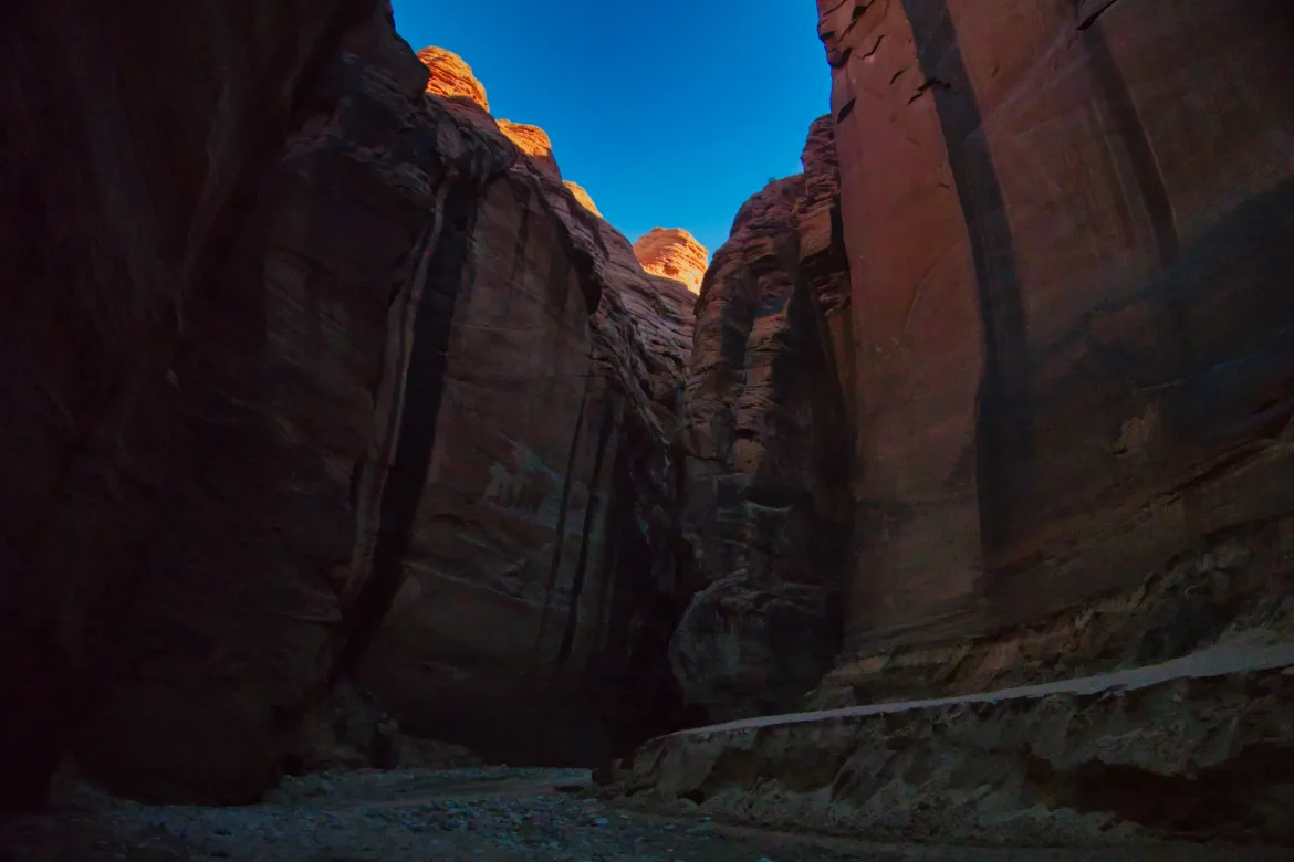
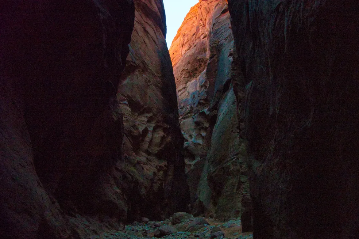
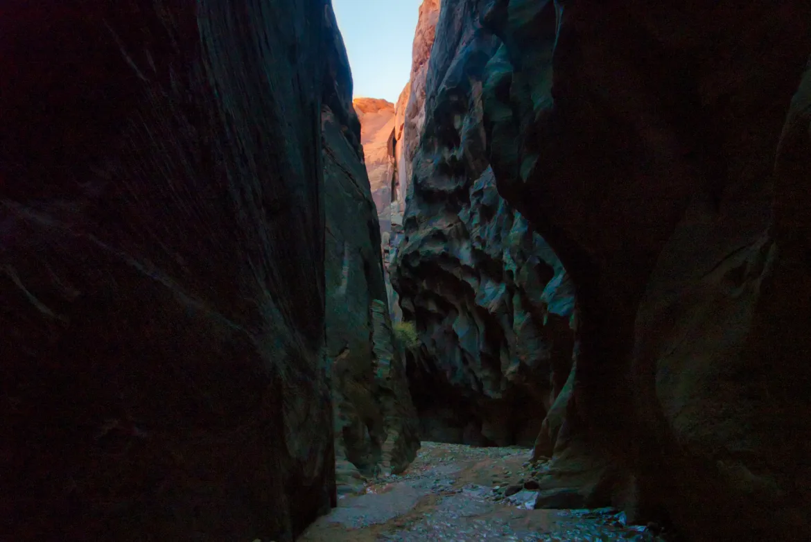
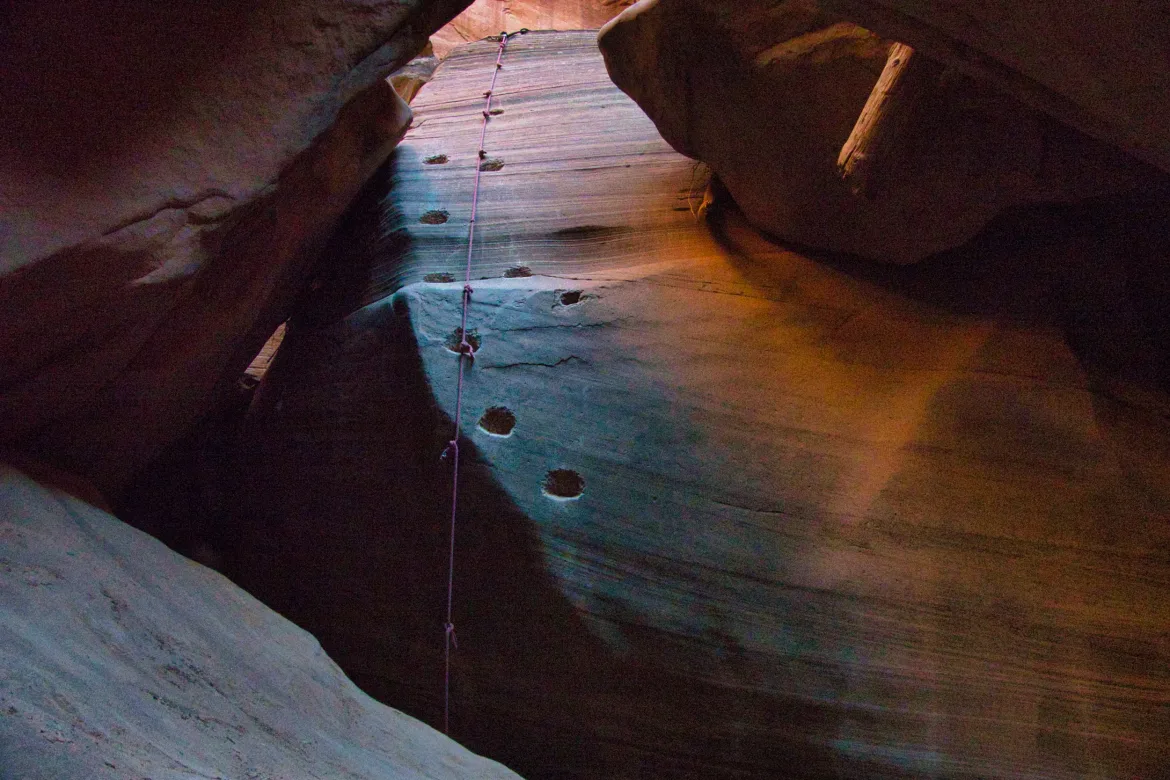
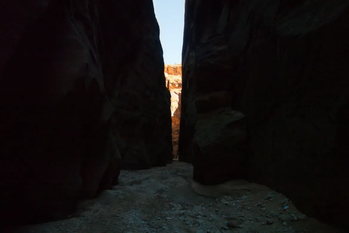
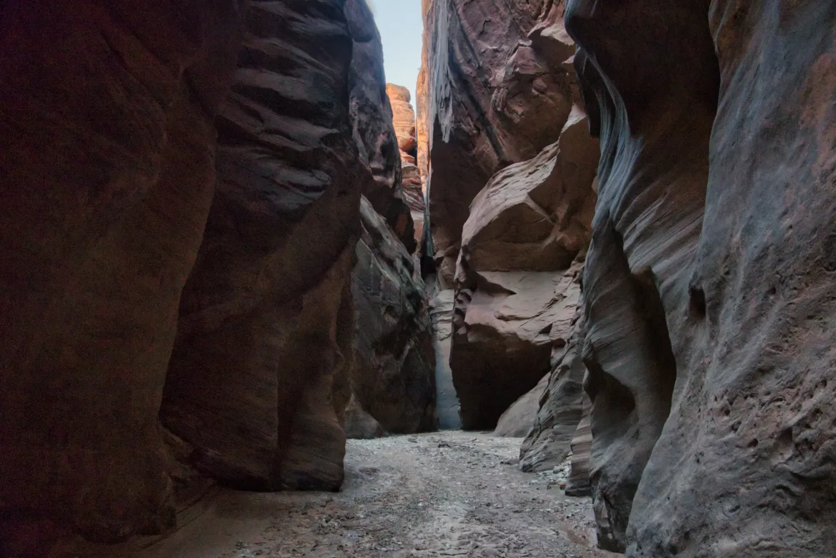
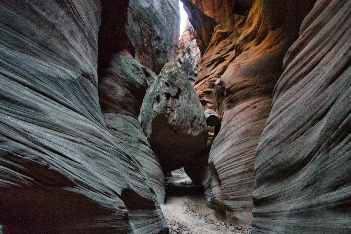
The second half of the canyon was easier. There was no wading like the first half, thankfully, and it was mostly a smooth stroll through the gray canyon. There was one scramble that got a little bit tricky, and there was a rope to help down climb a near-vertical 20-foot boulder. Someone had chiseled a few footholds into make it easier to climb down but it was still a little tough, especially with my pack on. Not too hard, though.
I tried to shoot the canyon as I was taking pictures, but it’s so difficult to do with the lighting in the canyon. There’s often light and dark parts and the canyon where the sunlight hits part of the canyon and not the others, and the camera just doesn’t want to pick up both the light in the dark parts. I’ve been experimenting with some other techniques, but I think it will ultimately go back to post-processing when I get home.
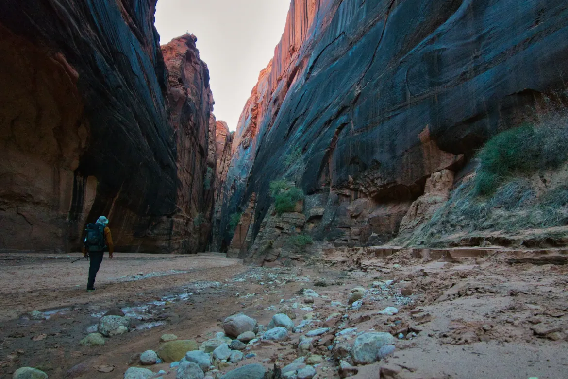
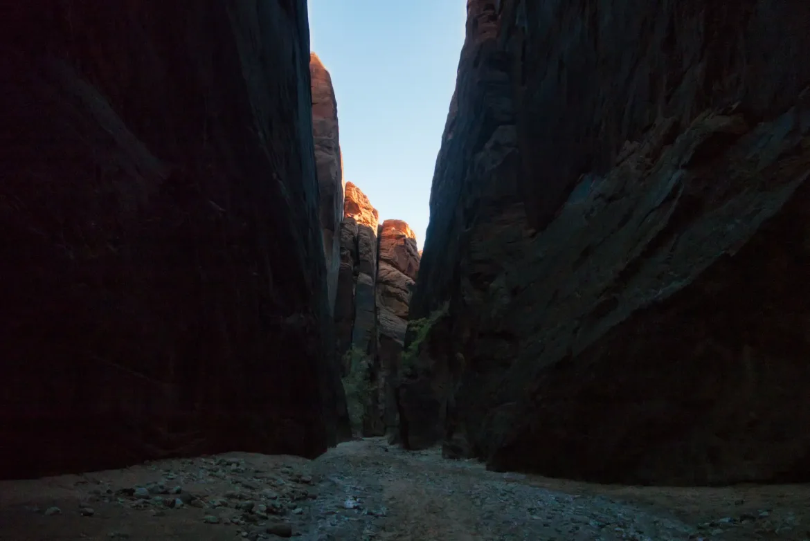
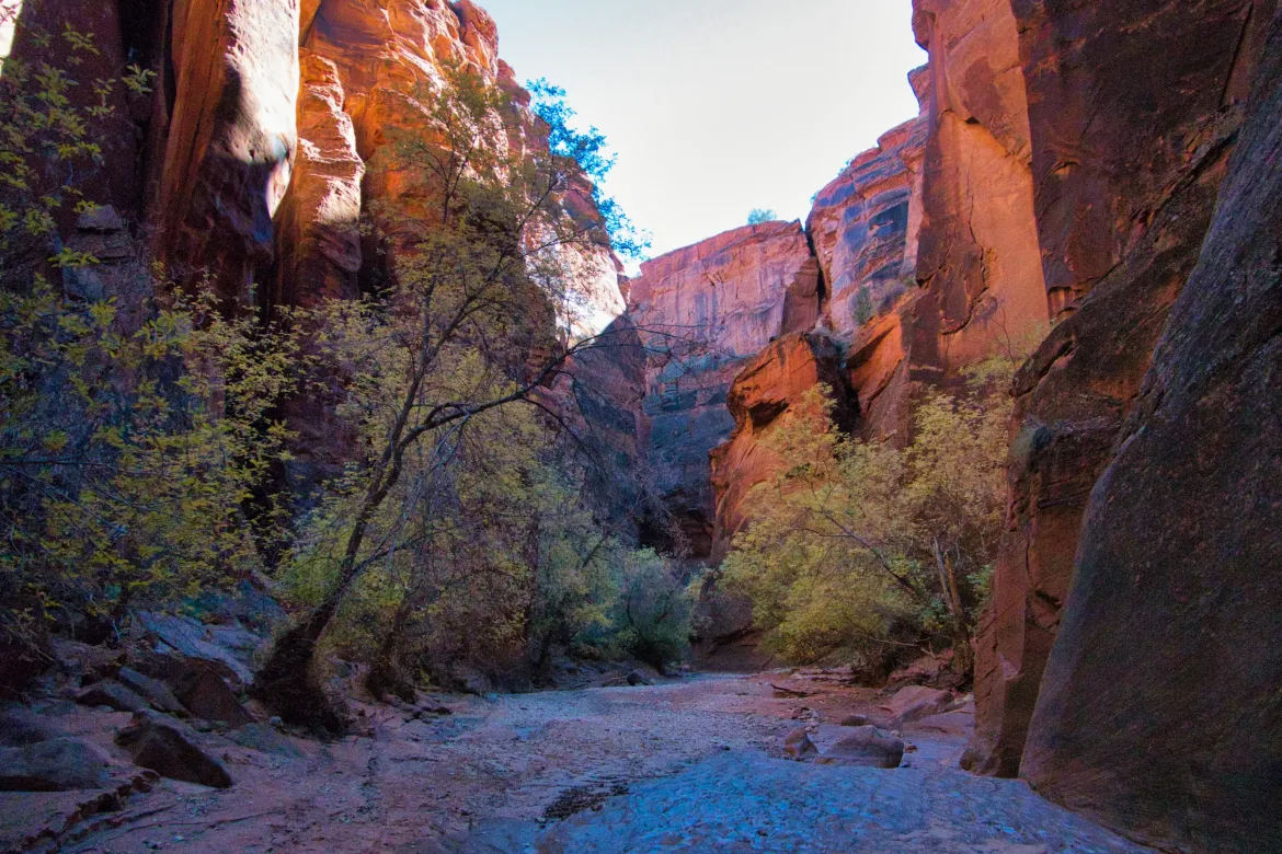
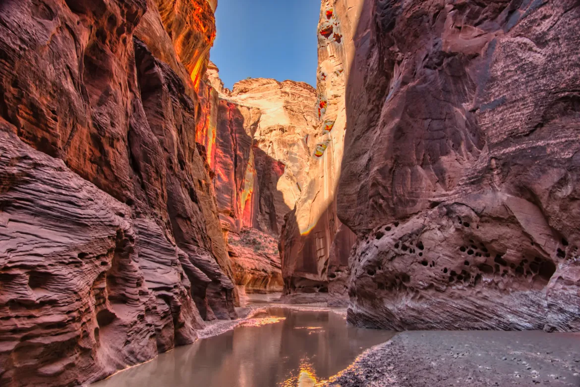
A river came in from the left, and I assumed it was the Paria. This is the same river that I hiked up about a week ago, and now I’m going to continue down it. I joined the river only about 10 miles from where I first picked up the river about a week ago. That shows you how circuitous this route can be even though this is an alternate that I’m doing that’s off the official route.
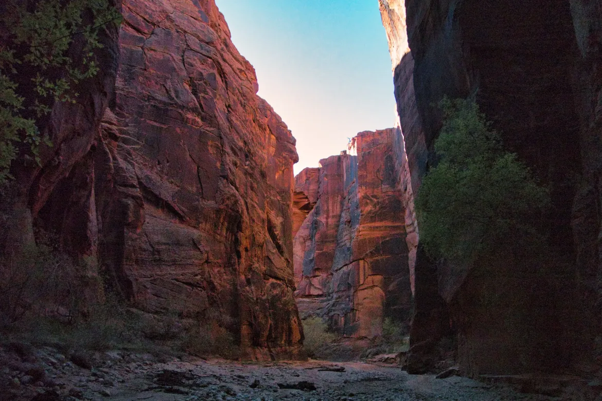
When the Paria came in, it was nearly constant crossing the river. It was often ankle-deep, so not a big deal, and the ground was firm with no real quicksand to speak of which is nice. The canyon got a little bit wider as well to accommodate the bigger river, but it was still generally 50 feet or less wide. It looks totally different than it upstream, just a narrow canyon with tall walls. I wandered down for quite a while but made pretty decent progress down the trail and soon got to Big Spring. I filled up my water for the night there. That was my initial goal for the day, but it was still early, so I continued on to see how far I could get.
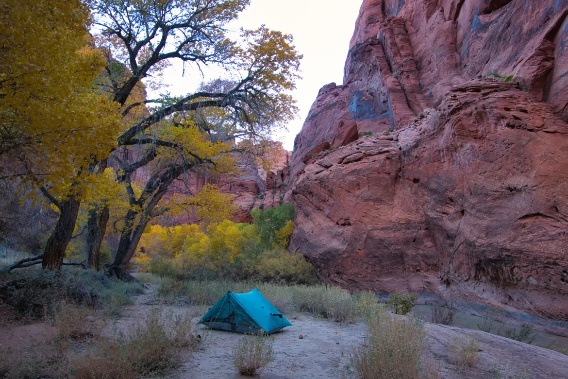
I continued downstream, and after I covered 18 miles or so, I just started losing energy. I set a second goal for the day arbitrarily, but my energy levels were just waning. When I got to a decent-looking campsite, I decided just to call it about a mile short of my goal. Since this is a nice canyon, I didn’t want to just put miles on through it; I wanted to be able to enjoy it, and I knew I wouldn’t have enjoyed it as much as I would tomorrow morning, so I’m sure I made the right call to stop a little bit early. Camped under some cottonwoods next to the river.