
Day 55
Start: Guyot Creek
Finish: Tyndall Creek
Daily Mileage: 13
PCT Mile: 775.9
I think last night was the coldest night of the trail so far. I got slightly chilled in my 20 degree quilt and had to put my down jacket on while I was sleeping for the second time ever, though I am not using my usual sleeping bag liner for this trip. My shoes were wet from the ford yesterday, and they were a bit stiff from being partially frozen this morning. In any case, a few degrees below freezing won’t stop us and we were hiking down the trail at 6.
There was a nice brief climb first thing to help us work off the cold, and it worked well. My shoes were quickly flexing like normal and I was starting to sweat in my wind shirt.
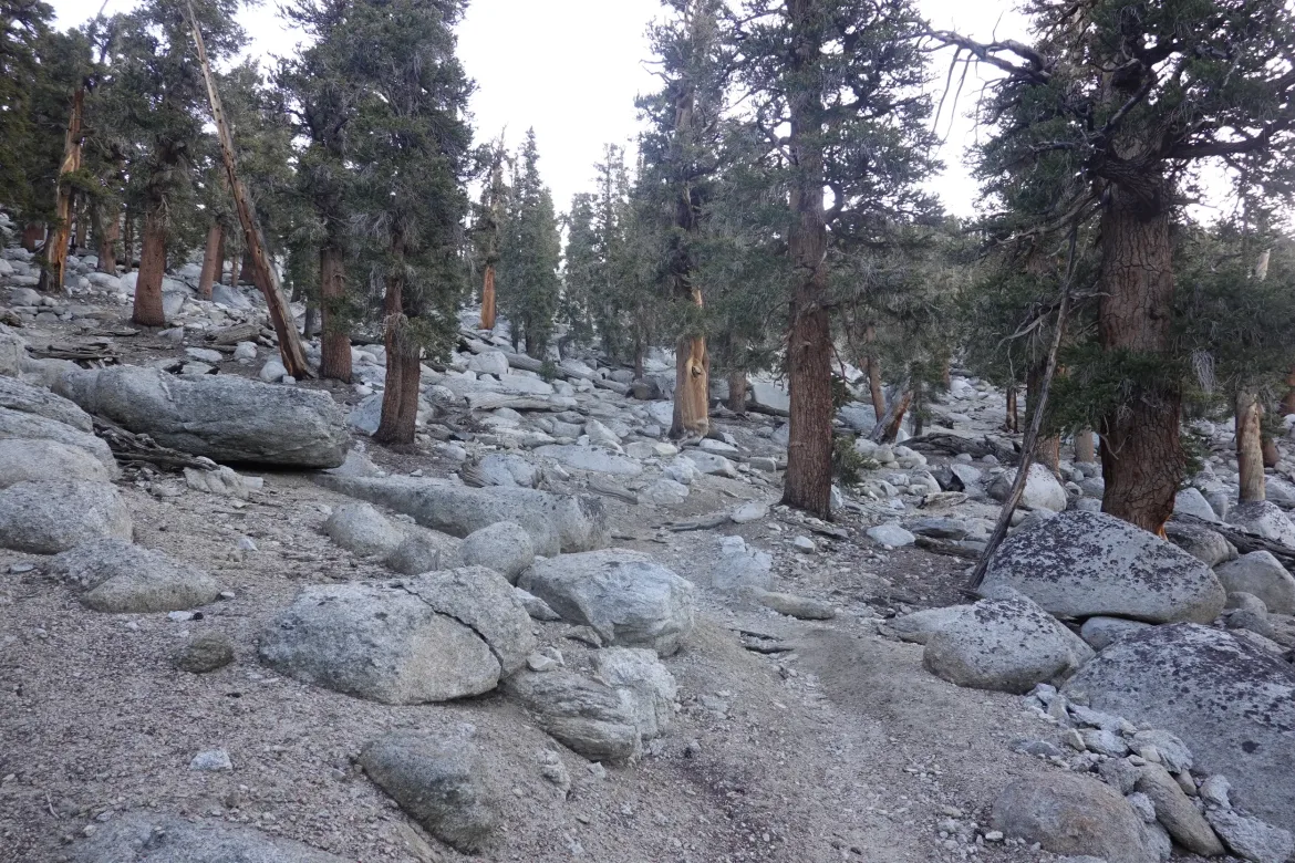
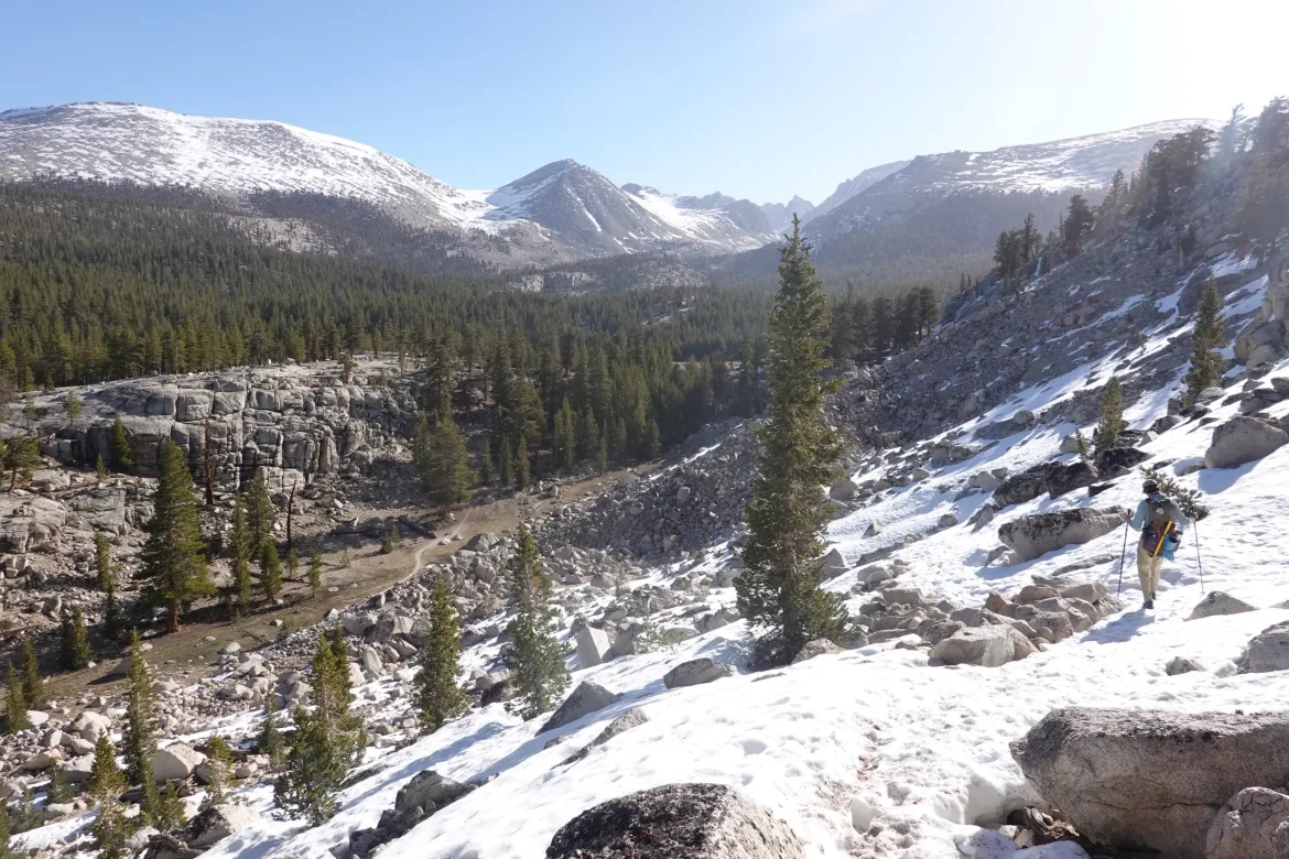
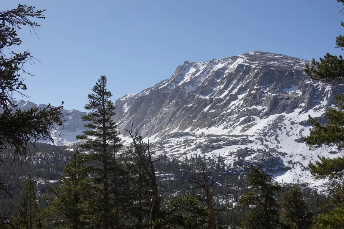
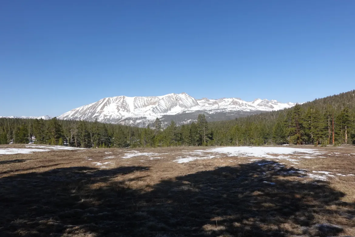
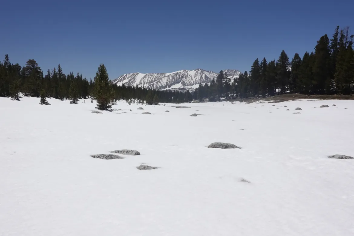
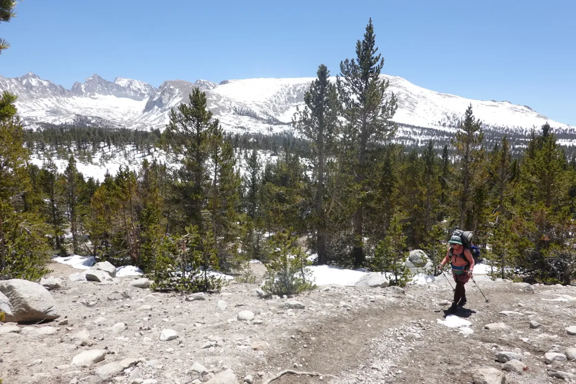
This day was full of snow and wonderful mountains. The first part of the day was through forest, but there was always the glimmer of the surrounding granite massifs now all around us. However, this doesn’t photograph well, so you will have to settle for the unoccluded views.
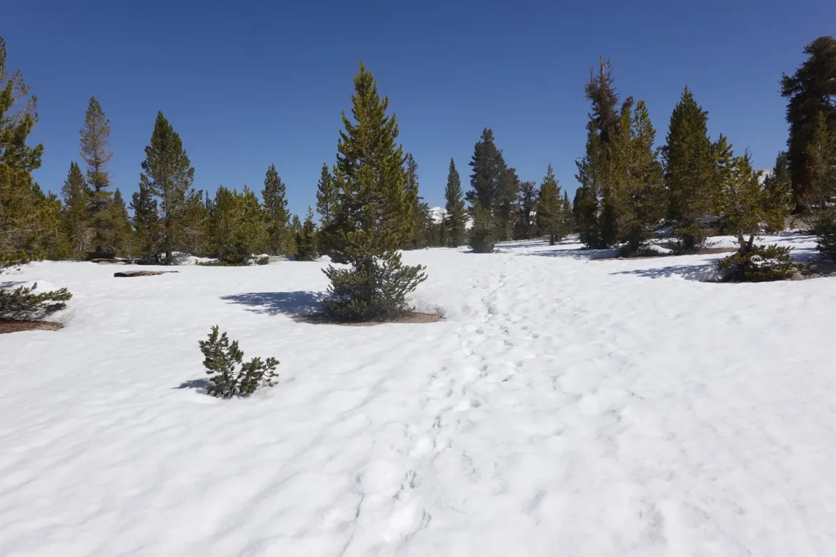
For the first part of the day, we alternated between clear trail and rock hard snow, solidified overnight. We kept our spikes at the ready and had to swap in and out of them multiple times. However, I’ll take spikes and rock hard snow over a slushy mess any day.
Early on, the snow wasn’t continuous enough to make navigation difficult, so it was just pleasant hiking over patches of snow and picking up a brief section of trail on the other side.
There was a trickier slope heading down to Crabtree Meadow where we had to go steeply down through a rock field with snow obscuring the trail. Almost ice axe time, but it was short and we were able to make out way down the steep and hard snow.
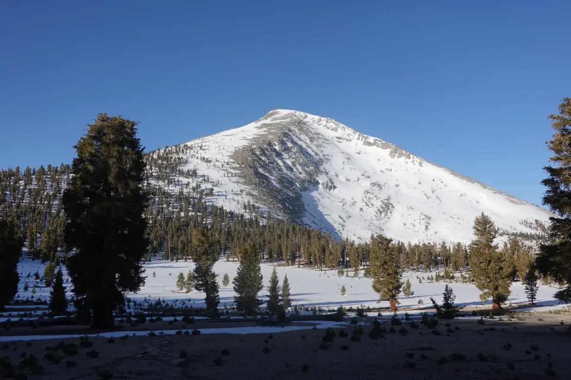
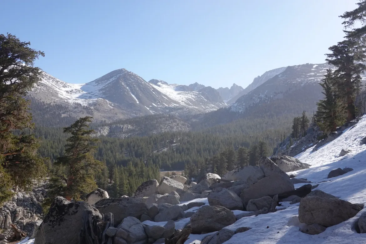
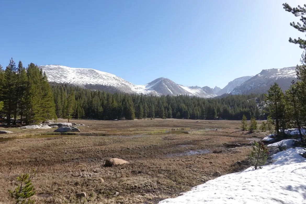
We then were presented with Crabtree Meadow. There were several meadows we crossed today, but Crabtree was snow free and open, and finally gave us a clear view of Mt. Whitney, the tallest mountain in the 48 states. Apart from Whitney, there were a few other mountains looming over the meadow was a spectacular sight and setting.
Many PCT hikers climb Mt. Whitney since our permit allows it, but we decided we wanted to focus on the trail since we had a big food carry anyways leaving town and climbing takes at least a day. Also, several hikers said that it really need crampons which Cookie Monster and I did not have. Several hikers also told us about bailing on their attempts due to the steep and sketchy ice. With all of that, none of us really had a desire to attempt the mountain.
We crossed Crabtree Creek with an easy ford and headed back up until we came to another meadow with views of the mountains in a different direction where we took a break. We were doing good on time and were only planning 13 miles today (as if), so we thought we had plenty of time for a break.
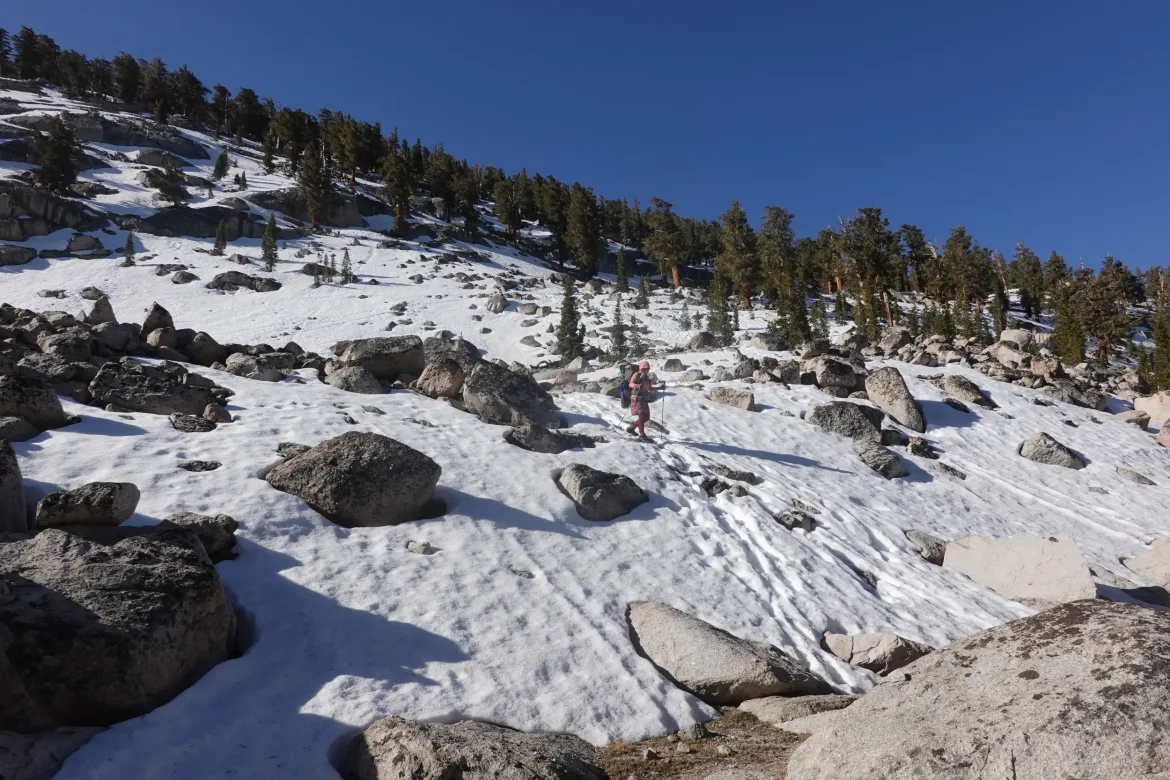
Heading on, we were faced with a steep and snowy descent to Wallace Creek. The trail was once again obscured and boot tracks went in all directions. We made our way as straight down as safely possible, which was probably near the limit of my microspikes. I am considering picking up some crampons when I get to town next since they would be better on the steep ice.
As we were assessing our crossing of Wallace Creek, Paws from the Spicy Bandits popped out on the other side to get water. We had caught them since they had attempted Mt. Whitney. They were parked in a beautiful grassy meadow for lunch, so we took ours as well, and caught up with out stories.
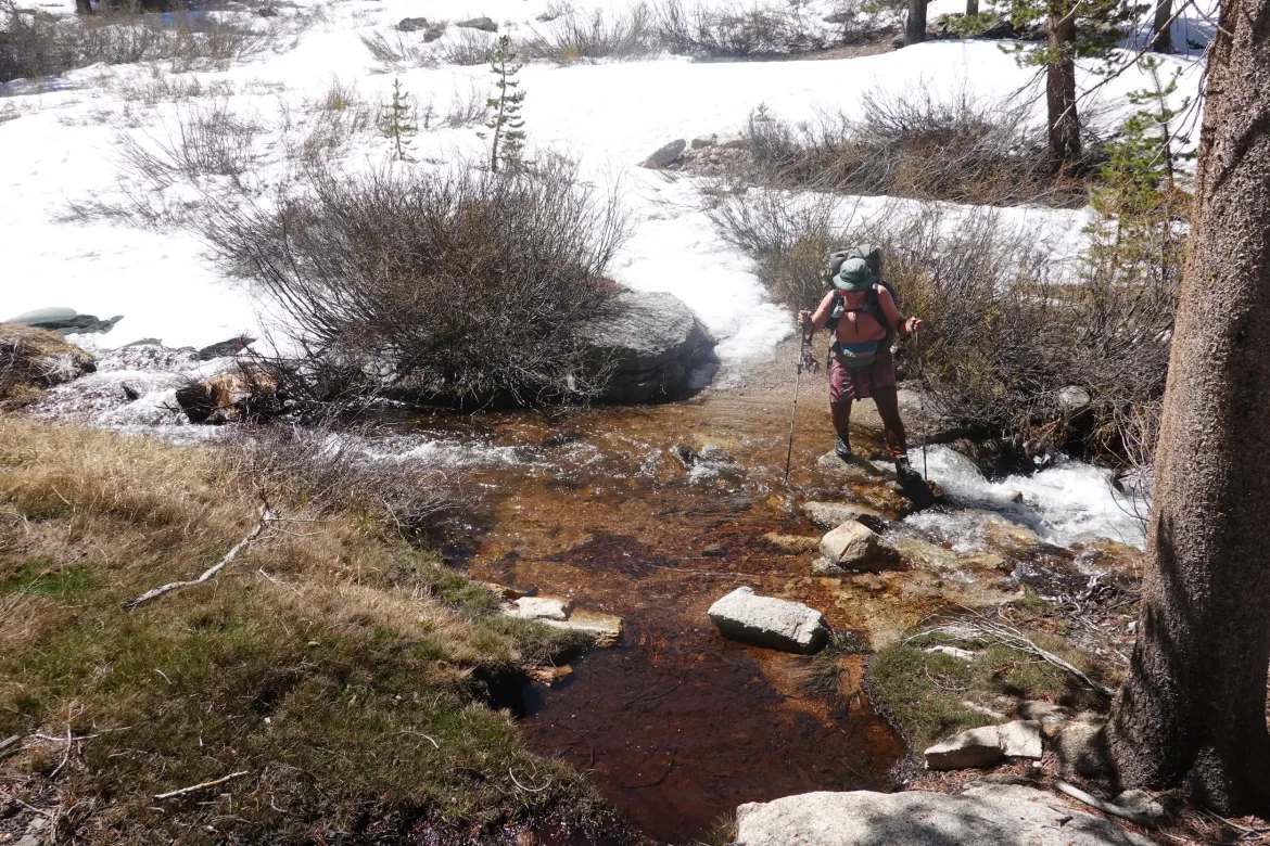
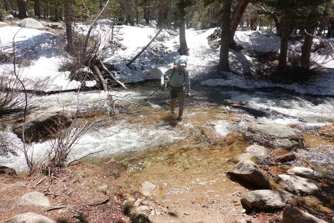
Leaving lunch around noon, it was game time. The snow was quickly softening, and we still had a few miles to do. A quick climb up and then another ford of Wright Creek and the snow began to pick up. For the rest of the day it would be mostly continuous with brief patches of open ground. Most of the time that was enough to spot the trail, but sometimes the trail played tricks and crossed under us while we were walking on the snow. Not too hard to navigate with GPS though.
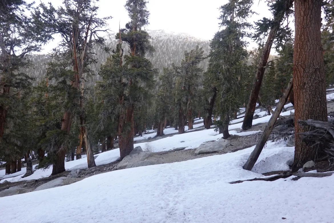
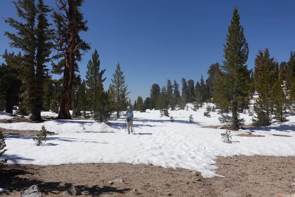
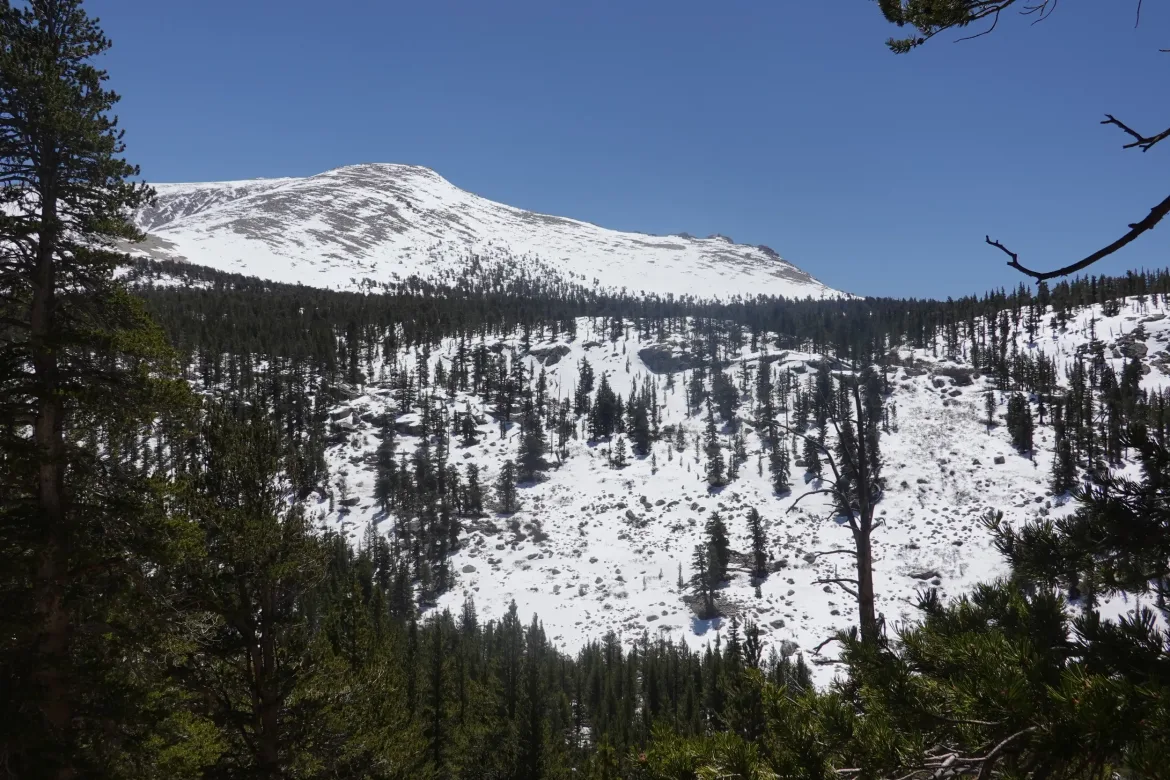
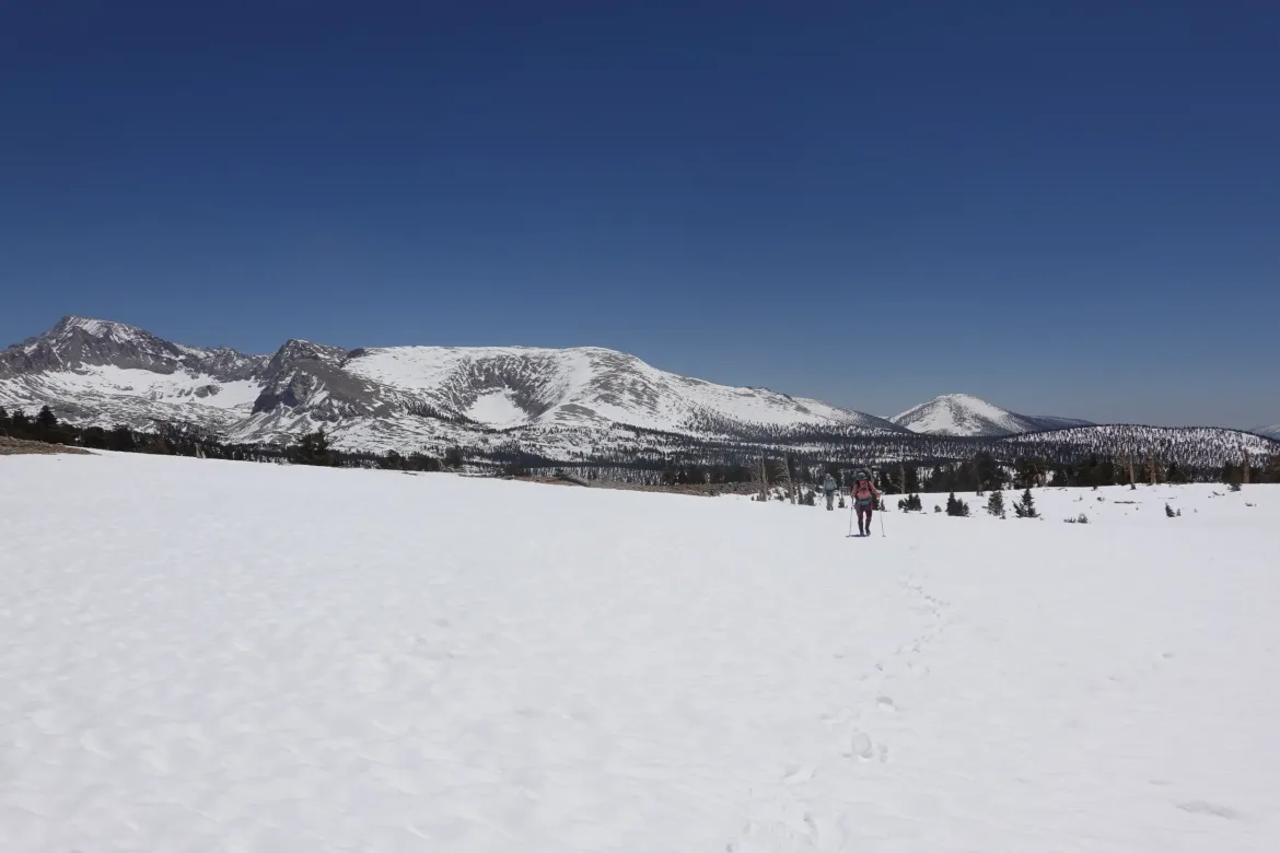
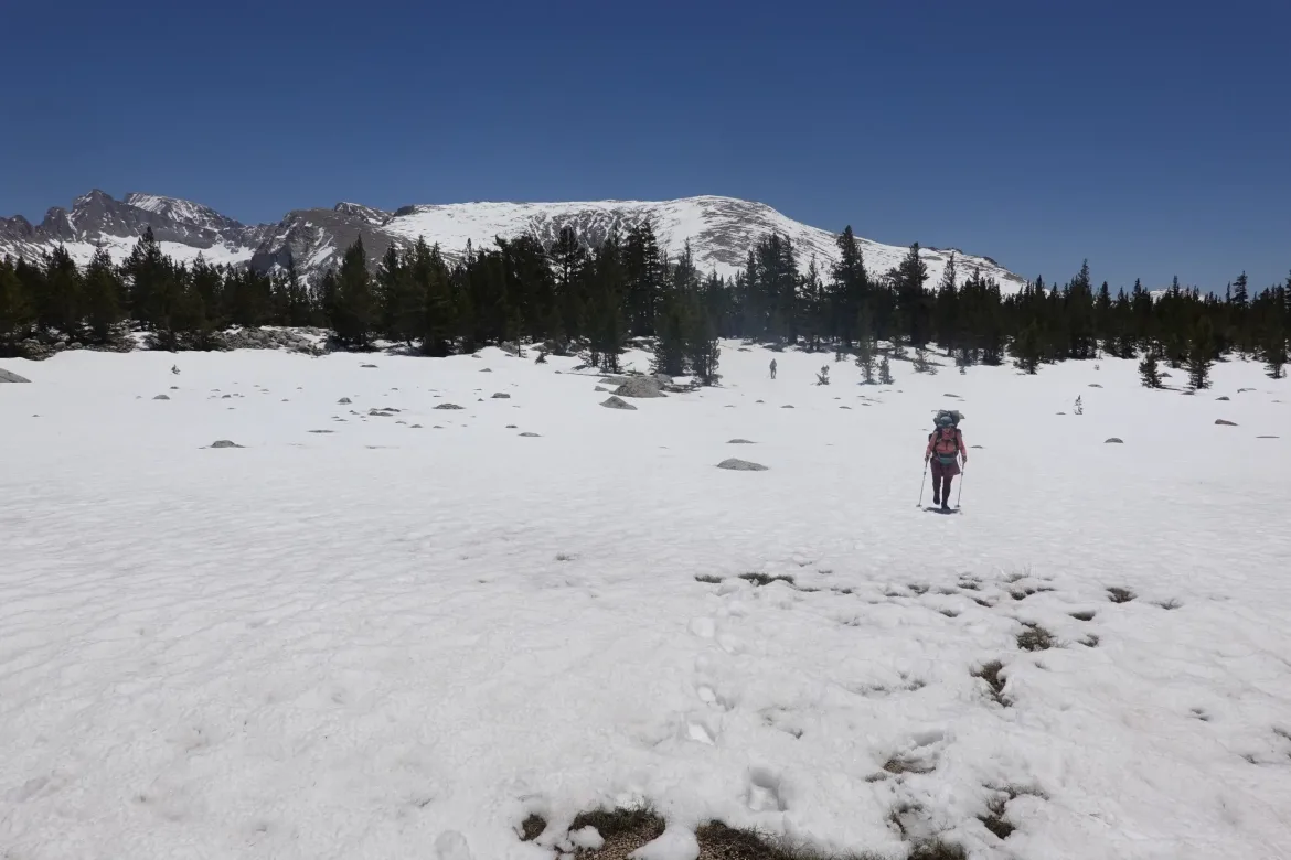
We began crossing meadows of increasing size. Unlike prior meadows, these were completely blanketed in snow, even if the forest surrounding them was partially melted out. We aren’t sure why this was possible since the meadows were in full sun, but the snow was mostly firm except around the edges, and we made good progress across them.
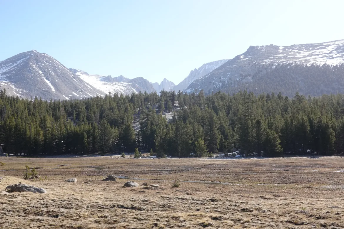
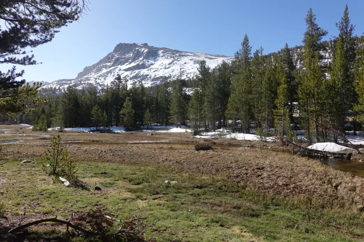
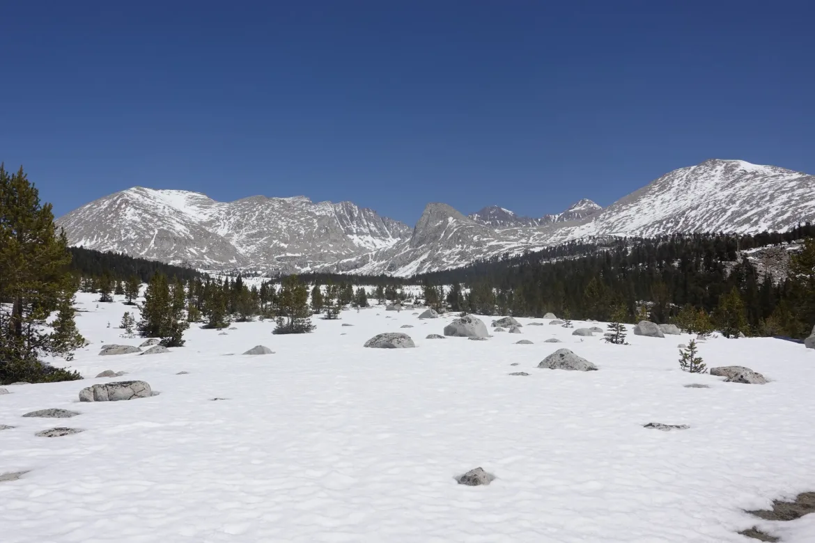
The meadows also offered more opportunities to take in the ever changing mountains around us. We were flying past so many of them now, that each time it was a completely new view. We say Mt. Whitney from several angles, as well as the sharp mountains to the west. Spectacular stuff, and amazing that we were surfing around 11,000 feet and had so many mountains still towering over us.
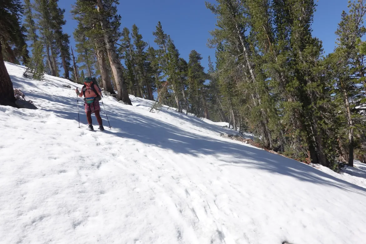
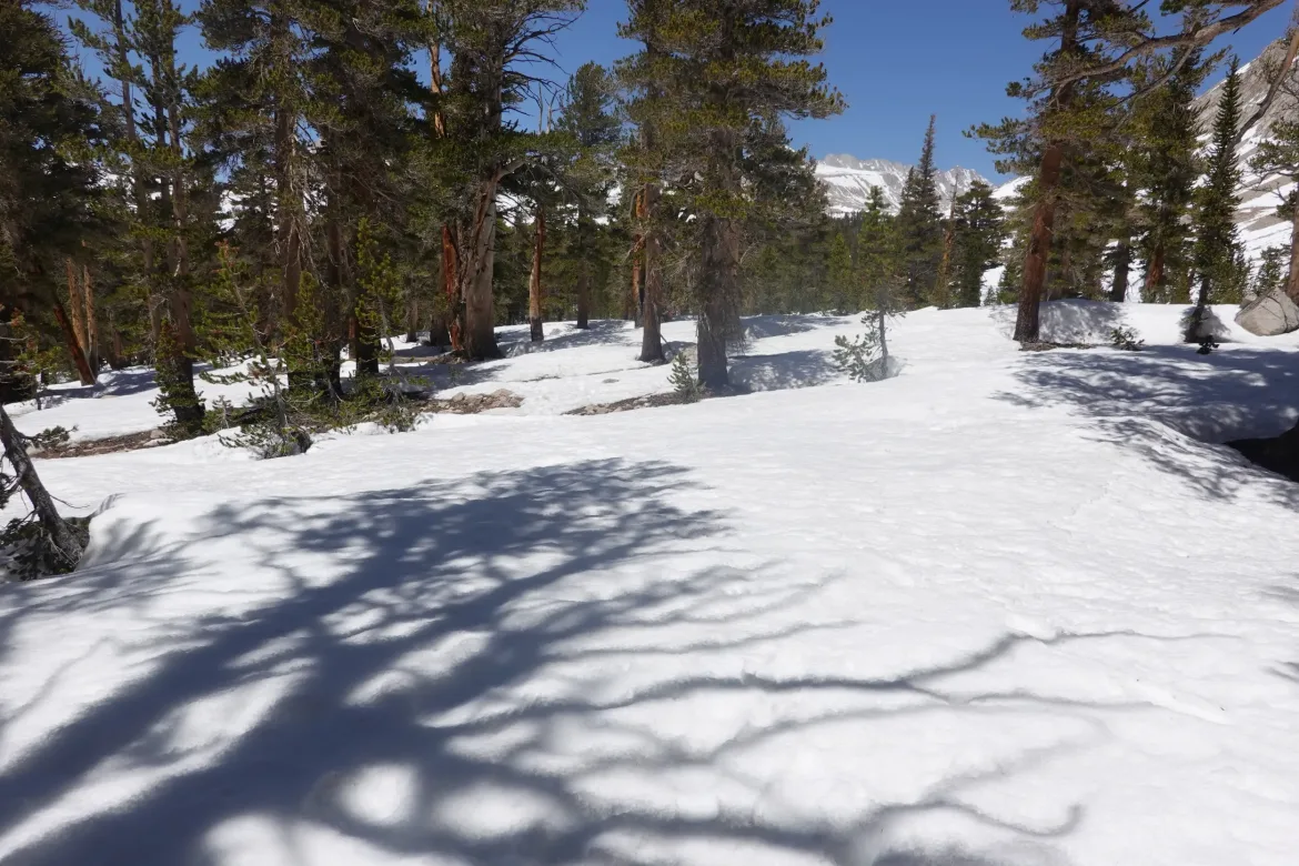
However, the snow was starting to take its toll. Since it was softening from the bright sun and cloudless sky, each step was taking more energy. Instead of the concrete early in the day, it was now slushy, and sometimes gave way completely so you would posthole. In the woods, the snow was in a million drifts. Each drift had crumbling edges that gave way when you tried to get on or off, and then you had to go up and down each drift like speed bumps. After miles of it today, it was getting exhausting. I’m sure the high elevation we are at and lower oxygen levels helped too.
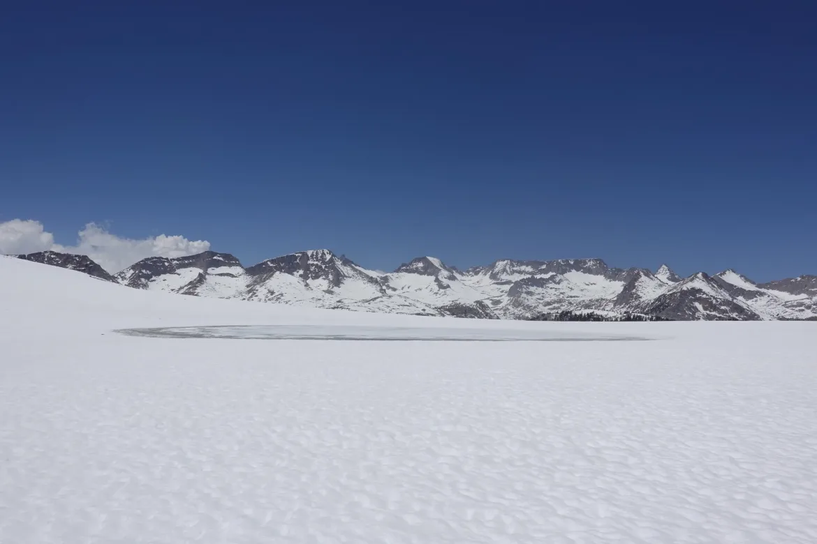
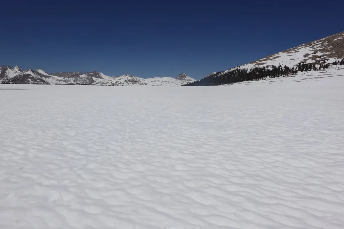
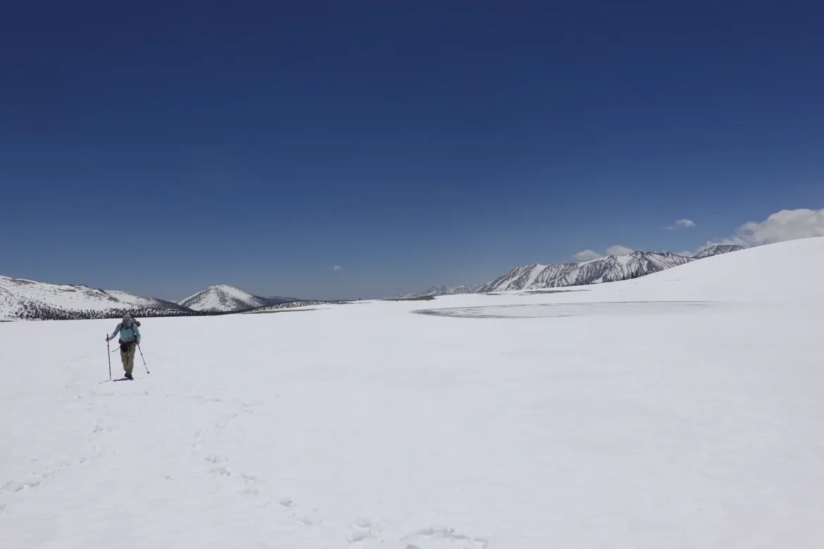
The meadows and woods gave way for an encore of the day on the Bighorn Plateau. This was an expanse of at least a couple miles that was almost perfectly flat with not a tree or bush showing through the snow. It was an enormous pure snowfield that looked like it could be in the Arctic. Of course, it was also surrounded by enormous peaks. The experience was vast and otherworldly. What an amazing place!
When our snowfield came to an unfortunate end, we started a descent through a forest. Once again we were into the speed bumps, and the trail was less evident since there was more snowcover. The snow was also getting very soft, taking immense energy to make progress. We picked our way slowly through the woods which seemed interminable, and I was happy when I heard the roar of Tyndall Creek which would be our last obstacle of the day.
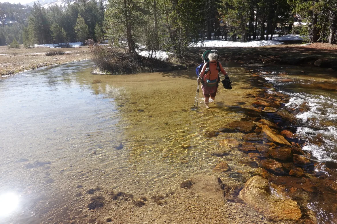
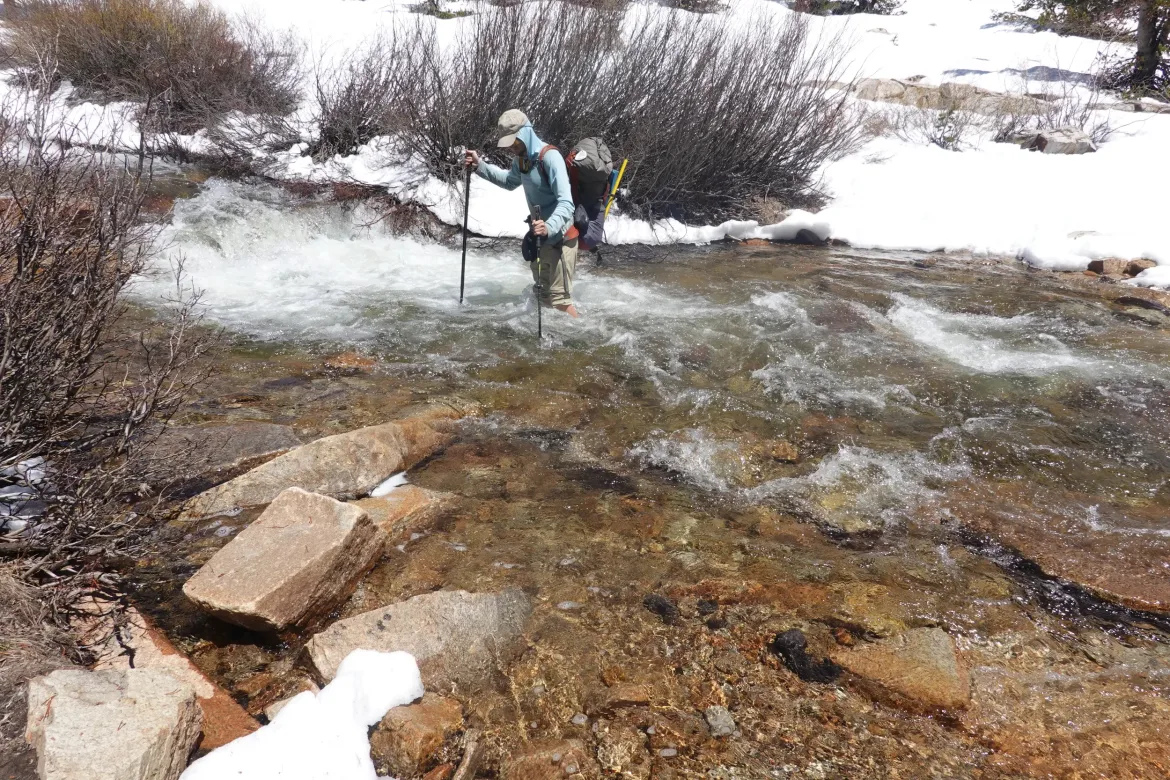
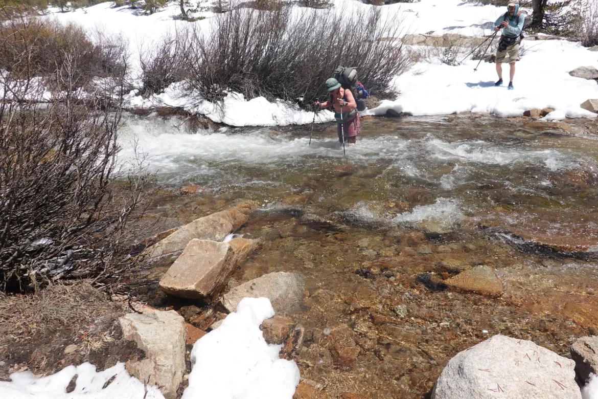
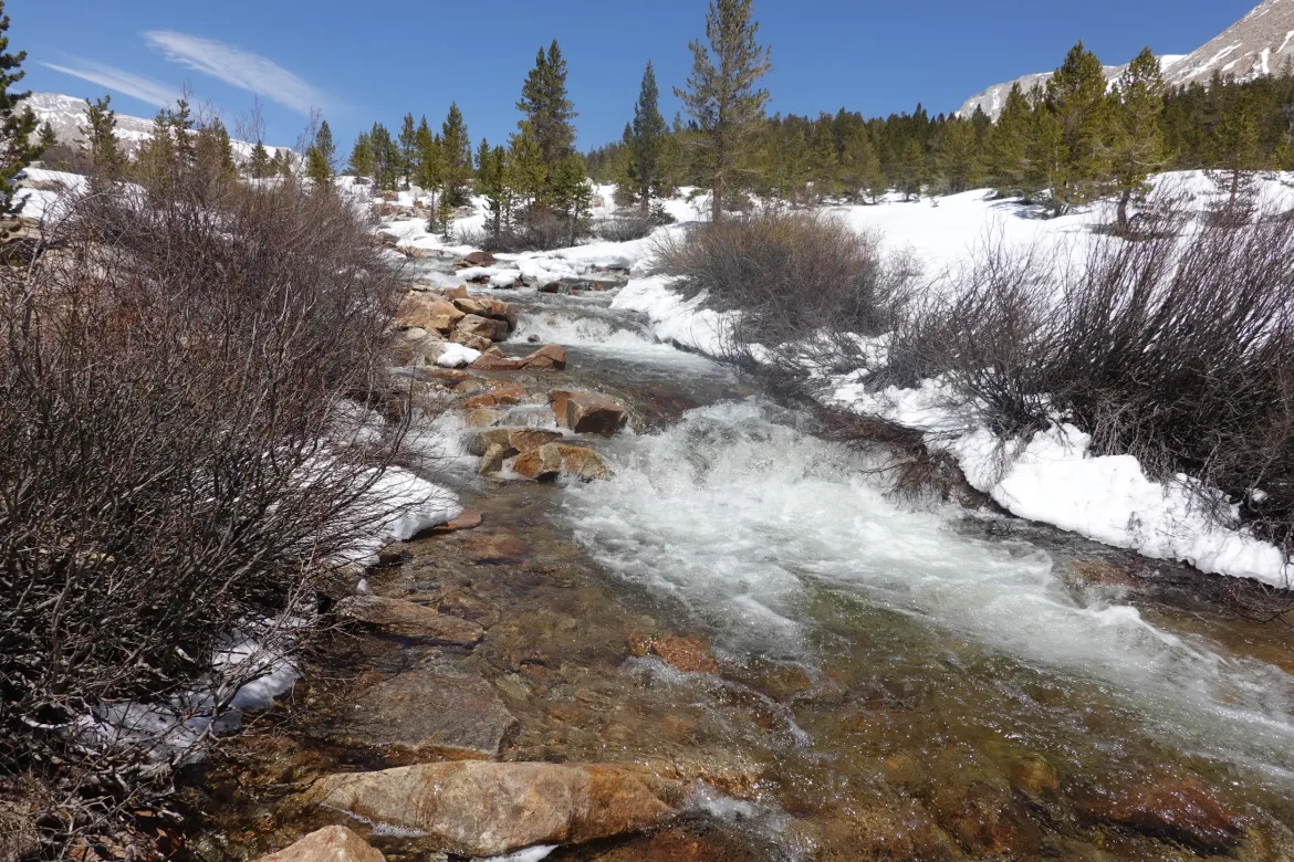
Tyndall Creek was our fourth knee-high ford of the day, but our shoes were already soaked from all the snow and other crossings so it made little difference.
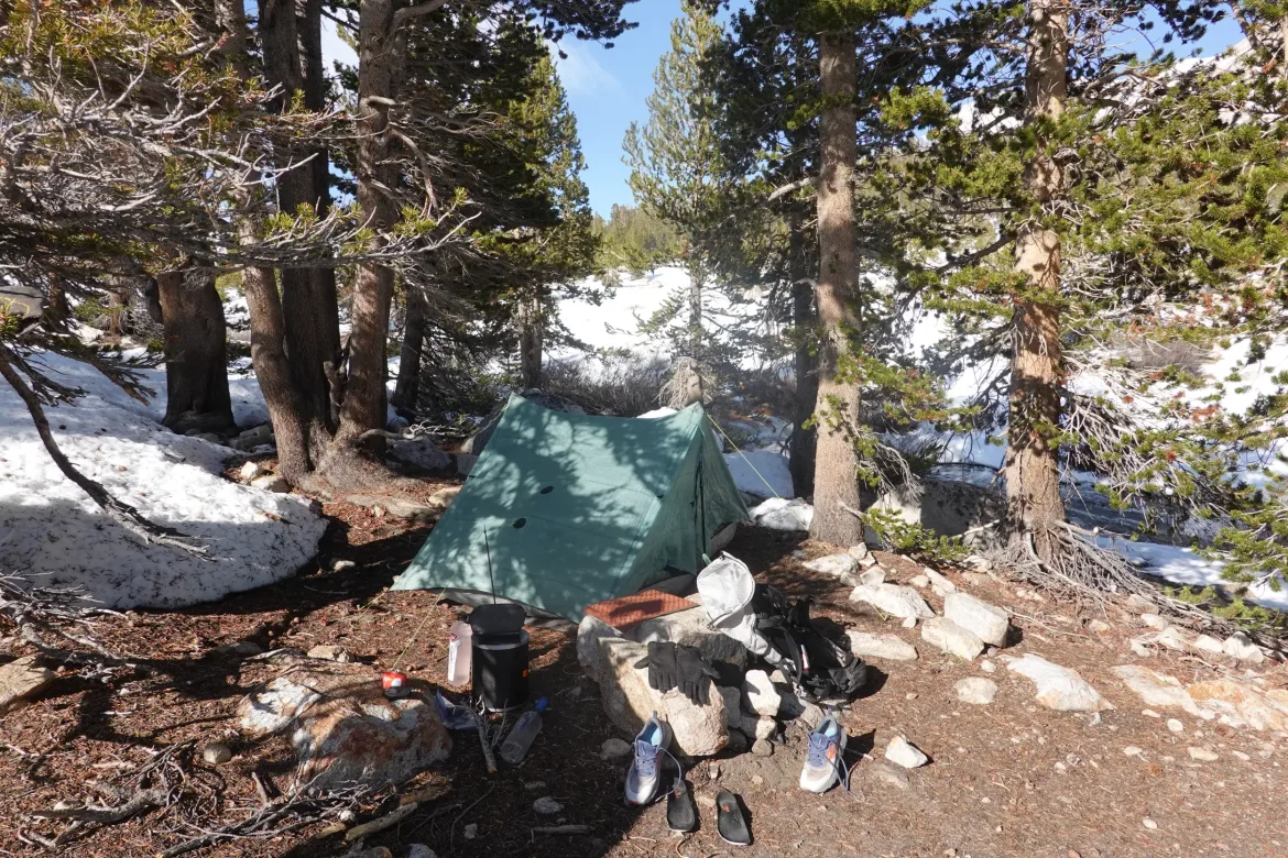
On the other side we found some small dry patches to pitch our tents. It took me some time to pitch as I was so exhausted. I got it done and set my wet gear out to dry in the afternoon sun. We arrived at 2:30, so there was plenty of time for the sun to do its work, and before it went away, everything was essentially dry.
We came up with a plan to cross Forester Pass tomorrow, which is the trail’s highest point. A couple other groups arrived later and camped as well since this is the last normal staging point to attempt the pass. We had our dinners a bit earlier as we are going to bed sooner due to a mountaineering start tomorrow.
Today had the most magnificent scenery and experiences of the trail so far, but after only 13 miles I was spent. I upped my ration for this portion of the hike, but I’m still starving, and should probably be eating more. Hard when you are carrying 8 days of food. The scenery and environment makes it all worth it in spades though, as this is some of the most spectacular trial I have been on!