
Start: Horse Mountain Road
Finish: Near Cottonwood Canyon Road
Daily Mileage: 16.9
Trip Mileage: 437.2
Elevation gain/loss: 1875/2718ft
As forecast, it definitely rained last night. Since I was camping at 7,000 ft., I wasn’t sure what form the precipitation was going to be in. It started off as rain in the middle of the night, but then it started hitting my tent harder, and I think it was fighting between freezing rain and snow. When I got out of my tent, the tent was coated in a layer of ice from freezing rain. There was a little bit of snow on the ground, but it seems like it was mainly just the freezing rain.
I started out on a 4×4 track. Unfortunately, with all of the rain and wintry mix, the track was pretty much just a slip and slide filled with mud. Mud was constantly clinging to the bottom of my shoes, and I was skating all over the place. Normally, I assume that road walks like this are going to be smooth sailing, but this definitely was not.
I didn’t end up staying on the 4×4 track for too long, thankfully. My track took me down to a basin. This is an alternate that probably few people have done. I saw a couple of prints, but I was largely on my own just picking my way down. It wasn’t too bad; sort of a fun challenge.
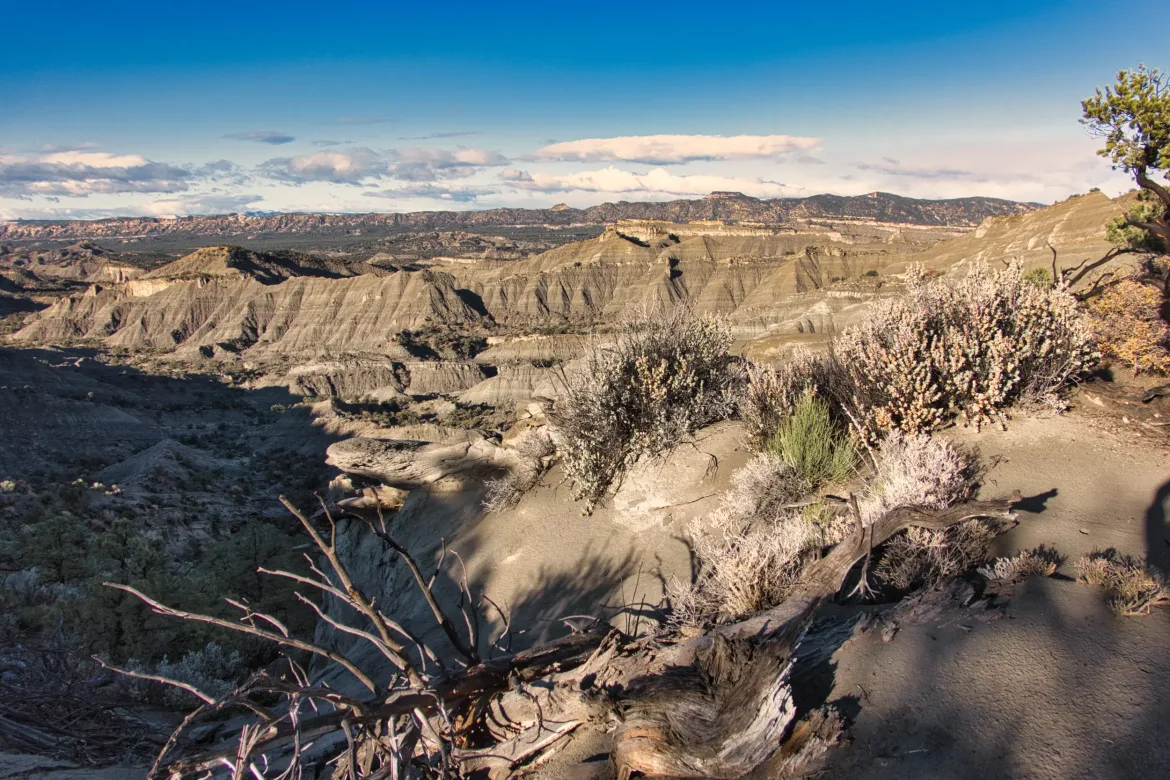
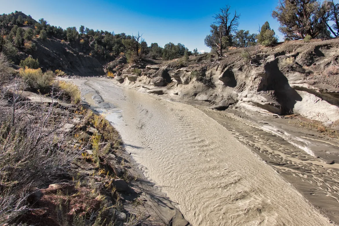
I got to the basin, and the route had me climbing some mud hills and said they had some exposure. That did not sound like anyone’s definition of fun after a big rain. I took a few steps in the wash that paralleled the route, and the sand was relatively firm even though the wash was flowing. Pretty much all the washes were flowing due to the rain. I decided to follow the wash instead for a while and see where that got me.
The wash was really smooth sailing, and I made pretty good time on it. Looking up to the mud hills to my right, they did not look like fun. I followed the wash down for a couple of miles, and I decided to rejoin my intended route when it looked like it got a little bit tamer. I found a spot to climb up, a steep dirt slope. I needed to kick in some steps, but it wasn’t too far, and I made my way to the top. From there, I wandered around on a ridge for a bit, and I think I made the right decision to go to my route since the wash had much better footing than the mud hill/ridge.
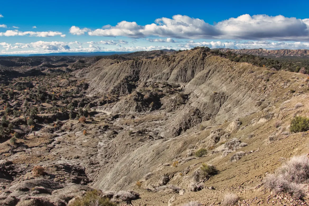
The route I was on descended the ridge and then followed a wash for a long time. I got down to the wash, and it was flowing pretty good with muddy water from the rain. It was probably normally dry like most of the washes around here. Not something that seemed like a good time to follow. I decided that instead I would go about a mile cross-country to hit a 4×4 track indicated on my map and follow that south. That would take me to the same spot.
The cross-country travel wasn’t too hard except I had to cross a couple more streams that were also flowing. The most difficult part was getting down to them and back up the other side since they had sheer walls. Just had to find the right spot to go down and come back up. Other than that, I just had my compass out following a bearing to the road.
I got to the 4×4 track, and it was beautiful walking! Just packed sand with very firm footing and no mud; perfect walking. I’ll take it!
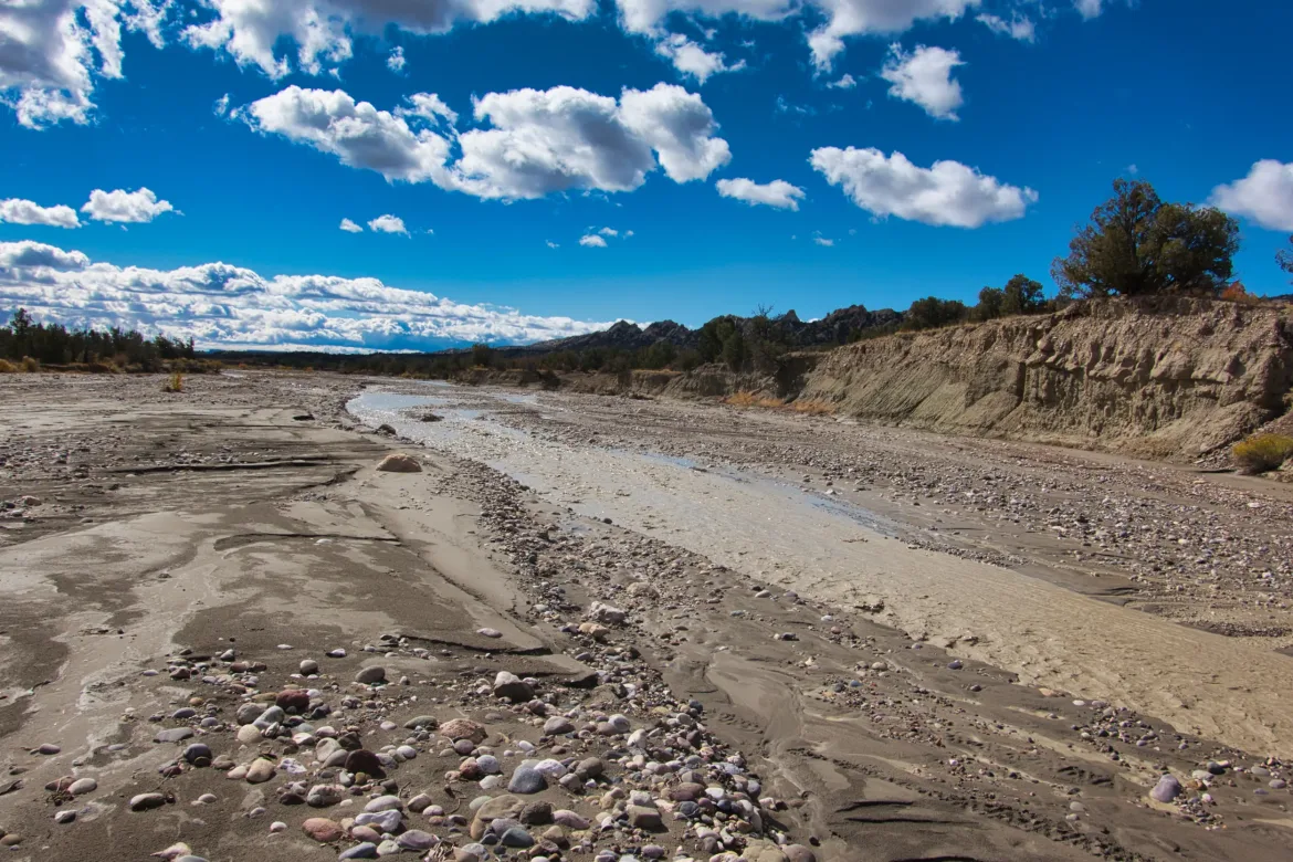
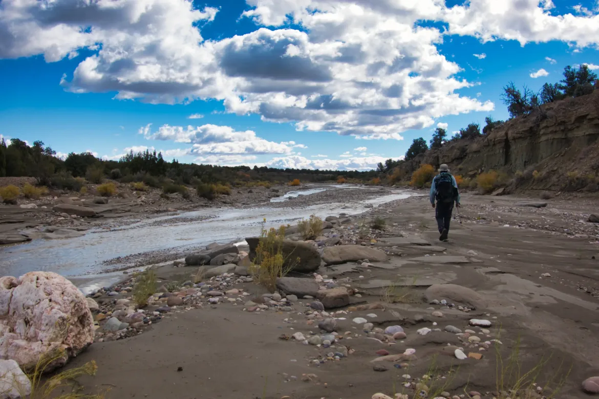
I followed that track for a mile or two until it intersected back with my intended route. This was in the same wash that I had opted to not go down before except some other streams had joined it and the wash itself was enormous, usually greater than 100 feet across. However, the stream itself was typically about six feet or so. Since the wash was so wide, I followed it for a while, jumping over the stream at convenient places where it was going to trap me up against cliffs. It wasn’t too hard to go back and forth across it although you just had to find the right spot. I went back and forth quite a few times across it and managed to keep my feet dry!
So, you think that since all these streams are flowing, water would be easy to come by. However, the streams that were flowing were all brown and looked like chocolate milk with suspended dirt. Not something that’s easy to treat without clogging my water filter. I came across a spring and took all my water for the day and half of tomorrow from it. It just seems weird to carry all that water when there’s so much water around me.
After a while, the stream kept boxing me in against the banks, so I decided to go up on the right bank and do some cross country. It went pretty well, and after not too long, I hit the next 4×4 track that I would take over a mountain ridge. That 4×4 track varied from good to muddy. Sometimes it was smooth sailing, and sometimes I was carrying a couple of pounds of mud on my feet. It wound through a cut in the mountains and took me over a ridge.
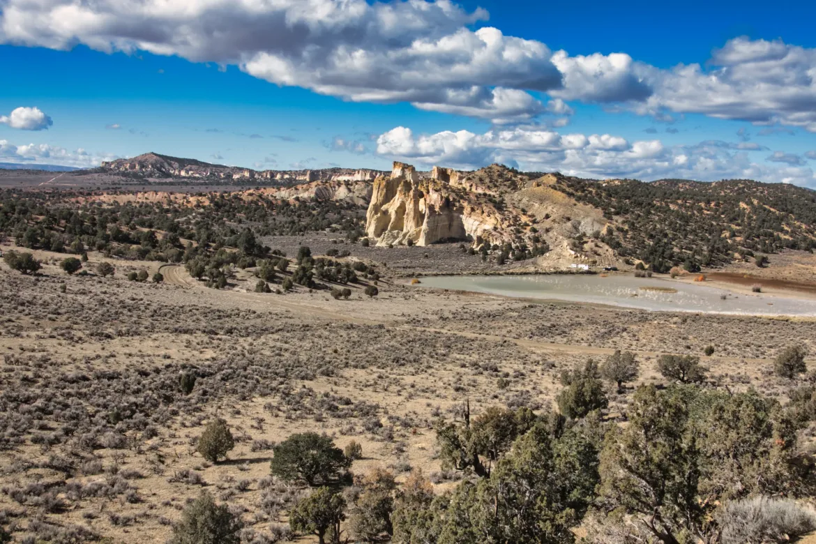
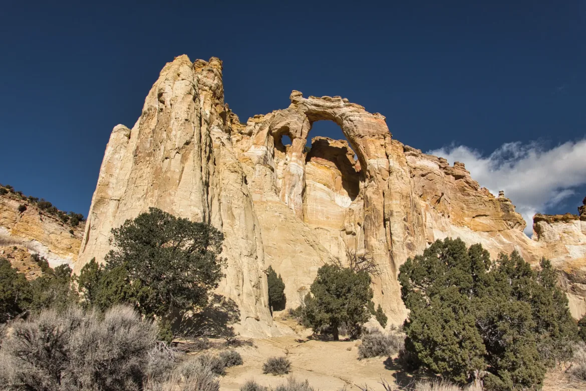
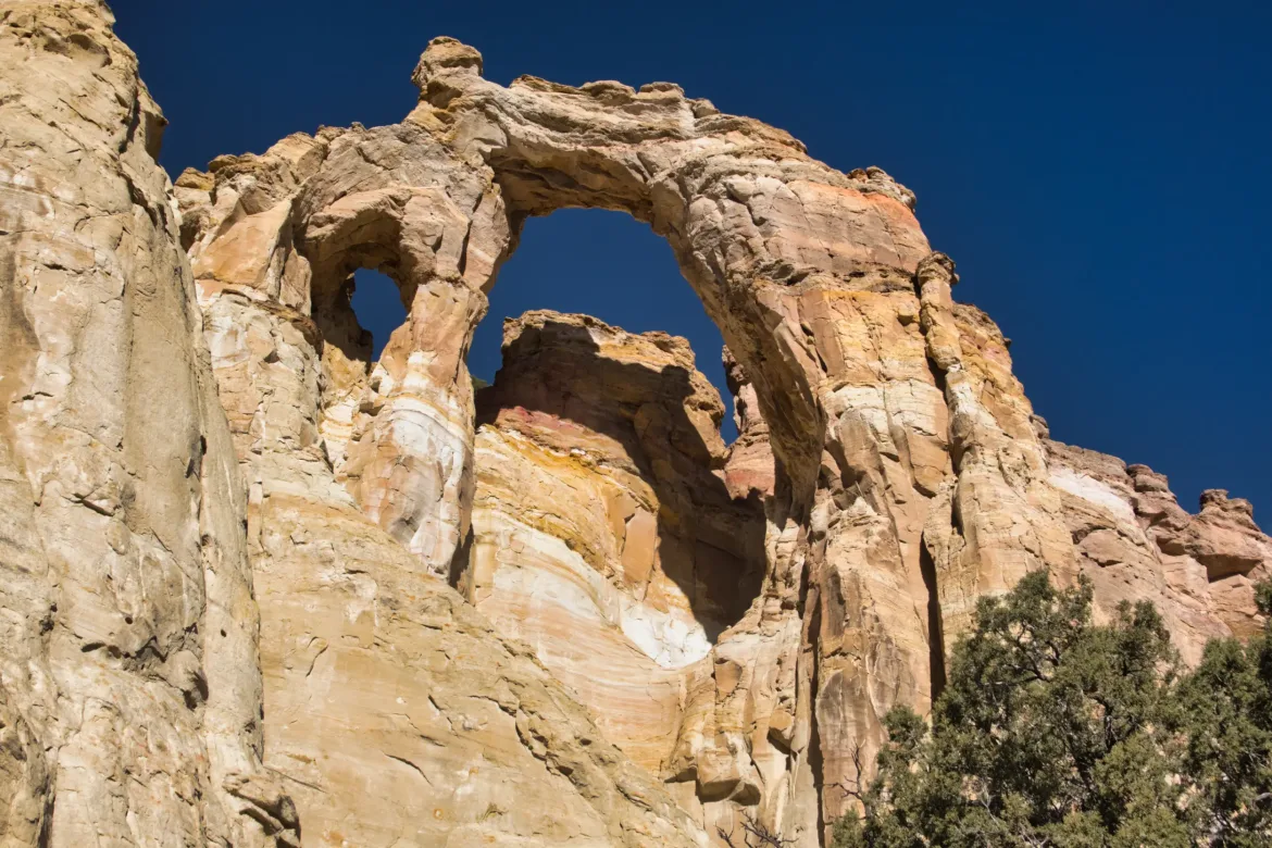
Dropping down from the ridge I came to Grosvenor Arch. The arch was amazing looking! It’s actually a double arch with two clear arches under one smooth curve. A good spot to take a break.
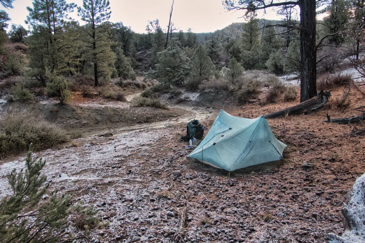
The Arch was where I planned to stay for the night, at least in the area. It had gotten very windy, and I knew I’d need to find someplace that was a little bit sheltered to pitch my tent. The wind was even blowing me around a bit. I continued on the trail which followed a road and scoped out a couple of places that didn’t work because they were still too windy. Then I saw some hills in the distance past some power lines and made for them. I found a flat spot in the lee of a hill under a juniper tree. It was still a little bit windy but the hill definitely blocked most of it. Set up my tent, and it was dry in no time from the wind. That’s one nice thing about hiking here I don’t bother trying to dry off my tent in the morning because I know I can just set it up at night and it will quickly dry out. Definitely not my most scenic spot camping but it will do.
Reading this entry, it may sound like I had a miserable day today. On the contrary, for a lot of the day I just felt on top of the world. I have no idea why but I just felt so positive. I was confronted with some big obstacles with the rain and flowing streams and mud, and I decided to change my course by just looking at my topo map and it all worked out. I was given a crappy set of cards this morning but I did great with them and perhaps that’s why I feel so good.