
Start: Fountain Tanks
Finish: Top of the Waterpocket Fold at the head of Stevens Canyon
Daily Mileage: 20.1
Trip Mileage: 337.9
Elevation gain/loss: 3130/2017ft
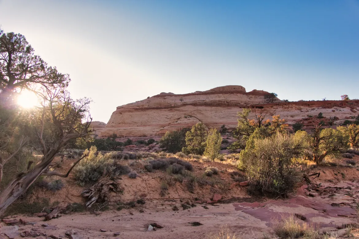
It rained a bit last night, but not too much, and there was periodic very gusty wind. Even though my tent was screened in, I woke up to a layer of sand covering pretty much everything. It happens from time to time in the desert. I hit the trail and headed towards Halls Creek Narrows.
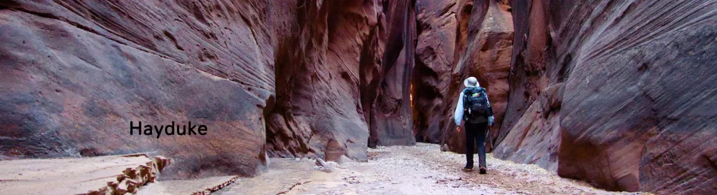
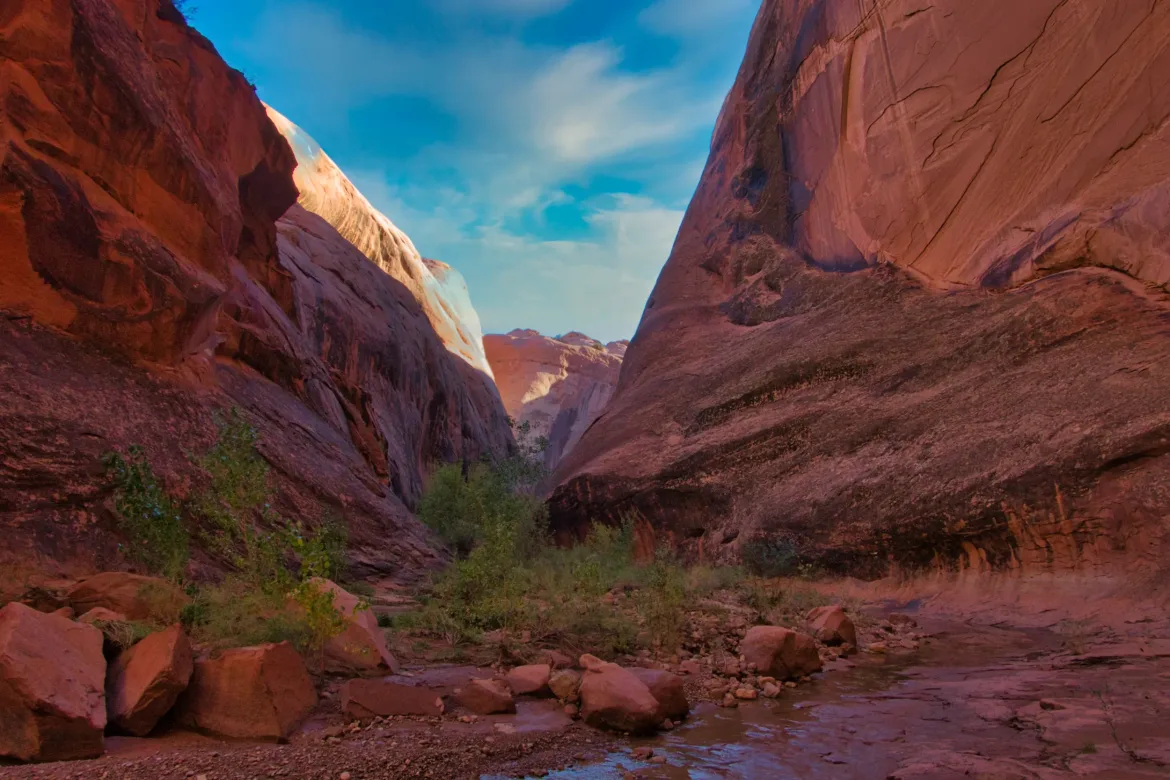
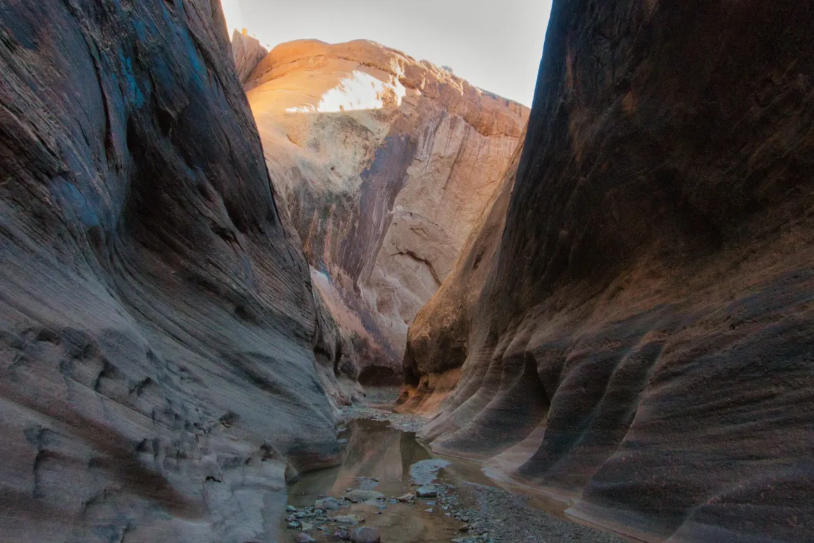
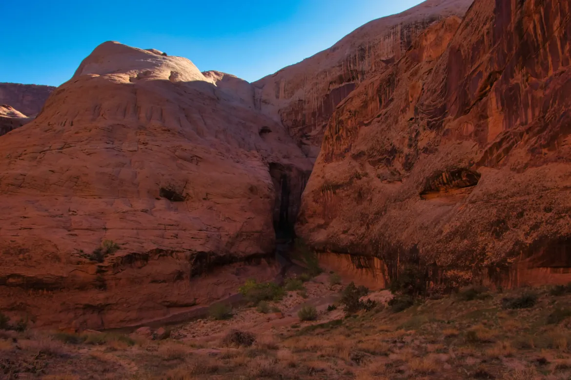
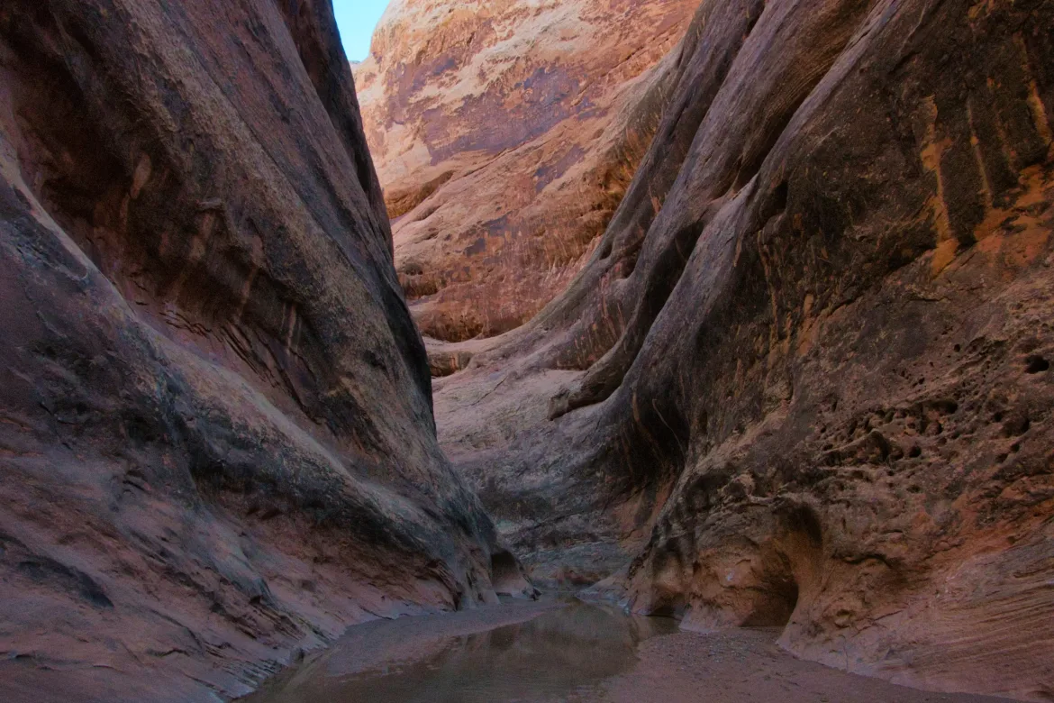
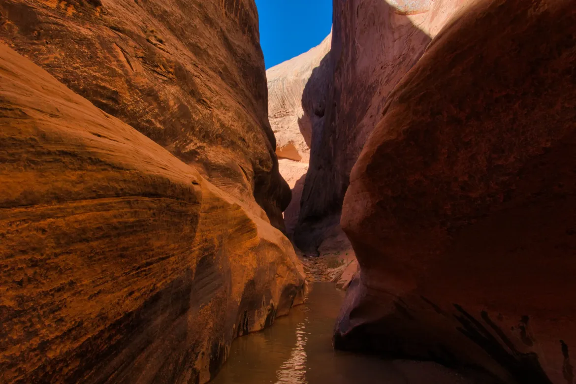
Easy treadway until the Narrows, where the walls of the canyon started closing in on the wash. Water also appeared in the wash and started flowing, but not too much. As the walls were closing in, I decided to pull a Michael Martin and just go straight into the water since I knew I would be getting my feet wet anyways. Just get it over with. Turned out to be a good call since my feet would stay wet for the duration of the Narrows.
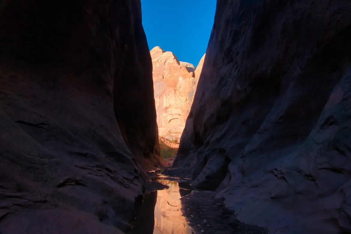
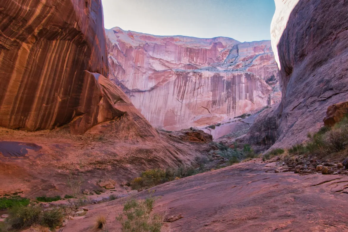
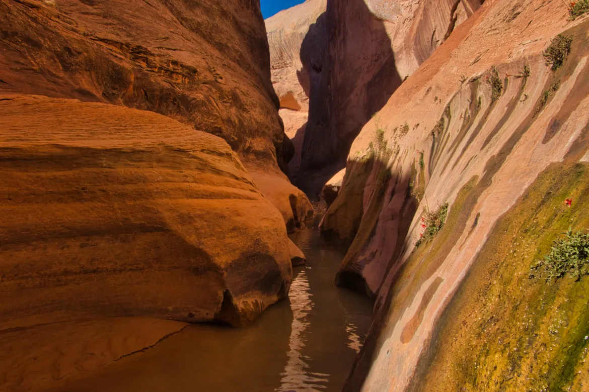
Going through the Narrows, I took a ton of pictures and was constantly craning my neck upwards to take in the canyon walls. There was a lot of wading, but it wasn’t too deep, mainly ankle-depth for the most part. Early in the traverse, there was a footpath up to the saddle across a bend in the river. I went up there, and it was a great view, straddling two branches of the stream and a very tight bend, sort of like the loop. It didn’t look like there was a cleared way trail down, but it looked possible for me to head down the other side instead of following the stream around, so I decided to do that. It wasn’t hard to descend until the very bottom where it got extremely brushy, including poison ivy. Perhaps that was a bad idea. I pushed really hard to get through the brush, and it was tough. I also later noticed that my tripod was no longer in my pack after I finished the Narrows. I assume it fell out during this brushy section at some point, unfortunately.
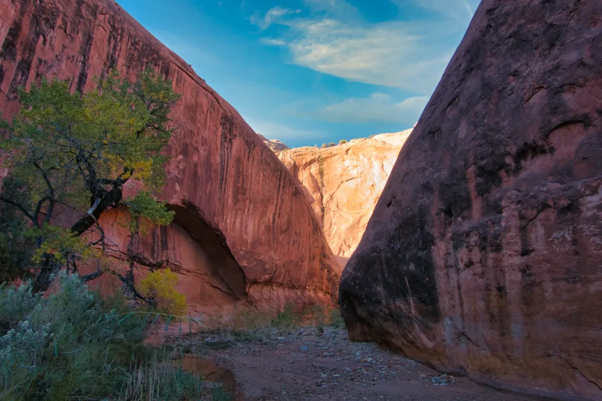
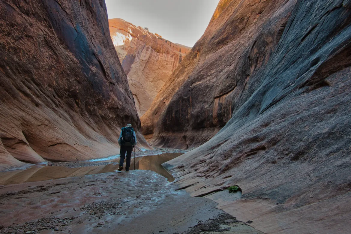
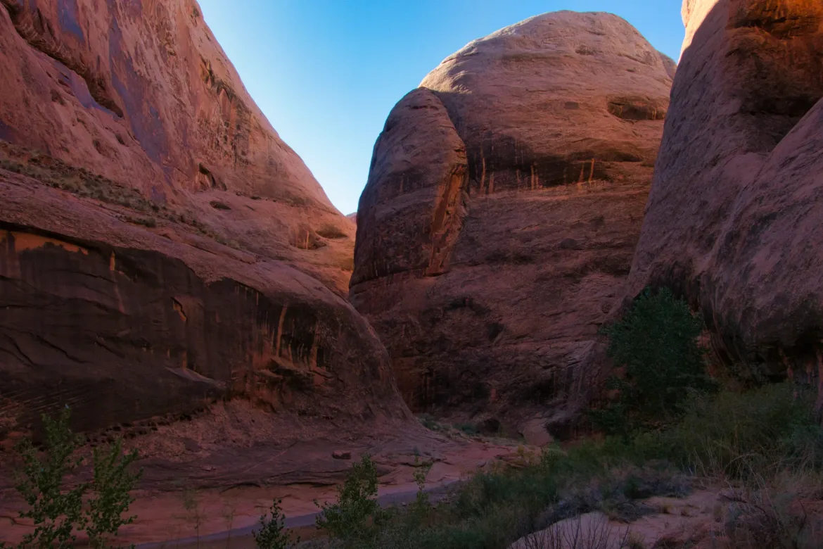
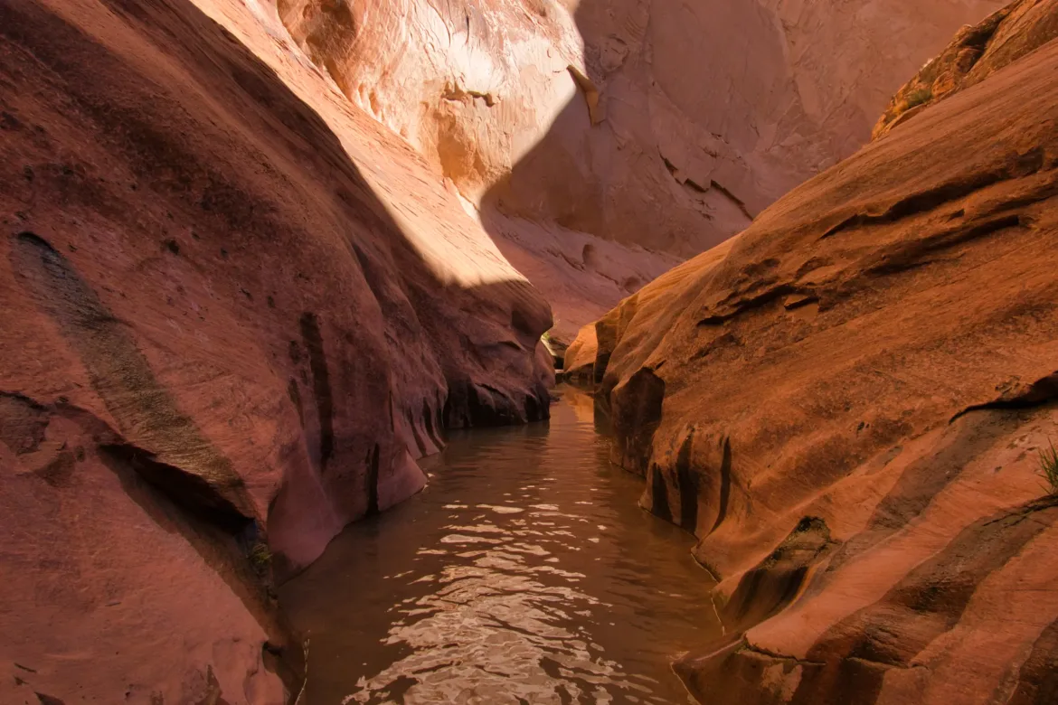
I got back down to the stream and continued to follow it. There were occasional sections up to knee deep, but I never really found the quicksand that the ranger had mentioned. It was slippery, though, and I was doing my best not to dump myself and my pack contents into the stream. Like Muley Twist, there were great undercuts in this canyon where the stream could be completely flowing under a large overhang that it had cut. I love these alcoves, showing two forces of nature fighting against each other.
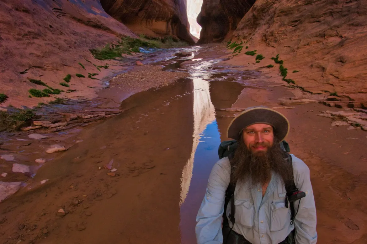
Towards the end of the Narrows, there was a spot where I couldn’t get up on the canyon walls and had to go straight through the stream for a section that looked deeper. I figured I might as well just try it and see how deep it got. It got deeper and deeper and was approaching waist level when I decided to take my pack off and carry it high to prevent it from getting submerged. The water never really got more than waist deep, so it didn’t turn out to be an issue. I finished the Narrows and took a break to recuperate and clean out my shoes and socks from all the sand and rocks that had accumulated in them during the traverse. I also washed my hands and my face, my only exposed skin, with soap to try to ward off any poison ivy. I used to get it on the East Coast a lot, and it’s not a huge deal but rather not have it than have it for sure.
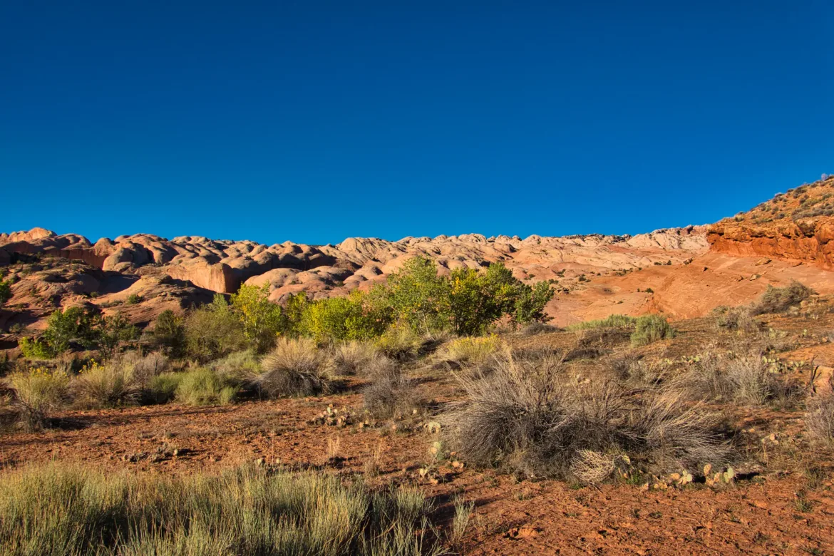
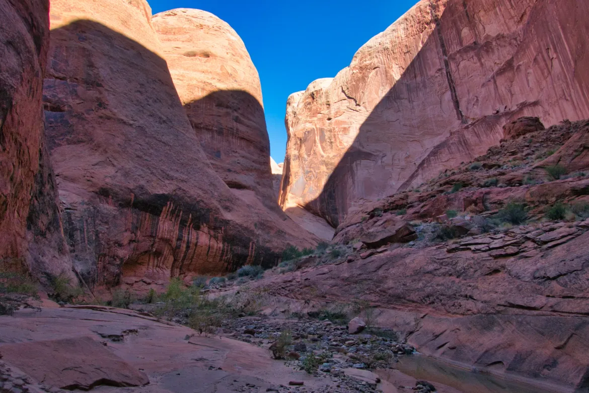
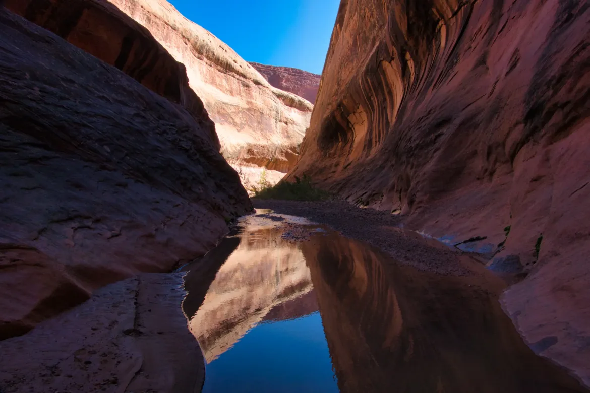
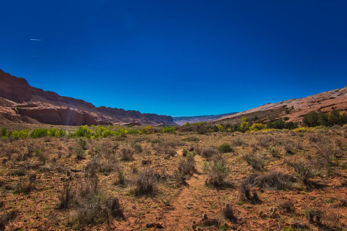
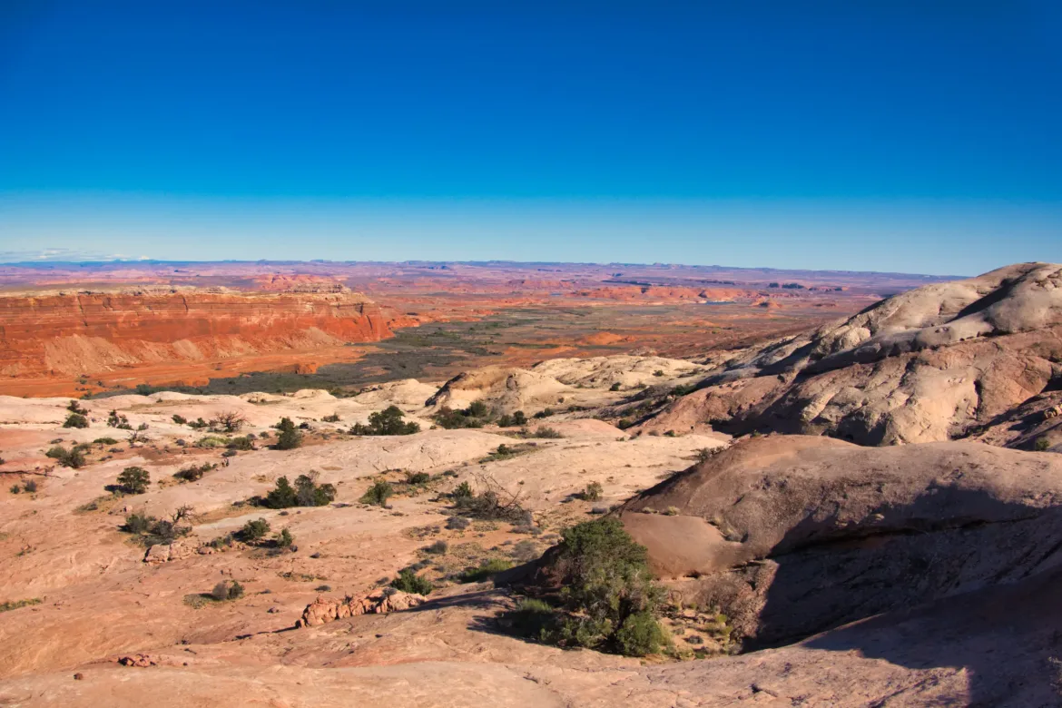
South of the Narrows, I continued to follow Halls Creek towards where Lake Powell used to reach before the low water levels of recent years. Treadway appeared and disappeared, and half the time I was just making my way cross-country, going up and down minor bluffs to keep heading south. Sometimes it got really brushy, which was tough to push through and not the most fun thing in the world. It was also getting warmer again.
I filled up with water towards the end of my descent in Halls Creek since I would be climbing the Waterpocket Fold soon for the second time. As I was about to start my climb on the Baker Route straight up the Waterpocket Fold, I encountered a huge, seemingly endless sea of reeds. I tried to go through the reeds in a couple of places, but they stopped me; they were that thick. Also, there is a stream running below the reeds that was a few feet down with no way for me to cross while pushing through the reeds at the same time. I got frustrated trying a couple of places and ended up just crossing Halls Creek to the other side, traversing further down, crossing again, and then heading back to where I needed to be to start my ascent.
I started the climb using the GPS track that I had, basically just taking a compass bearing because the track was pretty crude. After I got through the sea of reeds and onto the climb, I took a break to reset and recenter myself.
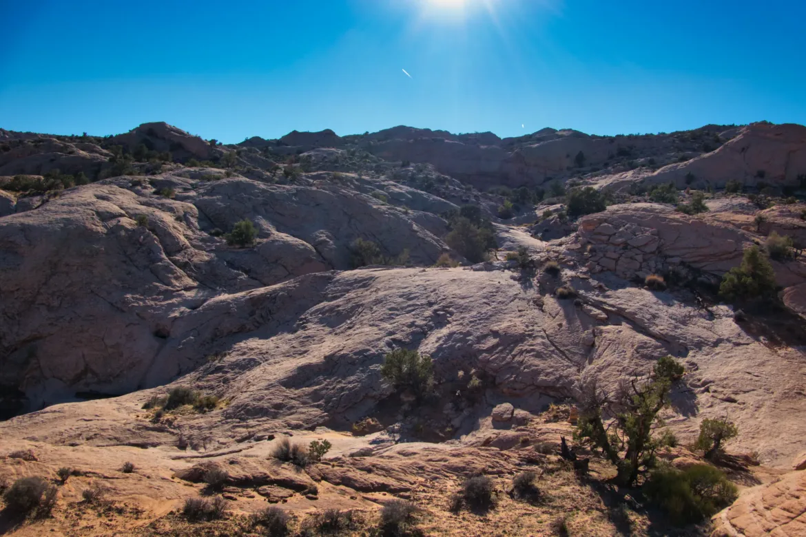
The ascent of the Waterpocket Fold was a 1,800 ft. climb, and it was getting hot, so I resolved to just take the ascent slow and steady, knowing I would get to my goal at the top by the end of the day in plenty of time. Using my compass bearings, I made my way up the Baker route, and I stumbled upon a cairn after not too long. I knew the route was cairned, so I started following the cairns instead of my GPS track. Sometimes the cairns are few and far between, so I had to hunt for the next one, but the route was laid out very well, and most of the time I could just think where would the trail go from here and start in that direction, and I would see the next cairn. There is also a treadway in places too that helped.
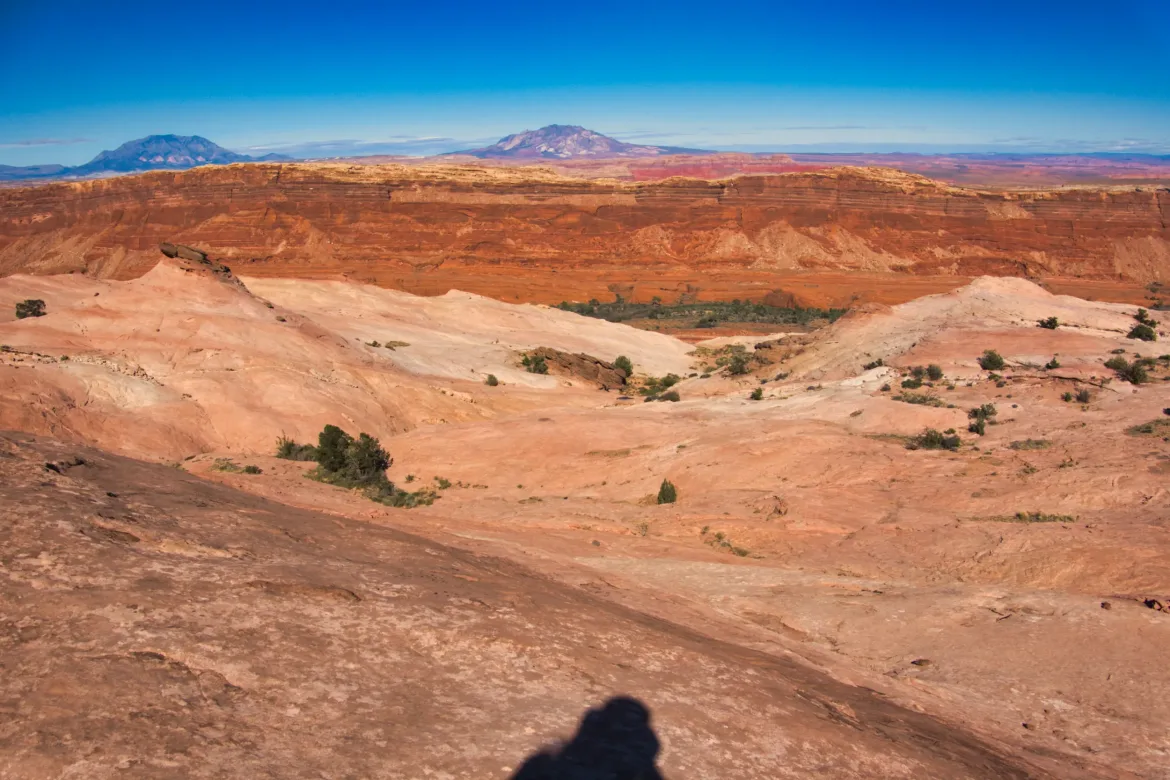
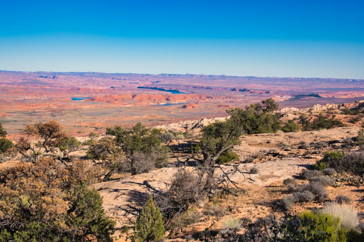
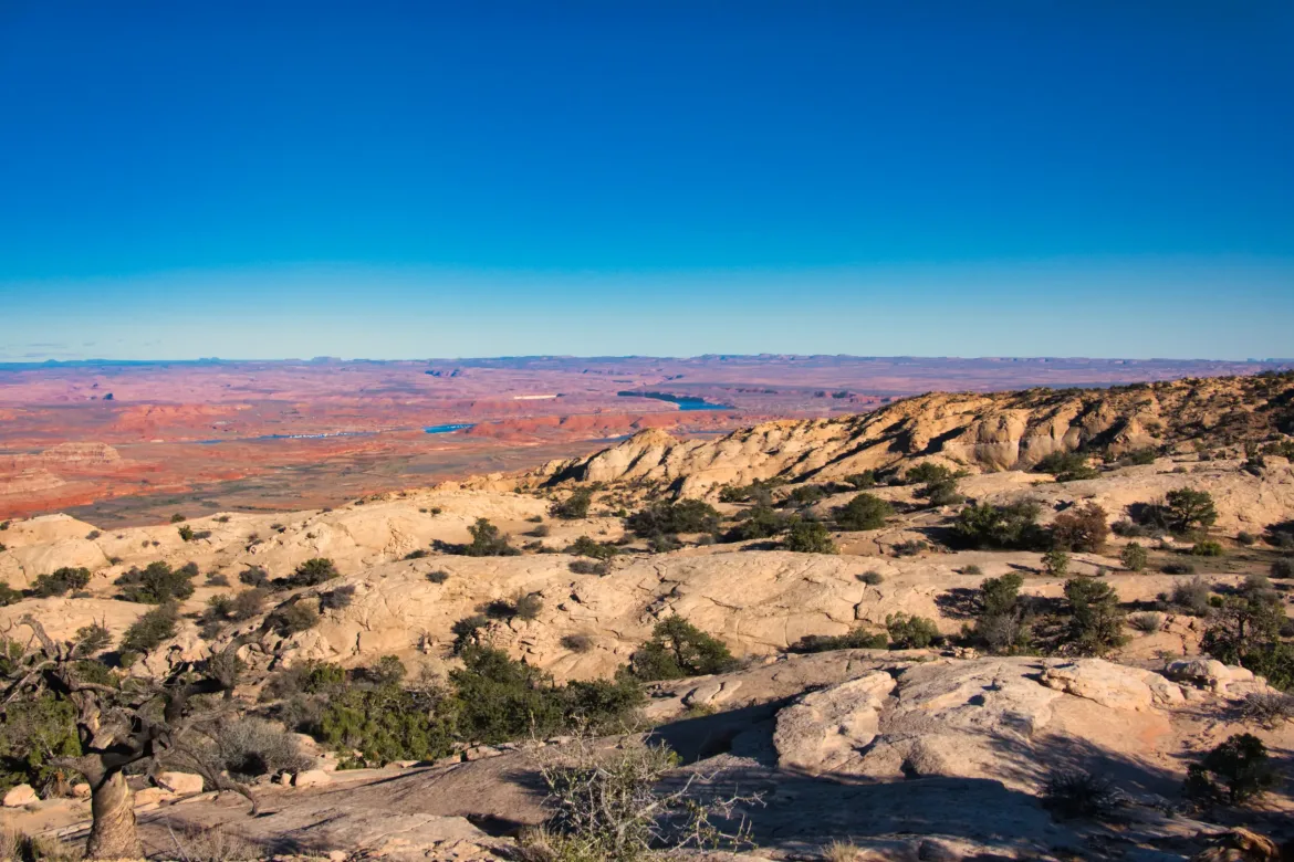
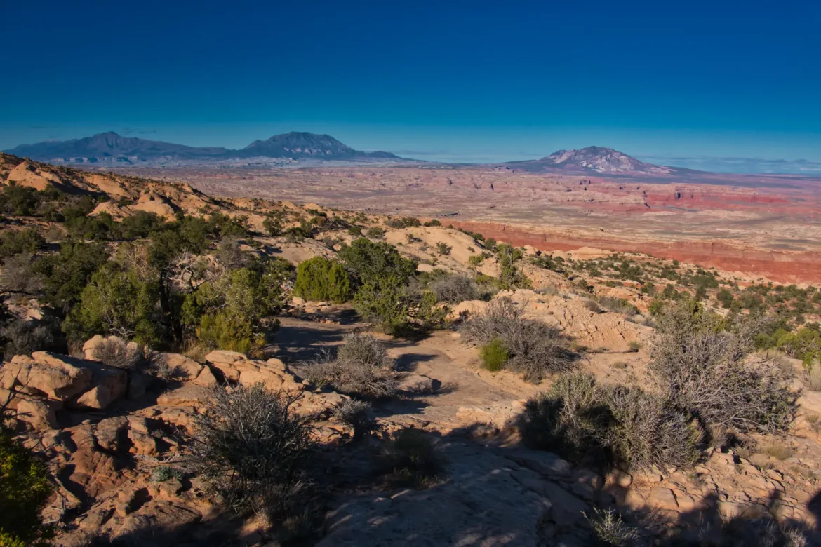
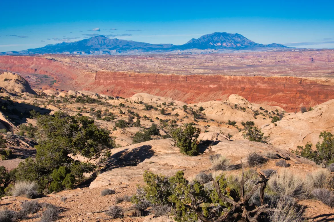
I climbed higher and higher on the Waterpocket Fold, and my views expanded as I went up. I climbed higher than the opposite Canyon wall and still had a long way to go up. Eventually, I could see Lake Powell and more and more of the country as I went. There were lots of potholes on the way up with water, but I already had plenty of water since I filled up before the climb. Oh well, you never know where these are going to be. No harm in carrying 6 liters up 1,800 ft.
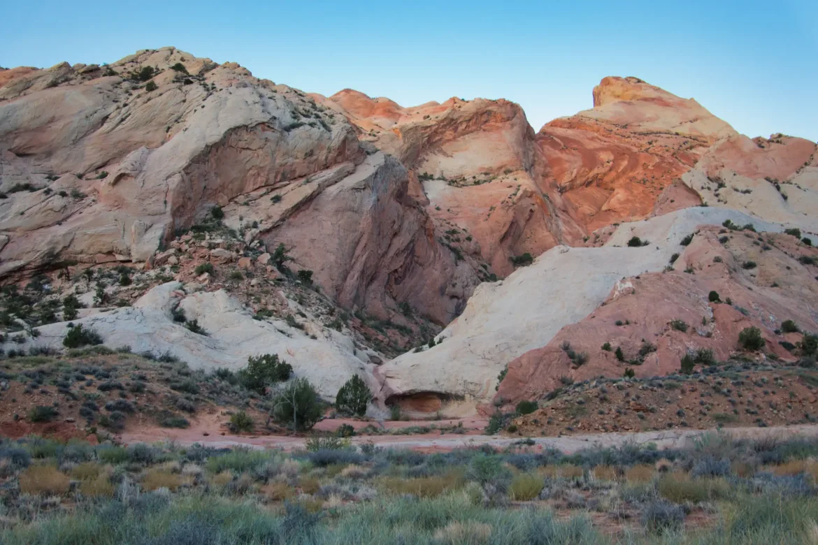
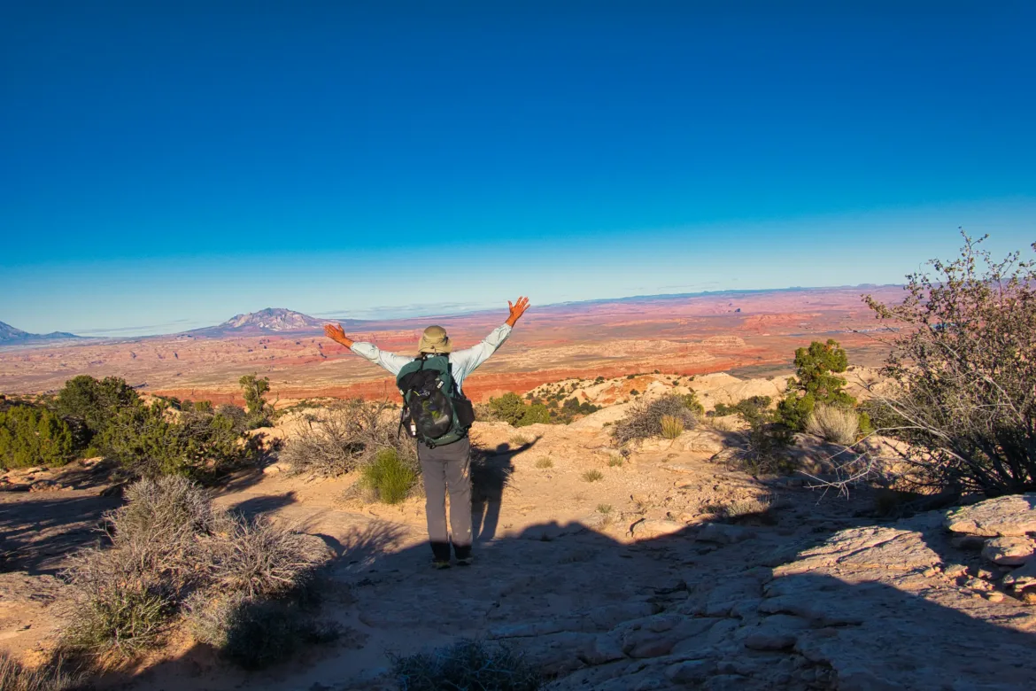
The Waterpocket Fold had many mounds of sandstone on it, and it was a slanted slab in general, but it just looked bumpy with the mound mountains. It was a cool look, all in white with some occasional red stripes. I got to the top of the Waterpocket Fold and had an awe-inspiring view in all directions, seeing the surrounding terrain and the lake. This is a moment that was really clicked for me, and I had a sense of euphoria on top. I took a break to take it all in.
Continuing on, I just wanted to get down a little bit and then find a reasonable camp spot. After I reached the summit, the cairns got harder to follow, and I eventually resorted to point and shoot with my compass again, sometimes coming across the trail. Not really a big deal, and I definitely didn’t follow the official route, but I stuck with the general route to get to where I needed to go. I got dumped out into a wash and shortly found a nice flat sandy spot where I set up camp among the big mounds of sandstone. A great spot for the night.