
Start: Lockhart Basin
Finish: The Loop
Daily Mileage: 16.8
Trip Mileage: 99.0
Elevation gain/loss: 1875/1467ft
Cowboy camping was great last night; I saw a ton of shooting stars and the Milky Way once again. However, I woke up to find my sleeping bag covered with big drops of water from condensation. I had a little bit of condensation the last time I cowboy camped, but there was a lot more this time. I wiped off my sleeping bag best I could and packed it at the top of my pack so I could take it out to dry at some point during the day.
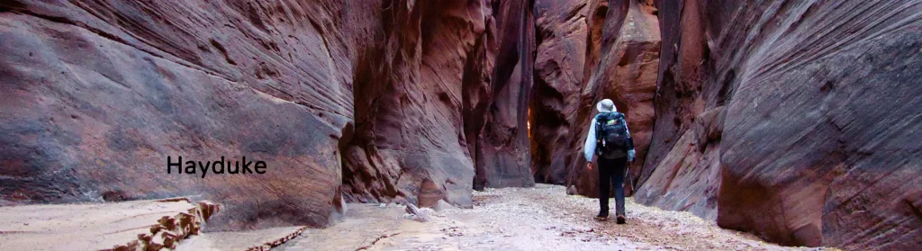
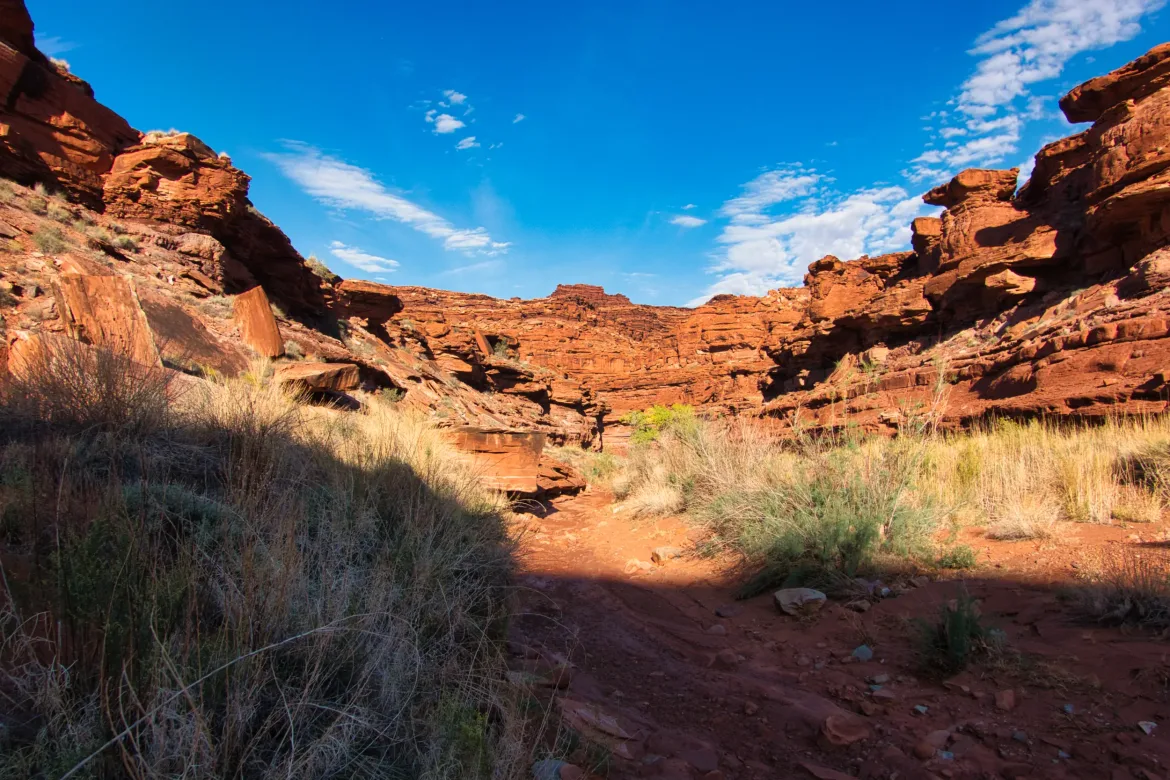
Starting out, I only had a brief walk down the 4×4 track I had been following since Lockhart Canyon before I turned off and followed a wash down into another canyon. There’s a lot of variety in the washes, but they actually seem to be the easiest way to travel off-trail. They are generally wide even at their source which is surprising given that they may only flow once a year or so. The footing is generally good and stable enough, though they can be rocky or muddy at times. They are also never direct since they constantly meander back and forth.
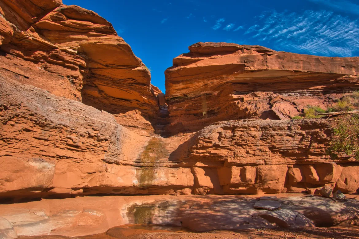
I continued down the wash until I got to the big pour-over (dry waterfall) that marks the trail’s entrance to Rustler Canyon. The pour-over looked daunting initially, but it was actually quite fun and easy to slide down the first the first water slide like chute and then skirt a ledge to the left and descend the rest of the way into the canyon.
Rustler Canyon was close and rugged and I was in it for a bit before I turned up Indian Creek to follow my next winding canyon. Indian Creek is usually flowing but it was not this time. Ranchers have the water rights and they sometimes shut off flow which cannot be predicted. However, there were a few pools of good water so I was able to fill up which was good since I was relying on this source today. Since it was turning out to be a very hot and sunny day, I was glad to top off my water. Of course, by hot I mean about 80° probably, but the sun was bearing down from a cloudless sky and that makes it feel hotter on the exposed desert rock.
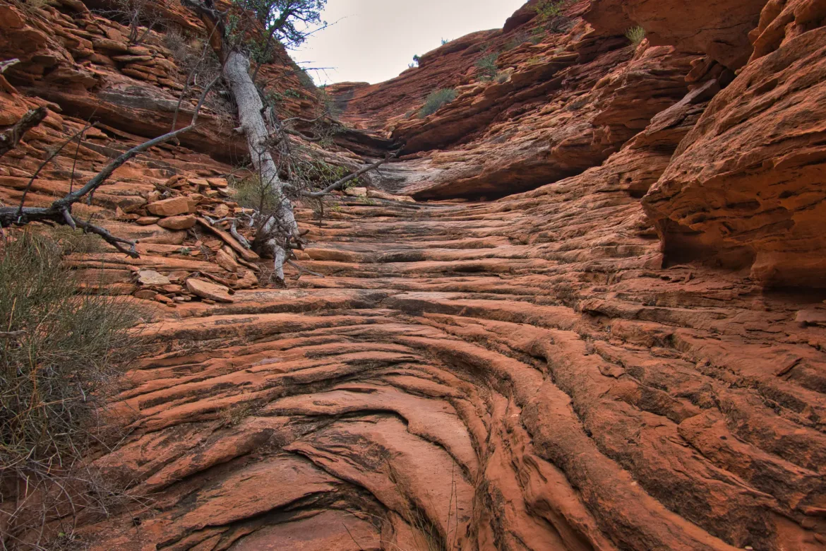
I slipped and slid along Indian Creek since it was still muddy from recent flow. The canyon wound back and forth along with a maze of side canyons. It was a great traverse and I would have been easily lost without my GPS.
The ascent out of Indian Creek is supposed to be tricky and difficult, and there is even a 20-foot chimney climb. The point to start the ascent out of the canyon is obvious and marked with a cairn, but after passing the cairn, apparently all bets are off. There were footprints here and there, and I was trying to follow the GPS track I had closely, but I had three different tracks that had slightly different routes. In the end I just kept winding my own way upwards roughly in the direction of the GPS tracks and following others’ footprints where I could see them. Though my route was in no way straight and I had to turn around a few times when the terrain became steep and impassable, I made good progress up out of the canyon and didn’t even hit the chimney climb that was much advertised. Apparently I found an alternate way up! I wasn’t sure if I wanted to do the chimney climb or not, but safely getting out of the canyon was my only real goal. I didn’t need a photo op.
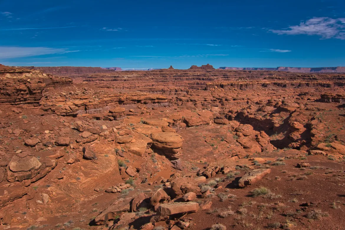
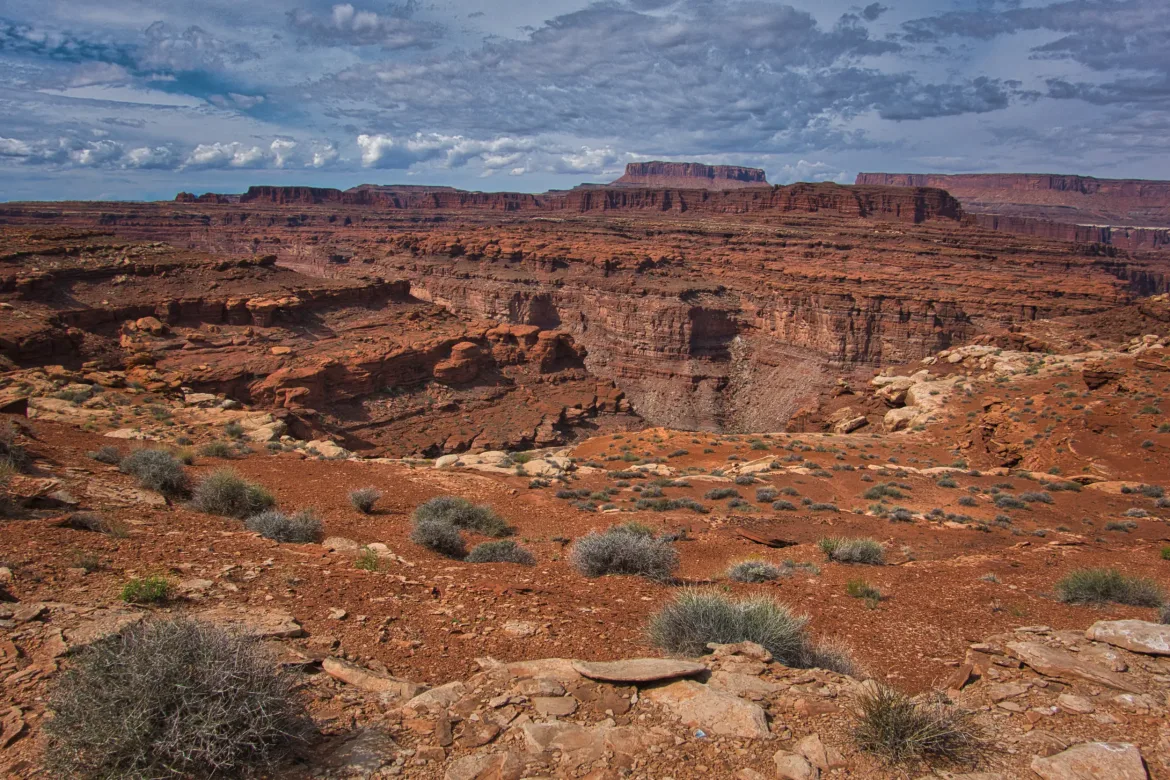
Once out of the canyon, the route followed high ledges that were elevated above most of the surrounding terrain. The ledges were pretty easy to follow but they also gave amazing views into the maze of canyons that I had just exited. I don’t know how the trail founders figured out how to cut through this land with a route that worked without too much navigation or difficulty. It just looks like a pile of spaghetti from above, and I was astounded that I had just crossed that impassable looking terrain. I took a couple breaks on the high ledges taking in the spectacular views, and I felt pretty confident that there was not another person within miles of me. That was surprising considering how beautiful the terrain is and how easily it could be made into a trail if someone wanted.
Unfortunately, while reaching for snacks in my hip belt pocket, I found that the pocket had torn during one of my scrambles and I had lost a few candy wrappers and some electrolytes. I was sad that I left trash unknowingly in this beautiful area. The pack that I brought on this trip is the pack that I finished the Appalachian Trail with, and it is 13 years old and has definitely seen better days. I figured that this would be the last trip before retiring that pack, but one of the reasons I brought it was that I thought any pack would be dinged up on this route, and that would be okay for this old pack.
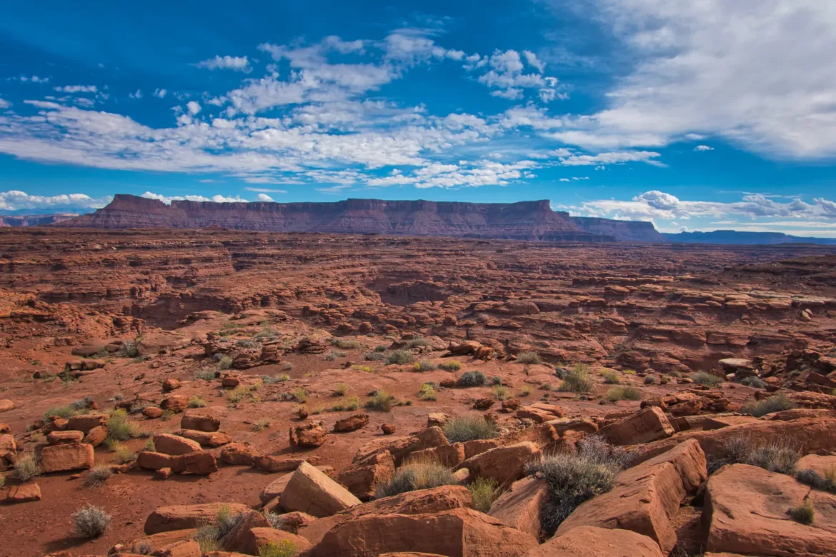
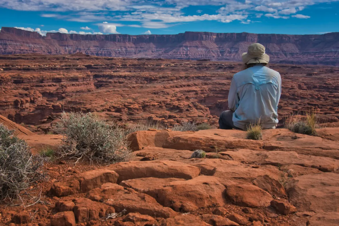
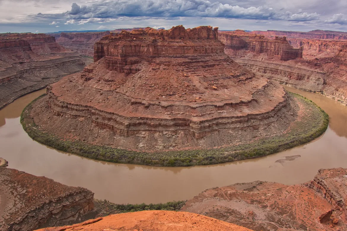
After the high plateau and ledges, the trail dropped into a shallow canyon. After a brief time in the canyon, I turned off to do a side trip to see the famous Loop of the Colorado River. The side trip followed a wash up and it was not very difficult though it got slightly steep at the end. But when I got to the viewpoint above The Loop it was so worth it! I sat out on a rock taking in the stunning view of the Colorado River winding back upon itself to make almost a complete circle around a tall rock plateau for at least an hour maybe more. It just looked as if you were looking at the river through a fish eye lens. It also gave me an opportunity to take out my sleeping bag and let it dry in the sun which worked great.

I left The Loop on a different route back to the main trail and had to once again get creative with descending from the high point I was at, winding back and forth to drop down layer by layer to the wash below. I got back to the main trail and in short order found several potholes of good clear water. I grabbed a little bit more to bring me up to 5 liters l which I figured would be enough to get me to The Needles tomorrow. It’s been hot, but I haven’t felt like drinking a whole lot today. That probably left me a little dehydrated though I just wasn’t thirsty for some reason. I forced myself to drink some water and tried to keep drinking, but with the heat and the amount I was sweating it probably wasn’t enough. This is something I have struggled with in the past in hot weather.
As I followed the wash, I started to lose a bit of energy, probably from the heat and getting dehydrated. I was doing great on time though and not all that far from The Needles where I had to stop tomorrow to line up my backcountry permit for the following day. Eventually I decided that even though it was a little early, I would just stop at the next spot I could find a camp. I ended up finding a big open spot just as I climbed out of the wash that I had been following. Looked good enough to me, and I had a view back down the canyon that I came up. I drank a bunch of water at camp and I’m doing better now. I just have to keep working on my water management. I set up my tent tonight to try to ward off the condensation even though there’s no chance of rain.
The Loop and the canyons today were incredible! It’s really something that should be seen by many people and it’s so weird that no one really knows about or goes into this area except for Hayduke hikers. I even am right next to Canyonlands National Park, but people mainly go to the popular spots in National Parks and don’t get off the beaten track as much, even when it is accessible.
I saw no people today, for the second day in a row.